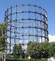
File:Rote Insel17.JPG
Jump to navigation
Jump to search
Rote_Insel17.JPG (479 × 527 pixels, file size: 78 KB, MIME type: image/jpeg)
File history
Click on a date/time to view the file as it appeared at that time.
| Date/Time | Thumbnail | Dimensions | User | Comment | |
|---|---|---|---|---|---|
| current | 19:19, 28 August 2005 |  | 479 × 527 (78 KB) | wikimediacommons>Lienhard Schulz | {{English}} * Description: The "Red Isle" (Rote Insel), called the "East End" of Berlin-Schöneberg, with the Gasometer, the architectural landmark * Author: User:Lienhard Schulz * August 2005, picture taken in Berlin-Schöneberg, Germany * License: |
File usage
The following page uses this file: