File:Schorndorf gebiete1.png
Jump to navigation
Jump to search

Size of this preview: 405 × 599 pixels. Other resolutions: 162 × 240 pixels | 444 × 657 pixels.
Original file (444 × 657 pixels, file size: 237 KB, MIME type: image/png)
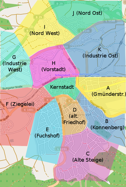
Einteilung von Schorndorf in einzelne Gebiete
File history
Click on a date/time to view the file as it appeared at that time.
| Date/Time | Thumbnail | Dimensions | User | Comment | |
|---|---|---|---|---|---|
| current | 08:38, 2 August 2009 | | 444 × 657 (237 KB) | Neuntoeter (talk | contribs) | |
| 08:36, 2 August 2009 |  | 444 × 657 (215 KB) | Neuntoeter (talk | contribs) | ||
| 08:30, 2 August 2009 |  | 444 × 657 (257 KB) | Neuntoeter (talk | contribs) | Einteilung von Schorndorf in einzelne Gebiete |
You cannot overwrite this file.
File usage
The following 2 pages use this file: