File:Stadtteile-Freising-Inoffiziell.svg
Jump to navigation
Jump to search


Size of this PNG preview of this SVG file: 714 × 599 pixels. Other resolutions: 286 × 240 pixels | 572 × 480 pixels | 915 × 768 pixels | 1,220 × 1,024 pixels | 2,440 × 2,048 pixels | 3,181 × 2,670 pixels.
Original file (SVG file, nominally 3,181 × 2,670 pixels, file size: 1.77 MB)
Summary
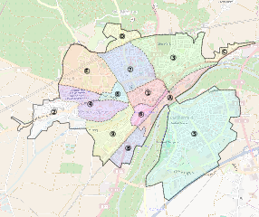
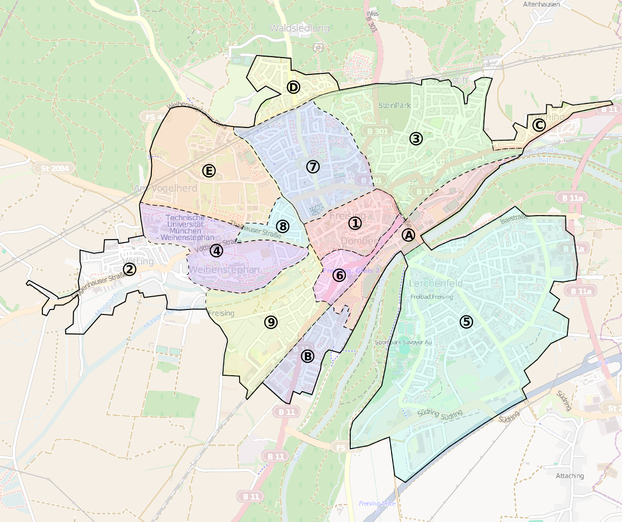
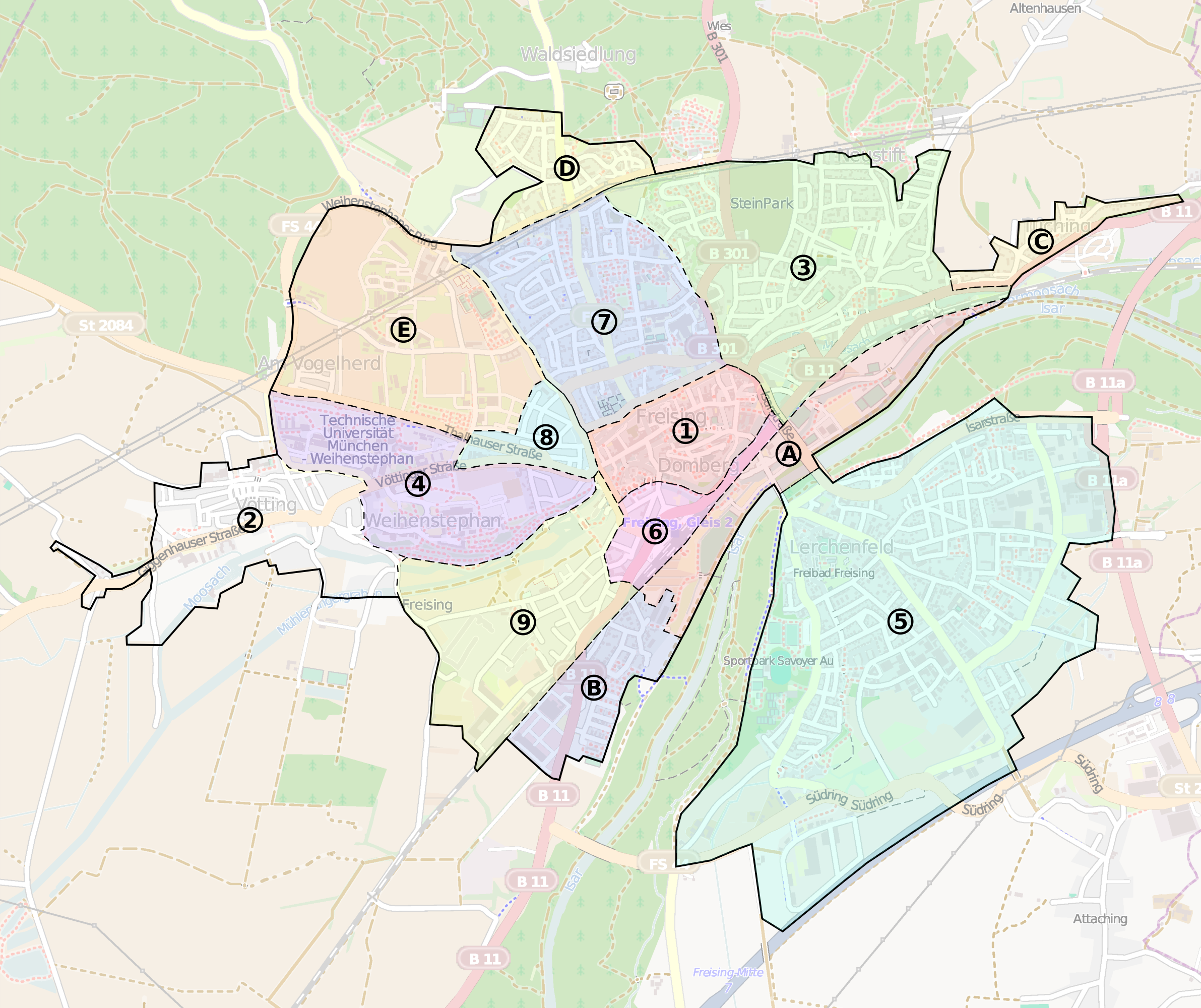
Karte der Freisinger Stadtteile. Da die Stadt Freising keine Stadtteile definiert hat, handelt es sich hierbei lediglich um einen Versuch, die Stadt zu gliedern. Weitere Informationen unter Freising/Stadtteil-Karte.
Licensing
![]()
![]()
![]()
This work is licensed under the Creative Commons Attribution-ShareAlike 2.0 License.
Attribution not specified as a parameter! THIS LICENSE ALWAYS REQUIRES ATTRIBUTION! Use {{CC-BY-SA-2.0|Attribution, typically name of author}} See Template:CC-BY-SA-2.0 for full description how this template should be used.
Note, there is
There is also
Attribution not specified as a parameter! THIS LICENSE ALWAYS REQUIRES ATTRIBUTION! Use {{CC-BY-SA-2.0|Attribution, typically name of author}} See Template:CC-BY-SA-2.0 for full description how this template should be used.
Note, there is
{{CC-BY-SA-2.0 OpenStreetMap}} for files based on old OSM map data, before the license change made on 2012-09-12.There is also
{{OSM Carto screenshot||old_license}} for files based on old OSM map data, before the license change made on 2012-09-12, created using OSM Carto map style.
File history
Click on a date/time to view the file as it appeared at that time.
| Date/Time | Thumbnail | Dimensions | User | Comment | |
|---|---|---|---|---|---|
| current | 13:21, 8 February 2013 | | 3,181 × 2,670 (1.77 MB) | Klamann (talk | contribs) | Karte der Freisinger Stadtteile. Da die Stadt Freising keine Stadtteile definiert hat, handelt es sich hierbei lediglich um einen Versuch, die Stadt zu gliedern. Weitere Informationen unter Freising/Stadtteil-Karte. |
You cannot overwrite this file.
File usage
There are no pages that use this file.