File:TC metro area.jpg
Jump to navigation
Jump to search

Size of this preview: 628 × 600 pixels. Other resolutions: 251 × 240 pixels | 503 × 480 pixels | 932 × 890 pixels.
Original file (932 × 890 pixels, file size: 321 KB, MIME type: image/jpeg)
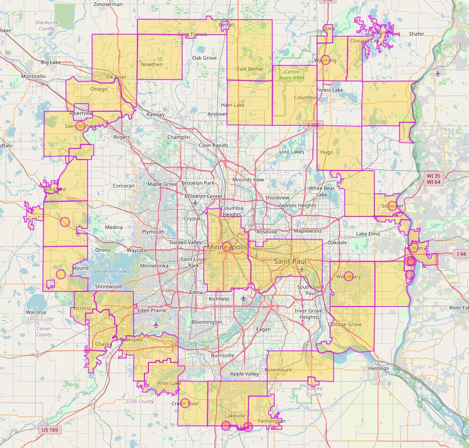
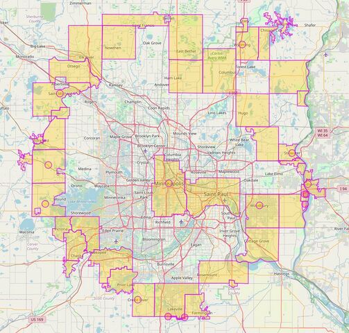
Twin Cities metro area defined by edge cities with Minneapolis and St. Paul also shown
| Contains map data © OpenStreetMap contributors, made available under the terms of the Open Database License (ODbL).
The ODbL does not require any particular license for maps produced from ODbL data, produced maps may be subject also to other licences. |
File history
Click on a date/time to view the file as it appeared at that time.
| Date/Time | Thumbnail | Dimensions | User | Comment | |
|---|---|---|---|---|---|
| current | 21:49, 17 December 2021 | | 932 × 890 (321 KB) | Rjgambrel (talk | contribs) |
You cannot overwrite this file.
File usage
The following 2 pages use this file: