File:Toko bing.jpg
Jump to navigation
Jump to search


Size of this preview: 800 × 531 pixels. Other resolutions: 320 × 212 pixels | 640 × 425 pixels | 886 × 588 pixels.
Original file (886 × 588 pixels, file size: 182 KB, MIME type: image/jpeg)
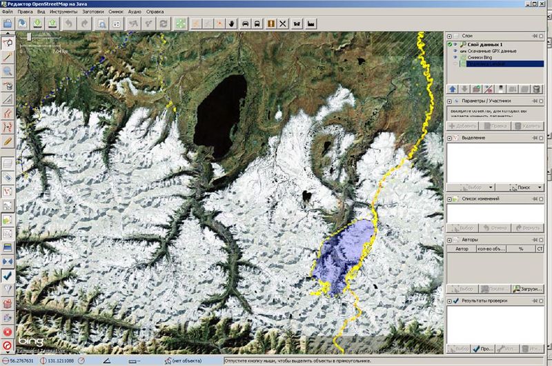
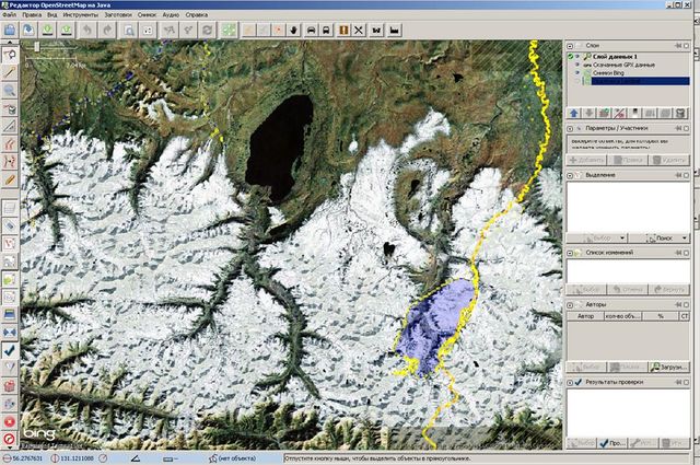
Плохо привязанная подложка Bing на оз. Большое Токо
![]()
![]()
This image is composed entirely, or almost entirely, of Bing aerial imagery.
Bing imagery is not open licensed, but is generously made available to the OpenStreetMap project for deriving open licensed map data in editors such as JOSM, iD or Vespucci. This upload is not covered by permission described at Bing Maps, as OSM Wiki cannot be interpreted as "editor application" and "We require you use access credentials to use the service and require use of transaction tracking and/or session tracking methods for all uses of the service" is not fulfilled.
This image is a relatively minor extract of the (worldwide) Bing imagery, used for illustrative purposes on the OpenStreetMap wiki, to help document ways of using and interpreting the imagery in the OpenStreetMap mapping process.
This image is a relatively minor extract of the (worldwide) Bing imagery, used for illustrative purposes on the OpenStreetMap wiki, to help document ways of using and interpreting the imagery in the OpenStreetMap mapping process.
File history
Click on a date/time to view the file as it appeared at that time.
| Date/Time | Thumbnail | Dimensions | User | Comment | |
|---|---|---|---|---|---|
| current | 10:31, 10 October 2011 | | 886 × 588 (182 KB) | S-s-s wiki (talk | contribs) | Плохо привязанная подложка Bing на оз. Большое Токо |
You cannot overwrite this file.
File usage
There are no pages that use this file.