File:Traffic signal set comparison.png
Jump to navigation
Jump to search

No higher resolution available.
Traffic_signal_set_comparison.png (582 × 384 pixels, file size: 126 KB, MIME type: image/png)
Summary
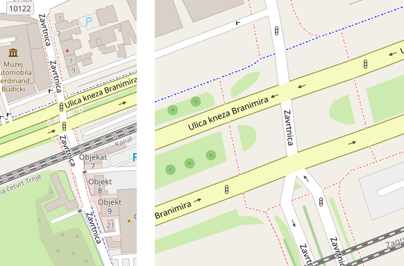
OSM.org screenshot of intersection at https://www.openstreetmap.org/#map=19/45.80810/15.99944
Shows how the traffic light information should be rendered at high and low zoom.
Map style is (c) OpenStreetMap. Map data is (c) OpenStreetMap contributors.
Licensing
| Contains map data © OpenStreetMap contributors, made available under the terms of the Open Database License (ODbL).
The ODbL does not require any particular license for maps produced from ODbL data, produced maps may be subject also to other licences. |
File history
Click on a date/time to view the file as it appeared at that time.
| Date/Time | Thumbnail | Dimensions | User | Comment | |
|---|---|---|---|---|---|
| current | 17:30, 13 February 2021 | | 582 × 384 (126 KB) | Rostaman (talk | contribs) | OSM.org screenshot of intersection at https://www.openstreetmap.org/#map=19/45.80810/15.99944 Shows how the traffic light information should be rendered at high and low zoom. Map style is (c) OpenStreetMap. Map data is (c) OpenStreetMap contributors. |
You cannot overwrite this file.
File usage
The following page uses this file: