File:US-44-trunk-Poughkeepsie.png
Jump to navigation
Jump to search

Size of this preview: 800 × 527 pixels. Other resolutions: 320 × 211 pixels | 640 × 422 pixels | 1,024 × 675 pixels | 1,211 × 798 pixels.
Original file (1,211 × 798 pixels, file size: 652 KB, MIME type: image/png)
Summary
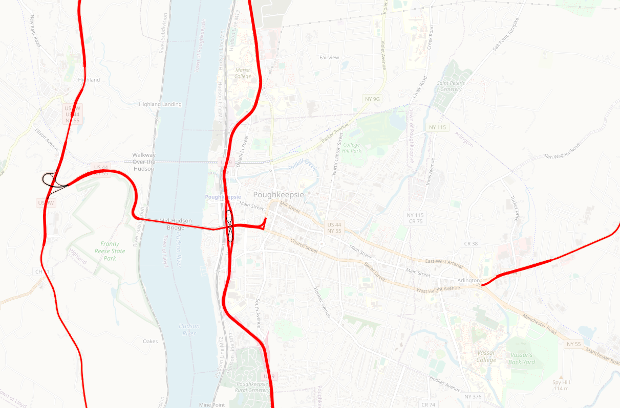
Map showing how New York's arterial class interrupts US-44 in Poughkeepsie.
Licensing
![]()
I, the creator of this work, hereby release it into the public domain. This applies worldwide.
In case this is not legally possible, I grant anyone the right to use this work for any purpose, without any conditions, unless such conditions are required by law.
Notice to creator or uploader: Please consider using {{CC0-self}} instead for your work.
"Releasing work to public domain" has some issues, as it is not well defined in some jurisdictions and/or it is not actually possible to "release to public domain". Using CC0 license achieves the intended effect while avoiding such problems and is well suited for media files.
| Contains map data © OpenStreetMap contributors, made available under the terms of the Open Database License (ODbL).
The ODbL does not require any particular license for maps produced from ODbL data, produced maps may be subject also to other licences. |
File history
Click on a date/time to view the file as it appeared at that time.
| Date/Time | Thumbnail | Dimensions | User | Comment | |
|---|---|---|---|---|---|
| current | 03:38, 6 September 2021 | | 1,211 × 798 (652 KB) | Ke9tv (talk | contribs) | Map showing how New York's arterial class interrupts US-44 in Poughkeepsie. |
You cannot overwrite this file.
File usage
The following page uses this file: