User talk:Mateusz Konieczny/archived talk:SWBeacon.png page
Hi,
i can provide 2 pictures of beacons which are made by myself, i tried to add the right licence to the exif data, but i never done that before, so please give me hints if something is not useful for that use case.
But it looks like i am not allowed to upload pictures. I uploaded them to my webserver: https://oerks.de/tmp/Rhinplatte-N-2.jpg https://oerks.de/tmp/Rhinplatte-N-1.jpg
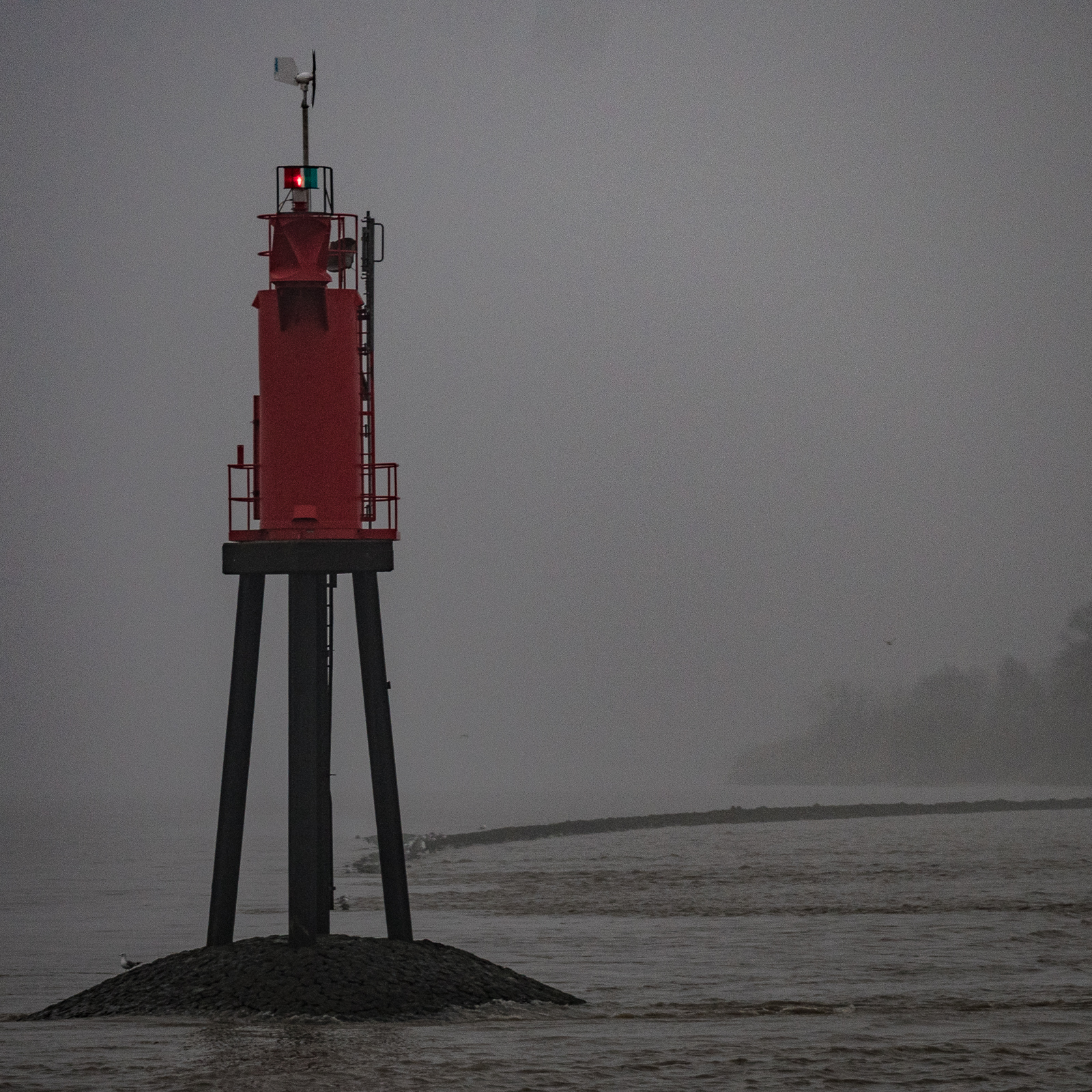
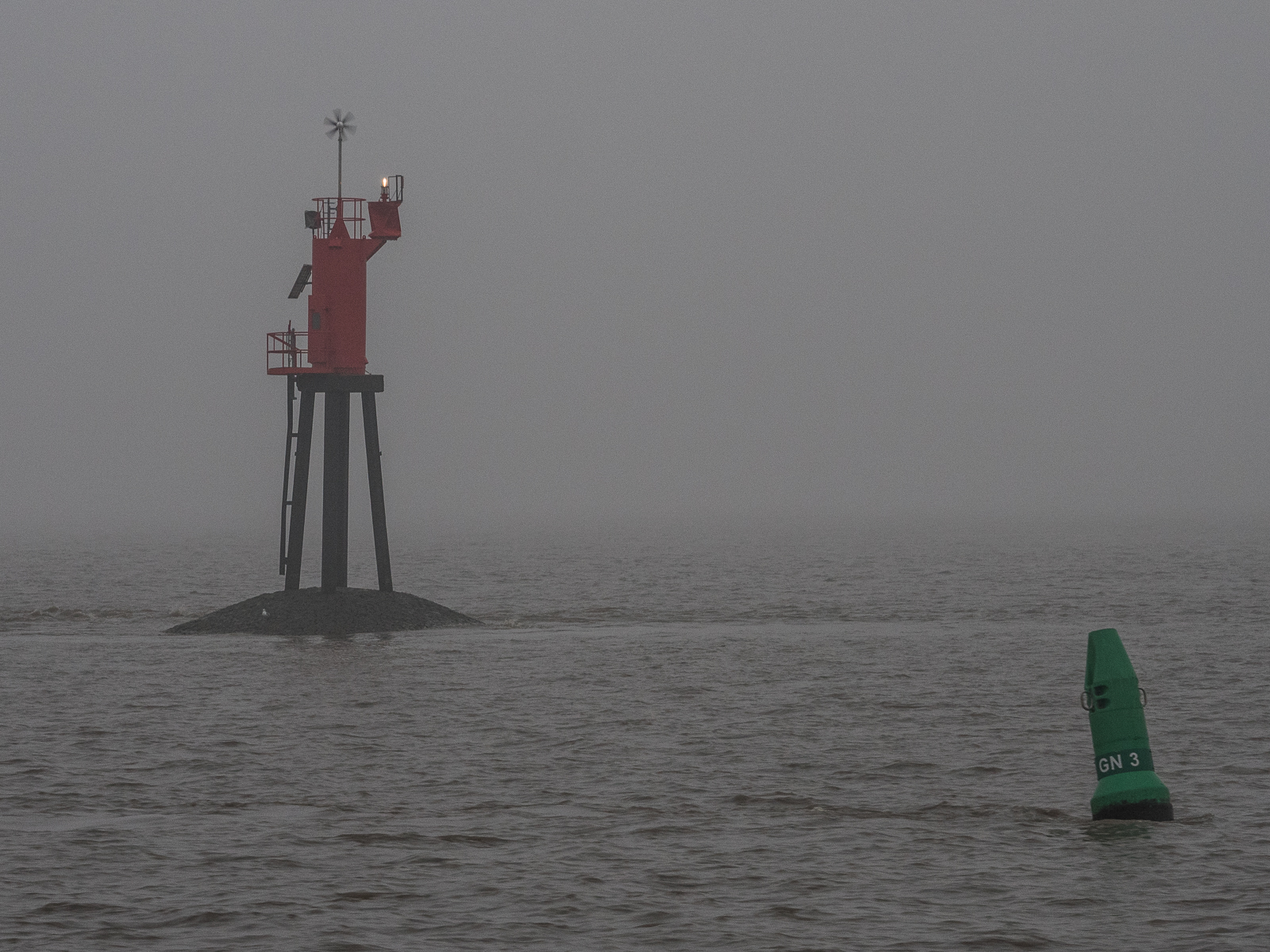
This is Rhinplatte Nord in River Elbe, Germany. See: http://map.openseamap.org/?zoom=16&lat=53.80195&lon=9.39067&mlat=53.80036&mlon=9.38826&layers=BFTFFFFFFTF0FFFFFFFFFF This is a tidal waterway, so the breakwater will be under water most of the time, but not deep enough for a save passage.
I would be glad if one of these are useful. Aleks
- @Astielau:
- For start: thanks!
- First explanation: you need to make a few edits before being allowed to upload.
- https://commons.wikimedia.org/wiki/Main_Page is a good place to upload images if you want to share them on open license - would you be willing to upload them there?
- Additional question: is it a safe water beacon specifically? (it is a beacon, but I have no idea is it a safe water beacon)
Mateusz Konieczny (talk) 14:06, 13 May 2022 (UTC)
- @Mateusz Konieczny:
- (i am not sure if i do it right, just editing the source)
- I created a wikimedia.org account and loaded it up there: https://commons.wikimedia.org/wiki/File:Rhinplate-N_Safety_Beacon.jpg
- From my point of view it is a safe water beacon, it sits on the end of a most times water covered jetty made from stones which also acts as breakwater. You cannot sail between the bake (beacon in german) and the northern end of the island Rhinplate even at high tide. There are also some buoys around it, but they have looong chains (due the difference of high and low water) and move around to their anchor stone in the ground with big circles even on high tide, you need to maintain a safe distance to them, but not to this hard mounted beacon.
- @Astielau: Thanks, used it on pages where this file was used! If you can find/take replacements of https://wiki.openstreetmap.org/wiki/File:CalshotLF.png and https://wiki.openstreetmap.org/wiki/File:Cone_Buoy.png then help would be even more appreciated! Mateusz Konieczny (talk) 17:06, 13 May 2022 (UTC)
@Mateusz Konieczny: Sorry, these types of light floats are uncommon in my area, so i cannot help with that. In my opinion they are a strict british thing :-)
But i added a version of the Cone Buoy type and also a lateral system buoy.
A cone buoy is also a lateral system buoy. In general they are distinct in form (cone/acute, spiky side up or stump), color (green, red in most cases), light (color, return, groups). So if you cannot recognize the color (hazy, near darkness...) you can distinct on the form or its light, to which site of the fairway it belongs.
I thing the 2nd is a better replacement, if it used on more general lateral buoys, the 1st for real cone buoys.
https://commons.wikimedia.org/wiki/File:Cone_Buoy.jpg https://commons.wikimedia.org/wiki/File:Lateral_Buoy.jpg
- Thanks! I looked for replacement for light floats on Commons and found something. Thanks so much for your help and pointing out lateral/cone classification! @Astielau: Mateusz Konieczny (talk) 10:26, 19 May 2022 (UTC)
- @Astielau: This talk page will be likely deleted together with file, so I will move it somewhere. The visible effect will be change of the page title Mateusz Konieczny (talk) 10:28, 19 May 2022 (UTC)