Panoramax
| Panoramax | |
|---|---|
| Author: | Panoramax Team |
| License: | MIT License |
| Platform: | Web |
| Version: | 2.5.0 [1] (2024-03-01) |
| Languages: | javascript and python |
| Website: | Panoramax.fr |
| Source code: | https://gitlab.com/geovisio |
|
"The free alternative to photo-mapping territories"[1] | |
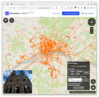
Panoramax (wikipedia) is a federation offering geolocated street-level pictures. Pictures are offered through a decentralized architecture, with a set of free and open-source tools. In other words, it is "like a self-hosted Street View"[2] that does not impose its own app and gives you the right to fork the server.
The main selling points are:
- self-hostable, as a public instance or in your private org
- free-licensed server (unlike Mapillary or Mapilio)
- freedom to choose or develop your favorite client app
- federation through a meta-catalog, which gives a single entrypoint to all publicly available servers
Instances
These are the publicly available instances, where anyone can view pictures or contribute:
- https://panoramax.openstreetmap.fr by OSM France
- https://panoramax.ign.fr by Institut national de l'information géographique et forestière
The meta-catalog list all pictures available across public servers: https://api.panoramax.xyz/
Software
As Panoramax is a federation, the main matter is to agree on standards. Servers have to offer their pictures through a STAC API. Beyond that, any compliant server can be a part of Panoramax.
As today, main software used for Panoramax are listed below.
Server-side
All servers are running under GeoVisio API, which is fully free and open-source. It's a Python and Flask API, relying on a PostgreSQL and PostGIS database. It handles users, pictures upload and serving.
Client-side
Many clients can be made available for Panoramax, as long as they accept STAC and/or WFS servers. As now, the following clients are available:
- GeoVisio website, the front-end of public servers
- GeoVisio web viewer, a stand-alone JS viewer
- STAC-compatible clients
Work in progress:
- QGis plugin: https://geovisio.gitlab.io/qgis-plugin/
- A plugin for JOSM has been requested here on the JOSM issue tracker.
- iD support has been requested here.
See also
- Panoramax official website
- GeoVisio on GitLab
- Key:panoramax
- Panoramax talk at State of the Map Europe 2023 for the slides and the talk on YouTube
- List of OSM-based services


