File:Marikina cycleways.png
Jump to navigation
Jump to search

No higher resolution available.
Marikina_cycleways.png (547 × 553 pixels, file size: 558 KB, MIME type: image/png)
Information
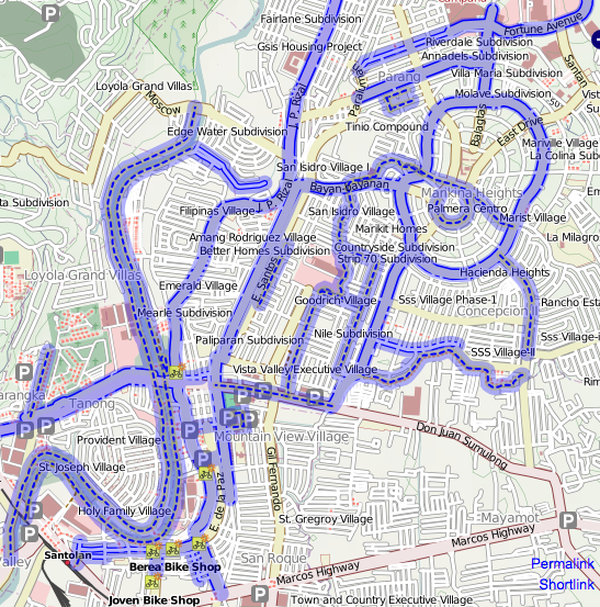
| Description | OpenCycleMap rendering of the bike paths in Marikina. |
|---|---|
| Author | maning |
| Source | OpenCycleMap (permalink to map) |
| Date | 2010-02-08 |
| Permission | CC-BY-SA |
File history
Click on a date/time to view the file as it appeared at that time.
| Date/Time | Thumbnail | Dimensions | User | Comment | |
|---|---|---|---|---|---|
| current | 02:08, 8 February 2010 | | 547 × 553 (558 KB) | Maning (talk | contribs) |
You cannot overwrite this file.
File usage
The following page uses this file: