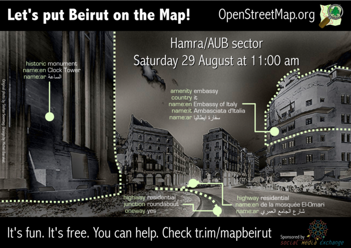
Lebanon/Beirut Mapping Party
August 29th, Beirut, Lebanon
Meeting point: t-marbouta Café (Map) at 11 am
See Results of the mapping party
| V・T・E |
| latitude: 33.896638809936, longitude: 35.504206264526 |
| Browse map of Beirut 33°53′47.90″ N, 35°30′15.14″ E |
| Edit map |
|
External links:
|
| Use this template for your locality |
Beirut is a city in Lebanon at latitude 33°53′47.90″ North, longitude 35°30′15.14″ East.
What?
The first mini mapping party in Lebanon organized by the OSM Lebanon community in collaboration with SMEX. We will be mapping the downtown Beirut area. The event is open to all OSM mappers as well as anyone interested in getting involved in the project. We will hold a crash course in mapping so you don't have to worry if it's your first time contributing to OpenStreetMap.
Where?
- Place: Hamra/AUB sector
- Meeting point: t-marbouta Café in Hamra.
- Directions: Driving on Hamra Street, take first left after Startbucks Coffee. t-marbouta is located on the first floor of the second building (Pavillion Center) to the right.
When?
- Date: 29 August 2009
- Time: 11:00 am - 5:00 pm
Schedule
TBD - Please check back a couple of days before venue
How?
- Type: Walking mappers, public and anyone can join.
- Level: Some OSM mapping experience would be nice, but it is not required to participate.
- Weather: This event is rain or shine.
Mapping objectives
- Complete missing road networks
- Add POIs (Points Of Interests) in the area. We would like to focus particularly on:
- Restaurants
- Banks
- Pharmacies
- Shops
- Complete naming of roads and POIs in Arabic, French and English
Equipment
If you own a GPS or laptop computer, please bring it along. If not, you can borrow some of the available equipment or contribute using walking papers. The following equipment will also be available for loan:
- 2 x Holux GPSlim 240 Bluetooth receivers. (Bmichel). Not sure if GPS signal will work though.
- 3 x Garmin eTrex Summit HCs (Jessica28)
- 2 x Garmin Gecko from Muzna
- (Please add to this list extra equipment that you can spare and allow others to use.)
Who?
- Extensive list on Facebook event page.
- Fill in your name on this table to get your free T-Shirt.
Promotion
- You can help out with the promotion effort by printing out a poster version of the flyer and have it displayed at your office, university campus or business.
- Media - TBD
Mapping Party Suggestions
Please feel free to suggest locations and goals for this mapping event as well as future events.

