Access to Antenatal Health Care in Entebbe
About the project
Inaccessibility to health centers in Entebbe Municipality is increasingly a great challenge especially for the heavily expectant and lactating mothers and their babies. The municipal authority through the Ministry of Health has recruited the Village Health Teams to curb this problem, but it has been a slow practice due to the lack of knowledge of their locations.
Therefore, the Vision Mappers Chapter through the fieldwork program seeks to collect data throughout the municipality to establish the location of healthcare services and at the same time improve their data collection skills through digital Open-Source tools like Kobo Collect. The team will create both static and digital maps for the municipal authority in an effort to reinforce data-driven decision-making and improve overall health care for the municipality. The chapter envisages to:
- Build the geospatial capacity of the chapter members through mapping of healthcare service delivery for women and children in Entebbe Municipality including its islands.
- Train on the field data collection tools and build the capacity of chapter members.
- Map the distribution of women's and children’s healthcare services.
- Validate the available OSM data and create healthcare maps for the municipality.
Remote Mapping tasks
Training
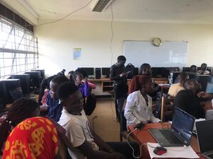
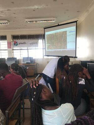
Students/project participants were trained in the use of the HOT Tasking Manager as well as the general OpenStreetMap contribution
TM Projects
The project remote mapping activities were done using the HOT Tasking Manager. The following projects have so far been mapped and validation is underway
Field Data Collection
ODK Form
Field data will be collected using mobile data collection tools. ODK is the most preferred data collection tool that will be deployed.
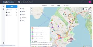
The data collection Kobo Form can be found here
Field data collection activities
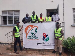
A team of five data collectors were trained in the use of Kobo Collect Application to collect data in the project area. Entebbe Municipality has Two Divisions with each division having two wards. Each data collector worked in a word except one word that was divided into two.
The team was briefed about the best practices for field data collection and was set to collect data.
Mode of Transport
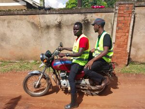
During the data collection activity, Boda Bodas were used as the mode of transport because they provide flexibility and can reach all the streets where vehicles may not reach. Each data collector was allocated a Boda Boda rider to transport them around their allocated places.
Kobo Toolbox Server
Field data was collected using Kobo Collect and was always sent to Kobo Server before the team left the field for proper tracking and identification of the possible gaps. A team of data managers was handling the data to check for completeness in terms of coverage of the allocated areas.
Below is sample data as CSV format
| name | addr:=suburb | addr:=village | opening_hours | ownership | amenity |
|---|---|---|---|---|---|
| Anna Health Care | Division B | Kigungu Central | Monday – Sat 08:00-18:00 | Private | Clinic |
| Mirembe Medical Chambers | Division B | Kigungu Central | 24/7 | Private | Clinic |
| Brother Amans Memorial Center | Division B | Kigungu Central | 24/7 | Private | Clinic |
| Family Drug Shop | Division B | Kigungu Central | Monday - Sunday 09:00-21:00 | Private | Pharmacy |
| Kigungu Drug Shop | Division B | Kigungu Central | Monday - Sunday 09:00-21:00 | Private | Pharmacy |
| St Auralia People'S Clinic | Division B | Kigungu Central | Monday - Sunday 09:00-21:00 | Private | Clinic |
| Gods Will | Division B | Mayanzi | Monday - Sunday 09:00-21:00 | Private | Pharmacy |
| Family Care | Division B | Mayanzi | Monday - Sunday 09:00-21:00 | Private | Clinic |
| Kigungu Health Center 3 | Division B | Bunonko Misoli | Monday – Sat 09:00-18:00 | Government | Doctors |
| Nginia Medical Click | Division B | Bunonko Misoli | 24/7 | Private | Clinic |
| Entebbe Central Clinic | Division B | Kakeeka | Monday – Sat 08:00-18:00 | Private | Clinic |
| Saviour Medical Clinic And Lab Services | Division A | Katabi Namate | 24/7 | Private | Clinic |
| St. Maria Gorretti Medical Clinic | Division A | Katabi Namate | 24/7 | Private | Clinic |
| Limitiless Pharmacy | Division A | Katabi Namate | Monday - Sunday 09:00-21:00 | Private | Pharmacy |
| Cromwell Health Services Ltd | Division A | Katabi Namate | 24/7 | Private | Clinic |
| Mdw Pharmacy | Division A | Katabi Namate | Monday - Friday 08:00-18:00; Sat - Sunday 08:00-15:00 | Private | Pharmacy |
| Naha Trust Services U Ltd | Division A | Katabi Namate | Monday - Sunday 09:00-21:00 | Private | Pharmacy |
| Claire Medical Clinic | Division A | Katabi Namate | Monday - Friday 08:00-18:00; Sat - Sunday 08:00-15:00 | Private | Clinic |
| God'S Gift Drung Shop | Division A | Katabi Namate | Monday – Sat 09:00-18:00 | Private | Clinic |
| Divine Medical Centre | Division B | Katabi Busambaga | 24/7 | Private | Clinic |
| Grendon Pharmacy | Division A | Manyago II | Monday – Friday 09:00-17:00 | Private | Pharmacy |
| Cose Drug Shop | Division A | Katabi Namate | Monday – Sat 08:00-18:00 | Private | Clinic |
| Dembe Drug Shop | Division A | Kiwafu Central | Monday - Sunday 09:00-21:00 | Private | Clinic |
| Progress Medical Clinic | Division A | Nakiwogo-lugonjo | Monday - Sunday 09:00-21:00 | Private | Clinic |
| Zion Medical Clinic | Division A | Nakiwogo-lugonjo | Monday – Sat 09:00-18:00 | Private | Clinic |
| New Medical Clinic | Division A | Nakiwogo-lugonjo | 24/7 | Private | Clinic |
| Airport View Drug Shop | Division A | Nakiwogo-lugonjo | Monday - Sunday 09:00-21:00 | Private | Clinic |
| Lee Medical Centre | Division A | Nakiwogo-lugonjo | Monday - Sunday 09:00-21:00 | Private | Clinic |
Data Cleaning
Data from the field is always not to the quality standard for upload to OpenStreetMap. Therefore, it is important that the data goes through a data cleaning session before its is uploaded. This session ensures that the errors in the open-ended answers are minimized, the keys and values conform to the OSM tagging, and that the data quality issues like positional and logical inconsistencies are delt with. The vision mappers team created a data-cleaning workflow for future references and whoever might need to use the same tools.
Maps
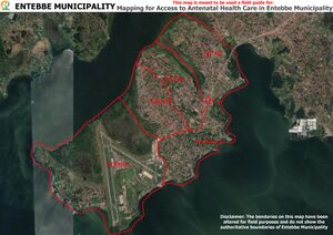
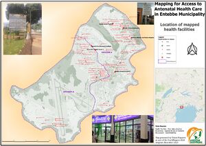
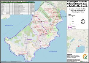
Both static and interactive maps were generated. These maps indicate the location of health facilities and also those that show health facilities that offer antenatal services.
An interactive map was generated using uMap and can be found here.
