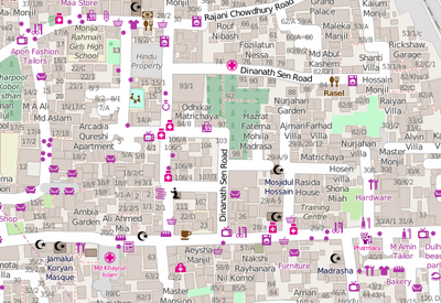
Dhaka
| V・T・E |
| latitude: 23.7596, longitude: 90.3790 |
| Browse map of Dhaka (ঢাকা) 23°45′34.56″ N, 90°22′44.40″ E |
| Edit map |
|
External links:
|
| Use this template for your locality |
Dhaka (ঢাকা) is a city in Bangladesh at latitude 23°45′34.56″ North, longitude 90°22′44.40″ East.
Community
Join the...
![]() OpenStreetMap Bangladesh facebook group
OpenStreetMap Bangladesh facebook group
Who is mapping Dhaka?
Check out the OOOC map of Dhaka for a view of who has been mapping. LOTS of people!
Many mappers have got involved here due to humanitarian mapping projects (many mapping from afar) see #Projects below
Wiki user list
Some wiki users have listed themselves here, since they are (or were) mapping in Dhaka, but this list is probably out of date, and certainly not complete (see above)
- flipo - works in Dhaka
- chamak - works in Dhaka
- Tausif - works in Grameenphone, Dhaka
- Fazlay s21rc
How to participate
Some ideas for how to participate:
- Survey and add data! Schools, universities, hospitals, restaurant, tourist sites or attraction, monuments, parks, train station, piers, etc. Also more detailed stuff, mapping every shop, every address, every building outline. See Beginners' guide
- Start adding the Bangla translation to the tags, city and village names, etc. See Names#Localization
- Add the names to the rivers. There are so many of them! Often it is necessary to ask the locals for the name of the river.
- If you have a GPS device upload your tracks and edit them
- Get in contact with other wiki sites (Wikipedia, Banglapedia, Wikivoyage, etc.) and provide them with an image of already mapped areas
- Start mapping bus routes (using relations) - perhaps get in contact with the bus operators
- Download all the data from the Bangladesh area, and make a .img file (with mkgmap) ready to be uploaded to your Garmin or your phone. You can eventually let people know about where one can access it by mentioning it at this page OSM Map On Garmin/Download
- Enhance this wiki page :)
Projects
Slum mapping
There have been some efforts (particularly ~2015) to do humanitarian mapping of some of the dense slum districts of Dhaka.
The Red Cross worked with the local community to map the district Gandaria
Several HOT tasking manager projects were set up there, but there has been a strong local mapping element to all these initiatives Missing Maps Bangladesh Field Mapping Jan15 involved local data collection.

