File:2015 USGS Illapel, Chile.png
Jump to navigation
Jump to search

No higher resolution available.
2015_USGS_Illapel,_Chile.png (444 × 593 pixels, file size: 54 KB, MIME type: image/png)
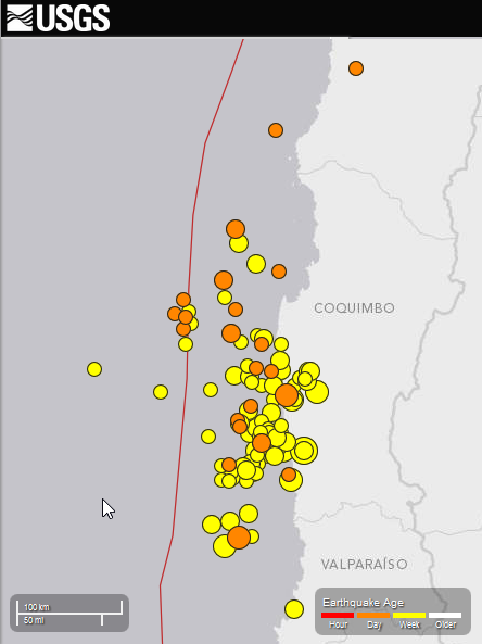
[USGS Earthquake map](https://earthquake.usgs.gov/earthquakes/map/), 2015-09-16 Earthquake near Illapel, Chile
File history
Click on a date/time to view the file as it appeared at that time.
| Date/Time | Thumbnail | Dimensions | User | Comment | |
|---|---|---|---|---|---|
| current | 15:57, 19 September 2015 | | 444 × 593 (54 KB) | PierZen (talk | contribs) | USGS records 102 earthquakes with magnitude 4.5+ From 2015-09-16 to 2015-09-19 13:09 UTC in the Illapel area, Chile |
| 14:14, 17 September 2015 |  | 724 × 585 (62 KB) | PierZen (talk | contribs) | USGS Earthquake map, 2015-09-16 Earthquake near Illapel, Chile |
You cannot overwrite this file.
File usage
The following page uses this file: