File:Areaselector on cadastre.gif
Jump to navigation
Jump to search

Size of this preview: 800 × 564 pixels. Other resolutions: 320 × 226 pixels | 640 × 451 pixels | 1,024 × 722 pixels | 1,400 × 987 pixels.
Original file (1,400 × 987 pixels, file size: 177 KB, MIME type: image/gif, looped, 88 frames, 5.9 s)
Note: Due to technical limitations, thumbnails of high resolution GIF images such as this one will not be animated.
Summary
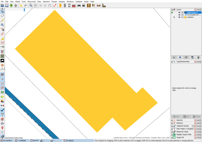
Using areaselector Josm plugin to detect building contour on the French cadastre raster layer
Licensing
![]()
This file is a JOSM screenshot, without imagery in a background.
Note: if the file is of data older than September 12, 2012 when different license was used by OSM for maps and data, then use {{JOSM screenshot without imagery|old_license}}
![]()
"JOSM" (Java OpenStreetMap Editor – josm.openstreetmap.de) is free software released under the terms of the GNU General Public License as published by the Free Software Foundation; either version 2 of the license, or any later version.
It may include OpenStreetMap data, in such case ODbL license also applies:
| Contains map data © OpenStreetMap contributors, made available under the terms of the Open Database License (ODbL).
The ODbL does not require any particular license for maps produced from ODbL data, produced maps may be subject also to other licences. |
File history
Click on a date/time to view the file as it appeared at that time.
| Date/Time | Thumbnail | Dimensions | User | Comment | |
|---|---|---|---|---|---|
| current | 19:09, 20 February 2022 | | 1,400 × 987 (177 KB) | StephaneP (talk | contribs) | Reverted to version as of 18:54, 20 February 2022 (UTC) |
| 19:07, 20 February 2022 | 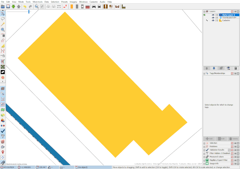 | 800 × 564 (95 KB) | StephaneP (talk | contribs) | ||
| 19:04, 20 February 2022 |  | 1,024 × 722 (141 KB) | StephaneP (talk | contribs) | ||
| 18:56, 20 February 2022 | 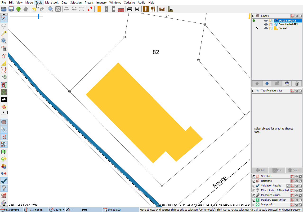 | 1,280 × 897 (181 KB) | StephaneP (talk | contribs) | ||
| 18:54, 20 February 2022 |  | 1,400 × 987 (177 KB) | StephaneP (talk | contribs) | ||
| 17:52, 20 February 2022 | 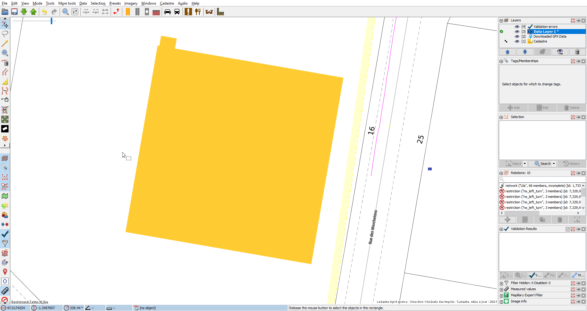 | 1,920 × 1,017 (213 KB) | StephaneP (talk | contribs) | Using areaselector Josm plugin to detect building contour on the French cadastre raster layer |
You cannot overwrite this file.
File usage
There are no pages that use this file.