File:Br-classificacao-camaqua-rs-plano-diretor.jpg
Jump to navigation
Jump to search
Size of this preview: 676 × 599 pixels. Other resolutions: 271 × 240 pixels | 541 × 480 pixels | 866 × 768 pixels | 1,024 × 908 pixels.
Original file (1,024 × 908 pixels, file size: 125 KB, MIME type: image/jpeg)
Summary
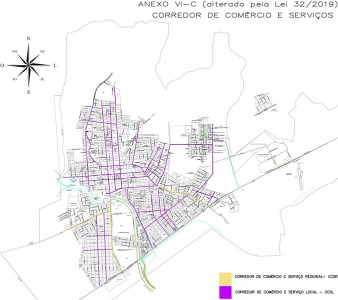
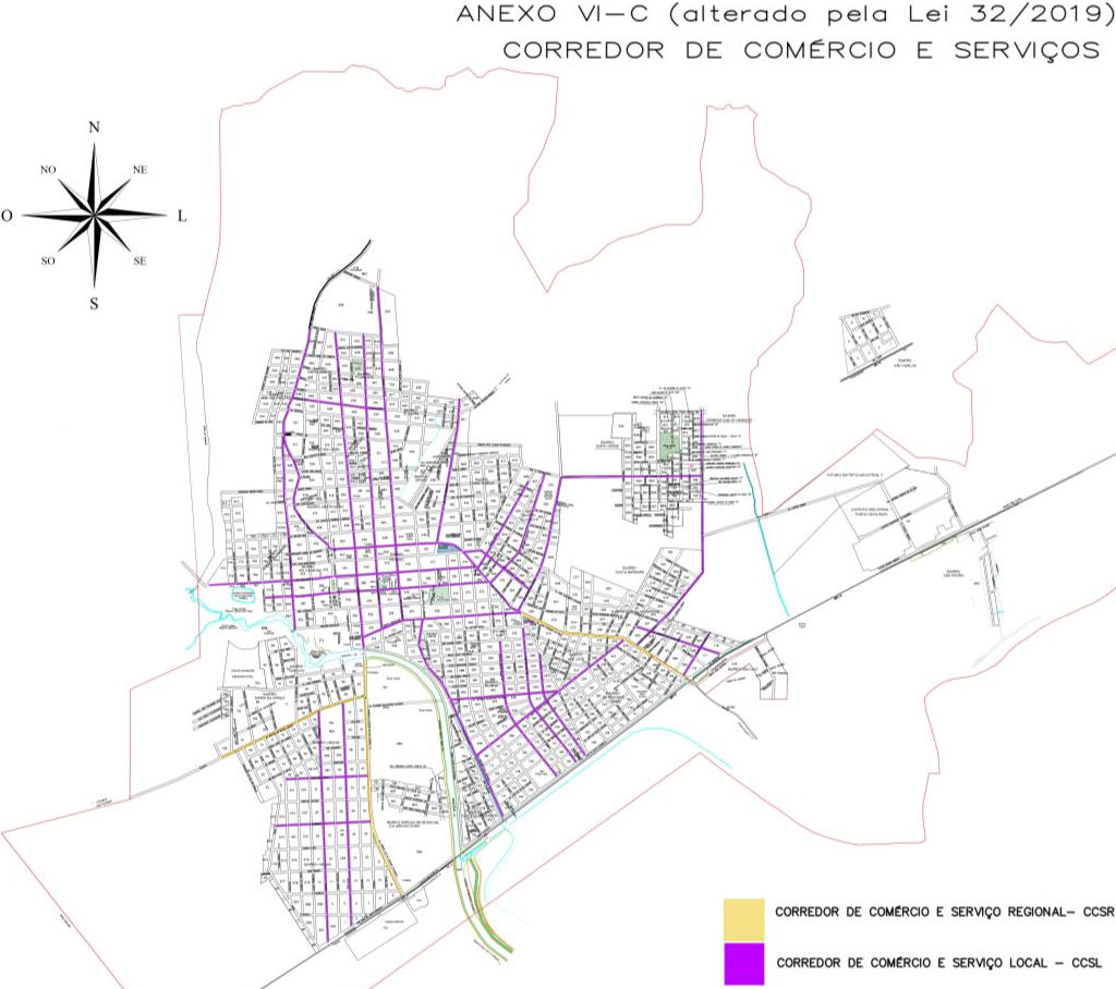
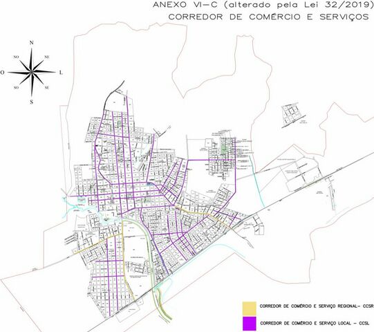
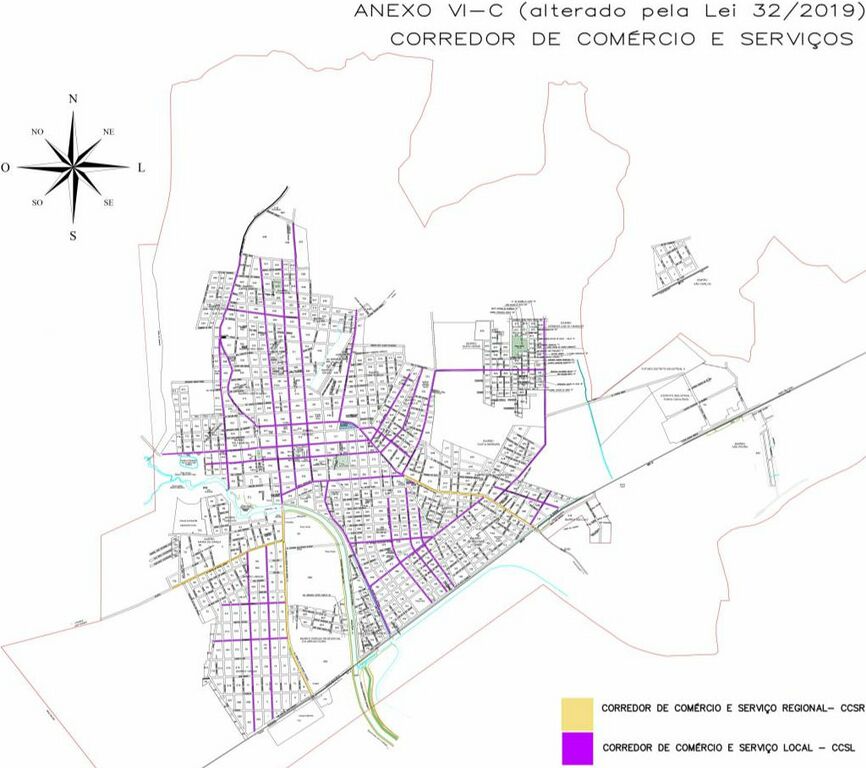
Classificação oficial segundo o plano de mobilidade, publicada em 24 de abril de 2019.
Disponível oficialmente no site da Prefeitura em Plano diretor municipal > Anexo VI-C: Corredores de comércio e serviços.
Licensing
![]()
This file has been released into the public domain by the copyright holder, its copyright has expired, or it is ineligible for copyright. This applies worldwide.
Please, please use more specific template such as {{PD-self}} / {{PD-creator}} / {{PD-shape}} / {{PD-USGov}} / {{PD-old}} / {{PD-RU-exempt}} ... This template is not making clear why this work is in the public domain.
Please, please use more specific template such as {{PD-self}} / {{PD-creator}} / {{PD-shape}} / {{PD-USGov}} / {{PD-old}} / {{PD-RU-exempt}} ... This template is not making clear why this work is in the public domain.
File history
Click on a date/time to view the file as it appeared at that time.
| Date/Time | Thumbnail | Dimensions | User | Comment | |
|---|---|---|---|---|---|
| current | 19:38, 14 January 2021 | | 1,024 × 908 (125 KB) | Ftrebien (talk | contribs) | Classificação oficial segundo o plano de mobilidade, publicada em 24 de abril de 2019. Disponível oficialmente no site da [https://www.camaqua.rs.gov.br/ Prefeitura] em [https://www.camaqua.rs.gov.br/portal/servicos/37/Servi%C3%A7os-ao-Empreendedor/Plano-Diretor Plano diretor municipal] > Anexo VI-C: Corredores de comércio e serviços. |
You cannot overwrite this file.
File usage
The following page uses this file: