File:Br-classificacao-colatina-es-plano-diretor.jpg
Jump to navigation
Jump to search


Size of this preview: 800 × 442 pixels. Other resolutions: 320 × 177 pixels | 640 × 354 pixels | 1,008 × 557 pixels.
Original file (1,008 × 557 pixels, file size: 74 KB, MIME type: image/jpeg)
Summary
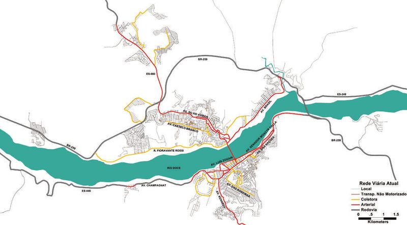
Classificação oficial segundo o plano diretor, publicada em 15 de outubro de 2015.
Disponível oficialmente no site da Secretaria de Saneamento, Habitação e Desenvolvimento do Espírito Santo em Planos > Plano de Mobilidade Urbana > Colatina > 2.1.1.3. Proposta de classificação funcional da rede viária atual (página 42).
Licensing
![]()
This file has been released into the public domain by the copyright holder, its copyright has expired, or it is ineligible for copyright. This applies worldwide.
Please, please use more specific template such as {{PD-self}} / {{PD-creator}} / {{PD-shape}} / {{PD-USGov}} / {{PD-old}} / {{PD-RU-exempt}} ... This template is not making clear why this work is in the public domain.
Please, please use more specific template such as {{PD-self}} / {{PD-creator}} / {{PD-shape}} / {{PD-USGov}} / {{PD-old}} / {{PD-RU-exempt}} ... This template is not making clear why this work is in the public domain.
File history
Click on a date/time to view the file as it appeared at that time.
| Date/Time | Thumbnail | Dimensions | User | Comment | |
|---|---|---|---|---|---|
| current | 18:31, 4 July 2020 | | 1,008 × 557 (74 KB) | Ftrebien (talk | contribs) | Atualizado a partir do plano de mobilidade urbana de 2015. |
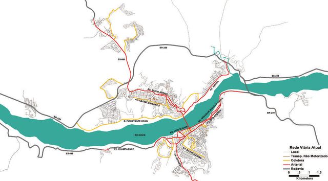
| 02:07, 14 October 2015 |  | 648 × 359 (35 KB) | Ftrebien (talk | contribs) | Classificação oficial segundo o plano diretor, publicada em 8 de abril de 2015. Disponível oficialmente no site do [http://www.planodemobilidade.com.br/ PlanMob Espírito Santo] (talvez referenciado futuramente no site do [http://www.es.gov.br/ Gov... |
You cannot overwrite this file.
File usage
The following page uses this file: