File:Br-classificacao-parobe-rs-plano-diretor.jpg
Jump to navigation
Jump to search

Size of this preview: 800 × 490 pixels. Other resolutions: 320 × 196 pixels | 640 × 392 pixels | 1,022 × 626 pixels.
Original file (1,022 × 626 pixels, file size: 176 KB, MIME type: image/jpeg)
Summary
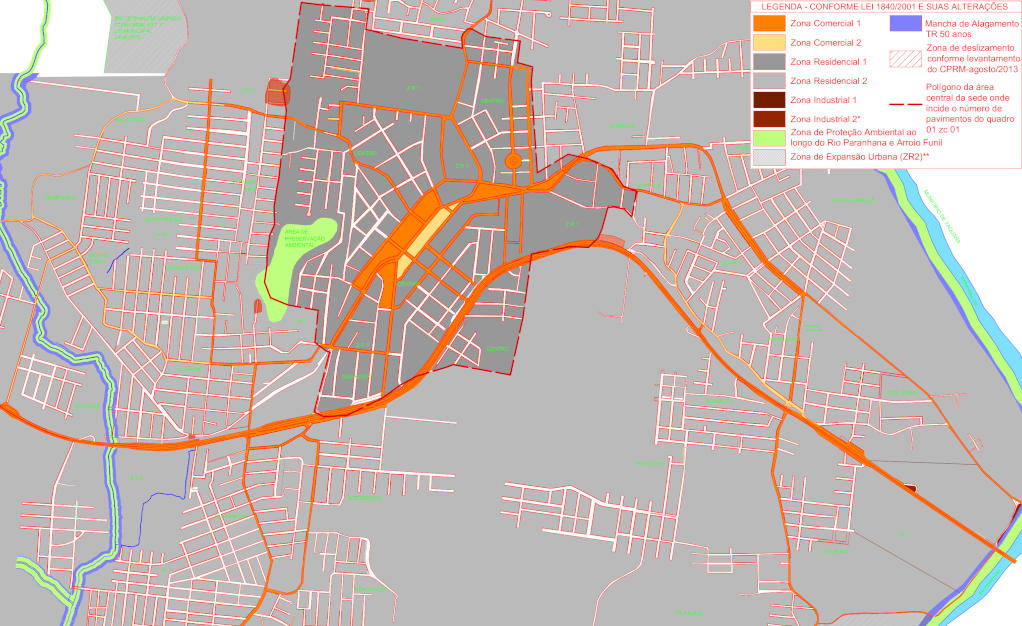
Classificação oficial segundo o plano diretor, publicada em 10 de outubro de 2019.
Disponível oficialmente no site da Prefeitura em Administração > Diretriz urbanística > Arquivos > Mapa do plano diretor > Mapa plano diretor oficial - 10/10/2019.
Licensing
![]()
This file has been released into the public domain by the copyright holder, its copyright has expired, or it is ineligible for copyright. This applies worldwide.
Please, please use more specific template such as {{PD-self}} / {{PD-creator}} / {{PD-shape}} / {{PD-USGov}} / {{PD-old}} / {{PD-RU-exempt}} ... This template is not making clear why this work is in the public domain.
Please, please use more specific template such as {{PD-self}} / {{PD-creator}} / {{PD-shape}} / {{PD-USGov}} / {{PD-old}} / {{PD-RU-exempt}} ... This template is not making clear why this work is in the public domain.
File history
Click on a date/time to view the file as it appeared at that time.
| Date/Time | Thumbnail | Dimensions | User | Comment | |
|---|---|---|---|---|---|
| current | 22:30, 11 January 2021 | | 1,022 × 626 (176 KB) | Ftrebien (talk | contribs) | Versão atualizada. |
| 02:50, 1 October 2015 | 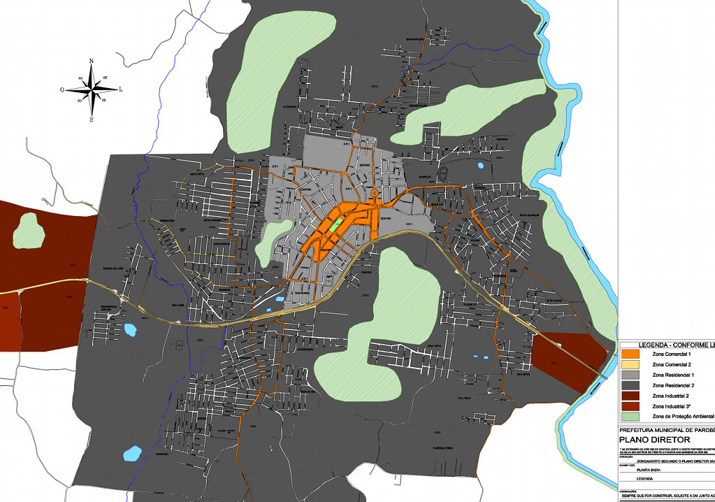 | 1,023 × 718 (167 KB) | Ftrebien (talk | contribs) | Classificação oficial segundo o plano diretor, publicada em 16 de outubro de 2014. Disponível oficialmente no site da [http://parobe.rs.gov.br/ Prefeitura] em [http://parobe.rs.gov.br/index.php/diretrizes-urbanisticas Diretriz Urbanística] > [http... |
You cannot overwrite this file.
File usage
The following page uses this file: