File:Carta Donación de Datos - TECHO - Asentamientos Irregulares Latinoamérica.pdf
Jump to navigation
Jump to search
 Size of this JPG preview of this PDF file: 465 × 599 pixels. Other resolutions: 186 × 240 pixels | 372 × 480 pixels | 596 × 768 pixels | 1,275 × 1,643 pixels. |
Original file (1,275 × 1,643 pixels, file size: 1.46 MB, MIME type: application/pdf, 2 pages)
Summary
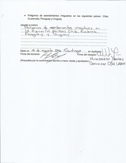
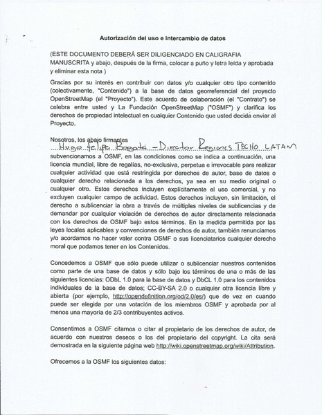
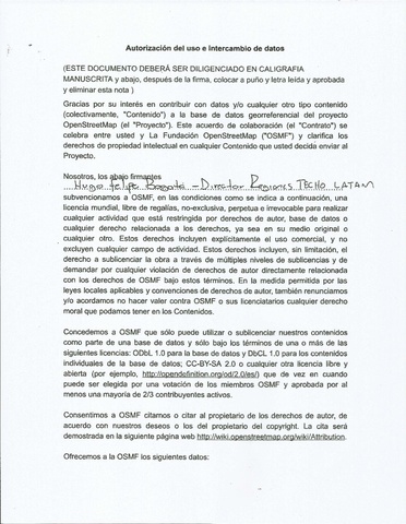
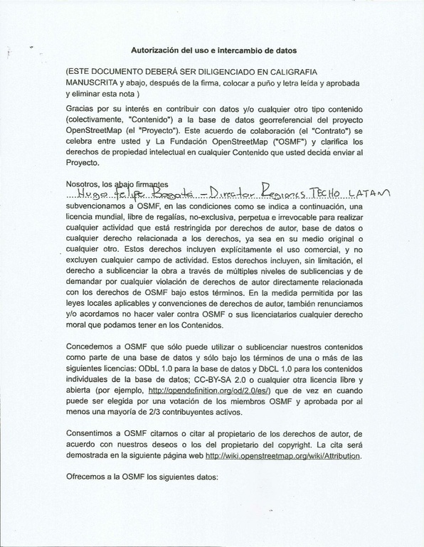
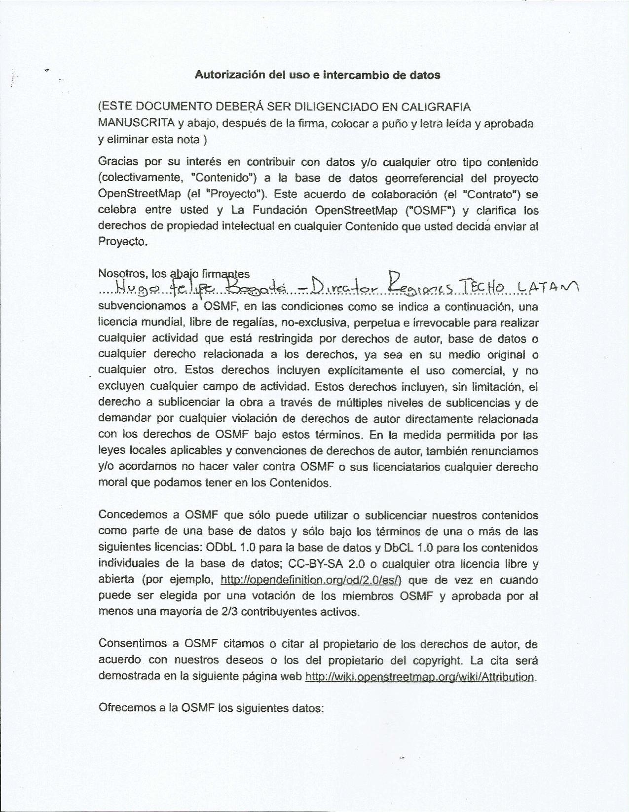
En el marco de la celebración de los 13 años de OpenStreetMap, la comunidad de Latinoamérica mapeará durante el mes de agosto de 2017 asentamientos irregulares en varios países de la región. Esta carta corresponde a los polígonos de estos asentamientos donados por la ONG TECHO Internacional. https://wiki.openstreetmap.org/wiki/OSM_Latam/AniversarioXIII_OSM
Licensing

The copyright holder of this file allows anyone to use it for any purpose, provided that the copyright holder is properly attributed. Redistribution, derivative work, commercial use, and all other use is permitted.
If you are the uploader, please provide proper attribution including source and name of author.
If you are the uploader, please provide proper attribution including source and name of author.
File history
Click on a date/time to view the file as it appeared at that time.
| Date/Time | Thumbnail | Dimensions | User | Comment | |
|---|---|---|---|---|---|
| current | 00:02, 5 August 2017 |  | 1,275 × 1,643, 2 pages (1.46 MB) | Hyances (talk | contribs) | En el marco de la celebración de los 13 años de OpenStreetMap, la comunidad de Latinoamérica mapeará durante el mes de agosto de 2017 asentamientos irregulares en varios países de la región. Esta carta corresponde a los polígonos de estos asent... |
You cannot overwrite this file.
File usage
There are no pages that use this file.