File:DLR 20100108 Albania floods terrasar north low.jpg
Jump to navigation
Jump to search

Size of this preview: 800 × 565 pixels. Other resolutions: 320 × 226 pixels | 640 × 452 pixels | 1,024 × 723 pixels | 1,280 × 904 pixels | 2,560 × 1,808 pixels | 3,311 × 2,339 pixels.
Original file (3,311 × 2,339 pixels, file size: 944 KB, MIME type: image/jpeg)
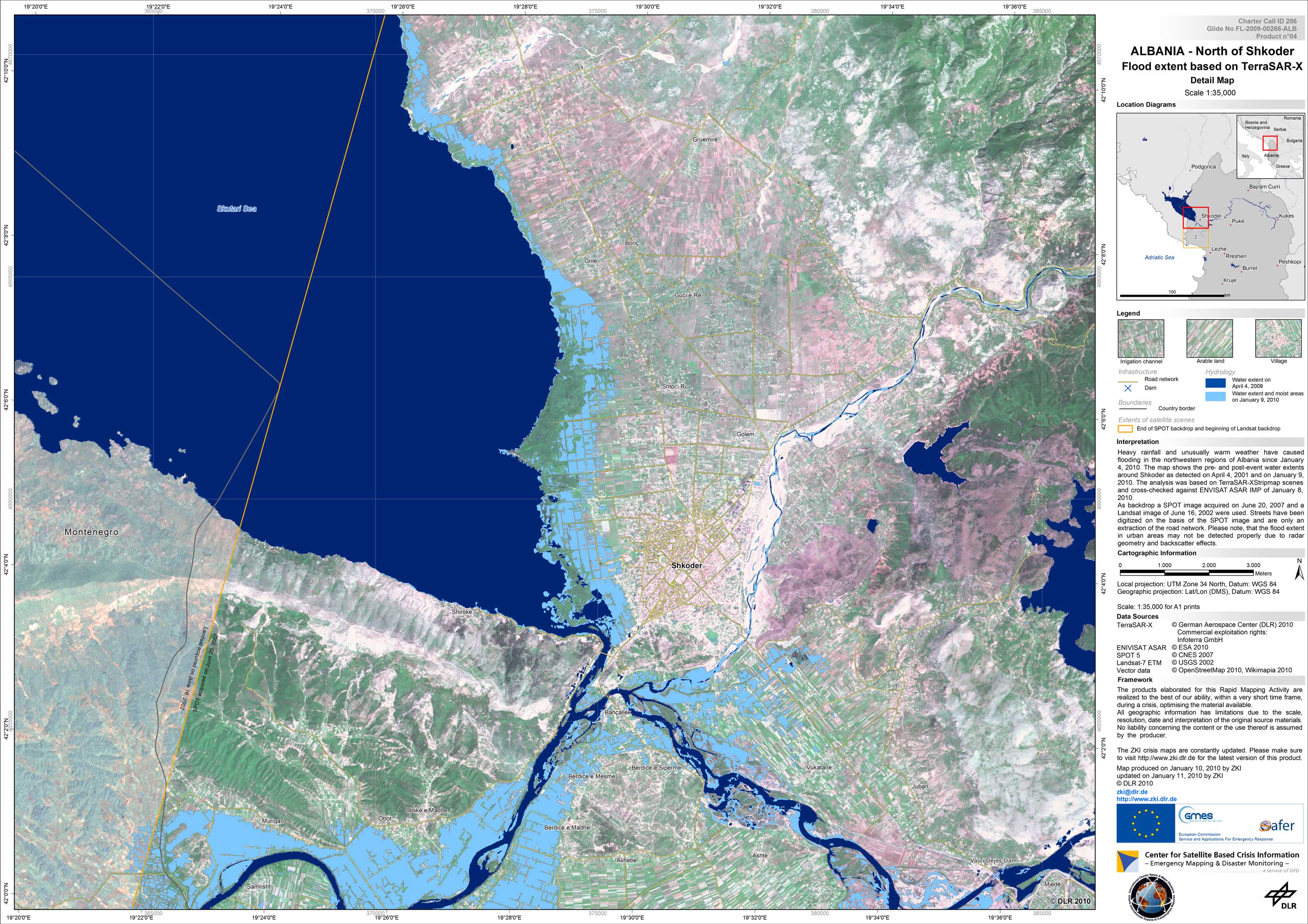
Satellite map of the flooded area around Shkoder, Albania based on TerraSAR-X imagery of January 9, 2010, northern part
January 10, 2010 8:20:33 PM CET
File history
Click on a date/time to view the file as it appeared at that time.
| Date/Time | Thumbnail | Dimensions | User | Comment | |
|---|---|---|---|---|---|
| current | 12:58, 21 January 2010 | | 3,311 × 2,339 (944 KB) | H4ck3rm1k3 (talk | contribs) | Satellite map of the flooded area around Shkoder, Albania based on TerraSAR-X imagery of January 9, 2010, northern part January 10, 2010 8:20:33 PM CET |
You cannot overwrite this file.
File usage
The following page uses this file: