AlbanianFloodingCrisisCamp
This is the page for the coordination of all efforts directed toward helping the people of Albania affected by the flooding in January and December 2010.
Project Blog
The official project blog is hosted here on our server:http://xhema.flossk.org:8081/blog/groups/albanianfloodingcrisiscamp/
see all the WikiProject_Shkoder
We have also a mapserver.org WMS and a sftp server for project collaborators to work together. please join us there as well!
Project team
- Miguel Morgado User:morgado.miguel
- James Michael DuPont User:H4ck3rm1k3
- Bekim Kajtazi
- Michele Morettini User:Mikykorovamilkbar
- Takeo Shibata User:TK777Dr
- Andrew Ross User:AndrewGeo
- Massimiliano User:Massimiliano
- Jeff Owen sporkacus
- Adebayo S. Adepegba User:BashDono
- Doug Brown User:dougcb68
- Janet Vaughn
- Kerice Masters User:masters876
With help from :
and other osm people! thanks!
Tagging
- Twitter :put links to news and photos under the #albanian_flooding hashtag.
- Identica
You can see the existing tags for Albania here:
Tagwatch
Generic
Key:source
Key:landuse
Key:name
Key:addr
Key:fixme
Key:ele
Key:layer
Key:access
Key:area
Key:barrier
Key:man_made
Roads
Tag:highway=unclassified
Key:highway
Key:name
Key:ref
Key:network
Key:access
Key:ele
Key:aerialway
Key:aeroway
Key:parking
Key:bridge
Key:tunnel
Key:lanes
Key:junction
Trails and Paths through the Flood
Dry areas between the floodzones
Key:embankment
Key:tracktype
Key:surface
City Boundaries
Key:name
Key:landuse
Tag:boundary=administrative
Forests
Key:wood
Key:landuse
Tag:natural=peak
Key:mountain_pass
Street Names
Key:highway
Key:name
Buildings
Key:landuse
Key:building
Hotels, Restaurants, Businesses
Key:amenity
Key:tourism
Key:website
Key:leisure
Key:man_made
The Affected Houses
Key:landuse
The Major Sources of Water
Key:maritime
Key:boat
Rivers
Key:waterway
Lakes
Key:waterway
Key:landuse
The Floodzone Itself
Key:landuse
Phototagging
Use Flickr for phototagging
External Links
WMS Layers
layer overview
See the layer definitions here: http://gitorious.org/albanianfloodingcrisiscamp/albanianfloodingcrisiscamp/blobs/master/mapserver/alllayers.map
The data about the layers: http://xhema.flossk.org:8080/cgi-bin/mapserv?map=/var/www/mapserver/alllayers.map&SERVICE=WMS&VERSION=1.1.1&REQUEST=GetCapabilities
qgis
All layers for qgis :
- http://xhema.flossk.org:8080/cgi-bin/mapserv?map=/var/www/mapserver/alllayers.map&
- http://xhema.flossk.org:8080/cgi-bin/mapserv?map=/var/www/mapserver/alllayers_bekim.map&
- http://xhema.flossk.org:8080/cgi-bin/mapserv?map=/var/www/mapserver/alllayers_bekim_42.map&
- http://xhema.flossk.org:8080/cgi-bin/mapserv?map=/var/www/mapserver/alllayers_bekim_41.map&
Russian Maps
Bekim from iMMAP has purchased and donated the georeferenced public domain data from the old russian maps for Albania, Macedonia and Kosovo.
I have Split them into sections, because of the 3 gb limitation.
total map
This map file contains all the tiles available online in one map file layer! http://xhema.flossk.org:8080/cgi-bin/mapserv?service=WMS&version=1.1.1&request=GetMap&layers=Test&srs=EPSG:4326&format=image/png&map=/var/www/mapserver/russian_50_total.map&
Map set a
Map set b
This is also online : http://xhema.flossk.org:8080/cgi-bin/mapserv?service=WMS&version=1.1.1&request=GetMap&layers=Test&srs=EPSG:4326&format=image/png&map=/var/www/mapserver/russian_50_b.map&
Map set c
Map set d
Map set e
Map set f
Layer Details
each layer is listed with the josm wms link.
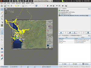
DLR_20100108_Albania_floods_overview_high
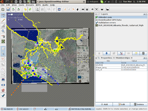
DLR_20100108_Albania_floods_radarsat_high
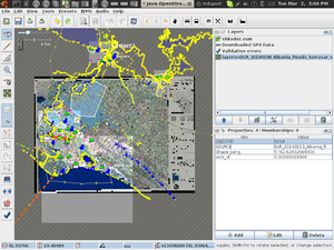
DLR_20100108_Albania_floods_terrasar_south_high
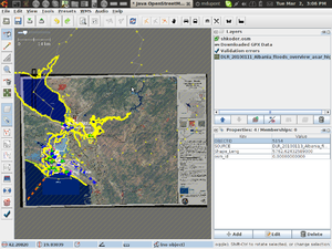
DLR_20100111_Albania_floods_overview_asar_high
DLR_20100112_Albania_floods_radarsat_change_high
DLR_20100113_Albania_floods_formosat_north_high
DLR_20100113_Albania_floods_formosat_south_high
Vector data from Agim Komapani
http://osmopenlayers.blogspot.com/2010/04/agim-komani-data-online.html
The wikipage to track the data is here:
https://wiki.openstreetmap.org/wiki/AlbanianFloodingCrisisCamp/AgimKompaniData
Vector data from tpginc.net
http://tpginc.net/gis/albania/albania.php
Road Network
For Shkoder: https://wiki.openstreetmap.org/wiki/Albania_TPGInc_Import/Shkoder
All streets: https://wiki.openstreetmap.org/wiki/Albania_TPGInc_Import
Shape File : http://xhema.flossk.org:8080/mapdata/03/MapAction/tpginc/LL_Roads_OSM.shp (and other files are here http://xhema.flossk.org:8080/mapdata/03/MapAction/tpginc/)
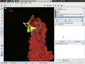
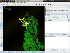
Villages
http://xhema.flossk.org:8080/mapdata/03/MapAction/tpginc/LL_Villages.osm
Works,
but needs to be compared on a osm file basis to the osm data.
so convert to osm and compare. The points are too small on this mapserver layer.
For Shkoder :
http://xhema.flossk.org:8080/mapdata/03/archive/LL_Villages_Shkoder.osm
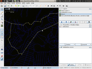
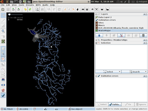
Rivers
https://wiki.openstreetmap.org/wiki/Albania_TPGInc_River_Import for Shokder:https://wiki.openstreetmap.org/wiki/Albania_TPGInc_Import/Shkoder/Rivers
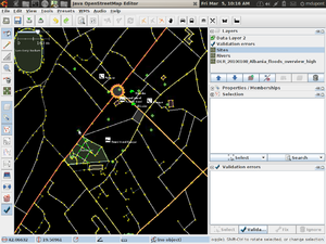
Sites
http://xhema.flossk.org:8080/mapdata/03/MapAction/tpginc/LL_Sites.osm Shkoder :http://xhema.flossk.org:8080/mapdata/03/archive/LL_Sites_Shkoder.osm
WaterMajor
OSM Import Page: https://wiki.openstreetmap.org/wiki/Albania_TPGInc_MajorWater_Import
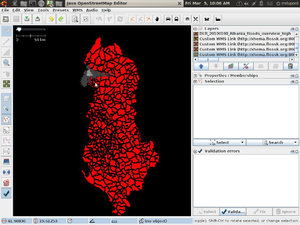
Communes
For Shkoder: https://wiki.openstreetmap.org/wiki/Albania_TPGInc_Import/Shkoder/Communes
Shape files :
http://xhema.flossk.org:8080/mapdata/03/MapAction/tpginc/
LL_Communes.dbf
LL_Communes.prj
LL_Communes.shp
LL_Communes.shx
OSM Files: http://xhema.flossk.org:8080/mapdata/03/MapAction/tpginc/out_LL_Communes/
GNS
http://xhema.flossk.org:8080/mapdata/03/archive/GNS_Shkoder.osm
All GNS Names: http://xhema.flossk.org:8080/mapdata/03/archive/al_fixed.osm
Roads from DLR
These are all done, in my opinion: http://xhema.flossk.org:8080/mapdata/03/archive/20100111_roads_overview_v1_fixed.osm
Contour Data
N41E019_aspect
Satellite Photos
Vector Data
- Importing of the GNS Names of Albania
we have the gns names from Albania in osm format, http://www.archive.org/details/OpenstreetmapAlbania need to import the other parts and check for duplicates.
- Street vector data
Here are the street data files from DLR
- Earthquake data
http://www.emsc-csem.org/index.php?page=current&sub=detail&id=155983
Relief Efforts
Areas affected
This includes Dajç e Obot
Agriculture Minister Genc Ruli declared that in Shkodra 3600 hectares of land were flooded English version
More flooding in Shkoder English version
WikiProject_Ohrid
WikiProject_Korçë
Problematic situation in Durres, landslides and floods English version
Sat Images
We have now permission to use the data from DLG: http://www.zki.caf.dlr.de/applications/2010/Albania/181_en.html
I have created a map here:
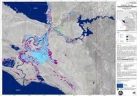
Satellite map of the flooded area around Shkoder, Albania based on TerraSAR-X imagery of January 9, 2010, northern part
January 10, 2010 8:20:33 PM CET
http://warper.geothings.net/maps/export/1969
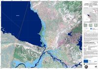
Here is the warped map : http://warper.geothings.net/maps/preview/1969 here is a new map I made.
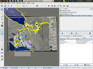
Here is a map of the change in the water:
Duke punuar në krizën e përmbytjes
Përmbytje në Shkodër, Shqipëri!
Kanë ndodhur përmbytje masive në Shqipëri, të cilat kanë shkatërruar një rajon prej rreth 10.000 hektarësh. Më shumë se 2.400 shtëpi janë përmbytur.
Duhet të ndihmojmë në ndërtimin e një harte për të koordinuar ndihmën si WikiProject_Haiti!
Ju lutemi të na dërgoni Gjurmë të GPS, Foto dhe të përdorni Walking_Papers. Na ndihmoni me emrat e rrugëve, na ndihmoni me njohuri në terren. Nëse keni humbur shtëpinë tuaj, ju gjithashtu mund të regjistroheni k¨tu dhe ne do ta vëjmë atë në hartë.
Ju lutem shkruani njerëzve dhe kërkojuni foto satelitore!
Këtu e keni krizën: http://www.disasterscharter.org/web/charter/activation_details?p_r_p_1415474252_assetId=ACT-286
këtu hartën e përmbytjeve: http://browse.digitalglobe.com/imagefinder/showBrowseMetadata?buffer=1.0&catalogId=101001000AF43700&imageHeight=natres&imageWidth=natres
Këtu është blogu im mbi krizën: https://www.openstreetmap.org/user/h4ck3rm1k3/diary/9264
Objekti i zonës së përmbytjeve është këtu: https://www.openstreetmap.org/browse/changeset/3645959
Këtu është wms që kam bërë: http://warper.geothings.net/maps/export/1957
Këtu mund të përcillni udhëzimet për instalim të webkitimageqt https://www.openstreetmap.org/user/h4ck3rm1k3/diary/9289
Të cilin mund ta përdorni në josm si vijon: http://warper.geothings.net/maps/wms/1957?request=GetMap&version=1.1.1&styles=&format=image/png&srs=epsg:4326&exceptions=application/vnd.ogc.se_inimage&
Këtu është videa se si përdoren të gjitha këto: http://www.youtube.com/watch?v=fLei9i2gq44
Këtu ka më shumë video rreth krizës: http://www.youtube.com/watch?v=XkSuuTzoUlE&feature=related http://www.youtube.com/watch?v=V2SVL2z5ZJE&feature=related http://www.youtube.com/watch?v=lcB_ELPq_eM&feature=related
Потопот криза се работеше за
Скадар Албанија беше поплавен!
Имало масивни поплави во Албанија, Поплавите се уништени регион на околу 10.000 хектари. Повеќе од 2.400 домови беа поплавени.
Ние треба да помогне во изградбата на сајтот за олеснување на Хаити, како напор!
Ве молиме пратете ни било која GPS_Traces, Photo_mapping и користи Walking_Papers. Помогнете ни со имињата на улиците, да ни помогнат со регионалните знаење. Доколку сте го изгубиле вашата куќа, можете да се регистрирате со нас и ние ќе го ова на сајтот.
Ве молиме напишете на луѓето и да побараат слики седна!
Potopot kriza se raboteše za
Skadar AlbaniJa beše poplaven!
Imalo masivni poplavi vo AlbaniJa, Poplavite se uništeni region na okolu 10.000 hektari. Poveḱe od 2.400 domovi bea poplaveni.
Nie treba da pomogne vo izgradbata na saJtot za olesnuvanje na Haiti, kako napor!
Ve molime pratete ni bilo koJa GPS_Traces, Photo_mapping i koristi Walking_Papers. Pomognete ni so iminjata na ulicite, da ni pomognat so regionalnite znaenje. Dokolku ste go izgubile vašata kuḱa, možete da se registrirate so nas i nie ḱe go ova na saJtot.
Ve molime napišete na luǵeto i da pobaraat sliki sedna!
Flood crisis being worked on
Shkoder Albania was flooded!
There has been a massive flooding in Albania, Floods have devastated a region of about 10,000 hectares. More than 2,400 homes were flooded.
We should help build a map for the relief effort like the Haiti!
Please send us any GPS_Traces, Photo_mapping and also use Walking_Papers. Help us with the names of streets , help us with regional knowledge. If you lost your house, you can also register with us and we will map it out.
Please write to people and request sat photos!
Here is the crisis: http://www.disasterscharter.org/web/charter/activation_details?p_r_p_1415474252_assetId=ACT-286
there is a sat map : http://browse.digitalglobe.com/imagefinder/showBrowseMetadata?buffer=1.0&catalogId=101001000AF43700&imageHeight=natres&imageWidth=natres
Here is my blog post about it :
https://www.openstreetmap.org/user/h4ck3rm1k3/diary/9264
The floodzone object is here :
https://www.openstreetmap.org/browse/changeset/3645959
Here is the wms I have setup: http://warper.geothings.net/maps/export/1957
Follow my instructions for installing the webkitimageqt https://www.openstreetmap.org/user/h4ck3rm1k3/diary/9289
you can use it in josm like this : http://warper.geothings.net/maps/wms/1957?request=GetMap&version=1.1.1&styles=&format=image/png&srs=epsg:4326&exceptions=application/vnd.ogc.se_inimage&
Here is a video how to use this all : http://www.youtube.com/watch?v=fLei9i2gq44
Here are more videos of the crisis :
http://www.youtube.com/watch?v=XkSuuTzoUlE&feature=related
http://www.youtube.com/watch?v=V2SVL2z5ZJE&feature=related
http://www.youtube.com/watch?v=lcB_ELPq_eM&feature=related
Data
POI Key
see here for more links on shkoder: http://www.shkoder.net/en/links.htm
Map Keys Locations are from here : http://xhema.flossk.org:8080/mapdata/03/SkoderCityMap/tiles/6.png
see the tiles : http://xhema.flossk.org:8080/mapdata/03/SkoderCityMap/tiles/
Buna River
https://www.openstreetmap.org/browse/way/52588360 http://en.wikipedia.org/wiki/Bojana_River
Velipoja | Beach
http://en.wikipedia.org/wiki/Velipoj%C3%AB http://en.tixik.com/velipoja-beach-2353549.htm http://www.velipoja.com/1.html http://www.velipojaguide.com/
this region : https://www.openstreetmap.org/?lat=41.8701&lon=19.4246&zoom=14&layers=B000FTF
Bashkia | Municipality
Old City Map Reference: POI 1
MAP C3
https://www.openstreetmap.org/browse/node/669294296
http://www.panoramio.com/photo/19467642
http://www.qarkushkoder.org/
http://www.shkodra.gov.al/
Biblioteka Publike Marin Barleti | Public Library
Prefektura | Prefecture. Town Hall, Rathaus
Old City Map Reference: POI 2
MAP C3
https://www.openstreetmap.org/browse/node/707435960
http://www.panoramio.com/photo/2225535
http://www.mpcs.gov.al/zedhenesi/6-njoftime-per-shtyp/168-ministria-e-punes-marreveshje-me-prefekturen-shkoder-per-strategjine-kombetare-te-personave-me-aftesi-te-kufizuar
Gjykata | Court
Old City Map Reference: POI 3
MAP C3
https://www.openstreetmap.org/browse/node/669516953
http://www.gjykatashkoder.gov.al/
Drejtoria e Policisë | Police Department
Old City Map Reference: POI 4
MAP A4
https://www.openstreetmap.org/browse/node/718952731
DREJTORIA E POLICISE SHKODER
- Drejtori (022) 48800 (022) 48375
- Shefi Komisariatit Shkoder (022) 43470
- Shefi Komisariatit Puke (021) 22381(021)22237
- Shefi Komisariatit M. Madhe (021)12321(021)12643
http://www.veriu.com/vp/index.php?ind=udhetime&veprimi=policia_shteti
Spitalet | Hospital
Old City Map Reference: POI 5
MAP B4
https://www.openstreetmap.org/browse/node/718952728
http://www.srshkoder.org/
Telekomi | Telecom
Old City Map Reference: POI 6
MAP C4
https://www.openstreetmap.org/browse/node/669516967
http://www.flickr.com/photos/ido_bushati/4373638730/
Muzeumi | Museum. Muzeu i Shkodrës
Old City Map Reference: POI 7
MAP C3
https://www.openstreetmap.org/browse/node/707435971
http://www.shkoder.net/fjala/2005/adushi.htm
http://www.facebook.com/note.php?note_id=161296343740
muzeu i Kalase se Shkodres
http://www.panoramio.com/photo/13940097
Teatri Migjeni | Migjeni Theatre
Old City Map Reference: POI 8
MAP C3
https://www.openstreetmap.org/browse/node/708839872
http://www.flickr.com/photos/improvvisazione/240501858/
http://sq.wikipedia.org/wiki/Teatri_%22Migjeni%22
Kinema Milenium | Millennium Cinema
Old City Map Reference: POI 9
MAP C3
https://www.openstreetmap.org/browse/node/669516958
http://www.flickr.com/photos/kencta/3517656917/
Blv.Republika -Shkoder
Tel.+ 355 82 45015
http://wikimapia.org/14212459/Kinema-Millennium
http://cinematreasures.org/theater/28422/
Radio Shkodra | Radio Shkodra
Old City Map Reference: POI 10
MAP C3
https://www.openstreetmap.org/browse/node/669516950
Kalaja | Castle
Old City Map Reference: POI 11
MAP F1
https://www.openstreetmap.org/browse/node/503678647
https://www.openstreetmap.org/browse/way/52391622
Quality control issue: This POI was already digitized in OSM, but is interesting because it contains an extensive list of tags that I have not used. I was wondering if it would be interesting to add some of these tags to our POI data. If so, which ones? I made no changes to this point.
Stadiumi Loro Boriçi | Stadium Loro Boriçi
Old City Map Reference: POI 12
MAP C3
https://www.openstreetmap.org/browse/node/703325514
Stacioni i Trenit | Train Station
Old City Map Reference: POI 13
MAP D5
https://www.openstreetmap.org/browse/node/614825302
https://www.openstreetmap.org/browse/way/48522575
Quality Control Issue: To follow this issue, please load http://warper.geothings.net/maps/2513 into JOSM. This point already was digitized into the OSM before I started, both as a point and a polygon feature. Neither feature is located where it falls according to the rectified old city map. I did not modify either feature.
Konsullata Austriake | Austrian Consulate
Old City Map Reference: POI 20
MAP C4
https://www.openstreetmap.org/browse/node/703744116
Konsullata Turke | Turkish Consulate
Old City Map Reference: POI 21
MAP C3
https://www.openstreetmap.org/browse/node/707435733
Konsullata Italiane | Italian Consulate
Old City Map Reference: POI 22
MAP C3
https://www.openstreetmap.org/browse/node/669516953
schools
Rektorati | Rectorat
Old City Map Reference: POI 23
MAP C3
https://www.openstreetmap.org/browse/node/669516949
Universiteti Luigj Gurakuqi | University Luigj Gurakuqi
Old City Map Reference: POI 24
MAP C4
https://www.openstreetmap.org/browse/node/722467000
https://www.openstreetmap.org/browse/way/48522596
Quality control issue: To follow this issue, please load http://warper.geothings.net/maps/2525 into JOSM. This POI already had a polygon feature in OSM that has a slight positional discrepency with the Old City Map. I placed the point at the position of the Old City Map.
Shkolla Mesme "28 Nëntori" | "28 November" Middle School
Old City Map Reference: POI 25
MAP C3
https://www.openstreetmap.org/browse/node/669294286
http://en.wikipedia.org/wiki/28_Nentori_High_School
ref :http://wikimapia.org/9656467/Shkolla-e-Mesme-e-P%C3%ABrgjithshme-28-N%C3%ABntori photo : http://albaniafoto.albumi.com/displayimage.php?album=14&pos=6
Group on facebook : http://www.facebook.com/group.php?gid=10864374106 on hi5 : http://permitofstay.hi5.com/friend/group/1793013--shkolla%2Be%2Bmesme%2B28%2Bnentori%2Bshk--front-html
Shkolla Mesme Oso Kuka | Oso Kuka Middle School
Old City Map Reference: POI 26
MAP B3
https://www.openstreetmap.org/browse/node/703325517
Shkolla Mesme Jordan Misja | Jordan Misja Middle School
Old City Map Reference: POI 27
MAP B4
https://www.openstreetmap.org/browse/node/718952646
http://en.wikipedia.org/wiki/Jordan_Misja_High_School
http://www.jordan-misja.org/
Scutari High School
http://en.wikipedia.org/wiki/Scutari_High_School http://scutari-highschool.webs.com/ "Gjimnazi jopublik Scutari" ndodhet ne adresen e meposhtme: Lagja Tom Kola Rr Daniel Matlija Nr 32. Mund te kontaktoni ne nr telefoni 249638 si dhe cel. 0692024936 e 0692066126 https://www.openstreetmap.org/browse/node/735982896
Shkolla Mesme Kol Idromeno | Kol Idromeno Middle School
Old City Map Reference: POI 28
MAP D3
https://www.openstreetmap.org/browse/node/669516948
Shkolla Artistike Prek Jakova | Prek Jakova Art School
Old City Map Reference: POI 29
MAP B4
https://www.openstreetmap.org/browse/node/724209630
Medreseja | Madrasah
Old City Map Reference: POI 30
MAP D2
https://www.openstreetmap.org/browse/node/669516940
Shkolla Pjetër Mëshkalla | Peter Mëshkalla School
Old City Map Reference: POI 31
MAP C4
https://www.openstreetmap.org/browse/node/669516957
http://en.wikipedia.org/wiki/Pjeter_Meshkalla_High_School
Others
Fshati i Paqes | Peace Village
Old City Map Reference: POI 32
MAP E1
https://www.openstreetmap.org/browse/node/724221074
Quality control issue: unable to find any information that would allow me to classify this POI.
Xhamia Fushë-Qelë | Field-Qelë Mosque
Old City Map Reference: POI 33
MAP C3
https://www.openstreetmap.org/browse/node/274122535
Also know as : Al-Zamil Mosque https://wiki.openstreetmap.org/w/index.php?title=AlbanianFloodingCrisisCamp/WhatToSee#Al-Zamil_Mosque
Xhamia Parrucës | Parrucës Mosque
Old City Map Reference: POI 34
MAP C3
https://www.openstreetmap.org/browse/node/658275184
Xhamia Bahçallëkut | Bahçallëkut Mosque
Old City Map Reference: POI 35
MAP F1
https://www.openstreetmap.org/browse/node/725252393
Quality control issue: The location of this POI is highly suspect, because I was unable to locate reliable control points to rectify the map. The position I chose represents my best guess. The roads that have been digitized in this area need considerable revision.
Xhamia Plumbit | Lead Mosque
Old City Map Reference: POI 36
MAP F2
https://www.openstreetmap.org/browse/node/725266433
Katedralja | Cathedral
Old City Map Reference: POI 37
MAP C4
https://www.openstreetmap.org/browse/node/721157171
https://www.openstreetmap.org/browse/way/48522585
Kisha Zonja e Shkodrës | Lady of Shkodra Church
Old City Map Reference: POI 38
MAP F1
https://www.openstreetmap.org/browse/node/721151301
Kisha Fretënve | Fretënve Church
Old City Map Reference: POI 39
MAP C4
https://www.openstreetmap.org/browse/node/704485275
Kisha Ortodokse | Orthodox Church
Old City Map Reference: POI 40
MAP C4
https://www.openstreetmap.org/browse/node/704485276
https://www.openstreetmap.org/browse/way/48522595
Varrezat e Dëshmorëve | Graveyard of the Martyrs
Old City Map Reference: POI 41
MAP E5
https://www.openstreetmap.org/browse/node/726577179
Varrezat e Vjetra Myslimane | Old Muslim Cemetery
Old City Map Reference: POI 42
MAP A3
https://www.openstreetmap.org/browse/node/702563562
Varrezat Katolike | Catholic Cemetery
Old City Map Reference: POI 43
MAP C5
https://www.openstreetmap.org/browse/node/718952723
Market
https://www.openstreetmap.org/browse/way/58379469 http://www.virtualtourist.com/travel/Europe/Albania/Rrethi_i_Shkodres/Shkoder-733939/Local_Customs-Shkoder-BR-1.html http://worldpics.com.au/Europe/Albania/shkoder_2.html
Old Bazaar
http://www.shkodraonline.com/galeria/main.php?g2_itemId=15289
Fototeke Marubi
Fototeke Marubi, Muhamet Gollesha. First ever photograph taken in Albania (1858) is here. 130 lek.
source :http://wikitravel.org/en/Shkodra
Restaurant List
Restaurant List AlbanianFloodingCrisisCamp/Restaurants
Monuments List
Monuments List AlbanianFloodingCrisisCamp/Monuments
Where to Stay
Places to stay List AlbanianFloodingCrisisCamp/WhereToStay
What to See
What to see List AlbanianFloodingCrisisCamp/WhatToSee
Directory
Directory AlbanianFloodingCrisisCamp/Directory
Streets Data
Information about Streets is located at: AlbanianFloodingCrisisCamp/Streets
See Also
http://worldpics.com.au/Europe/Albania/shkoder_2.html http://www.facebook.com/pages/Shkoder-Albania/Shkodra-qyteti-im/142343099842 http://www.albasoul.com/modules.php?op=modload&name=News&file=article&sid=511 http://wikitravel.org/en/Shkodra
data sources
Here are the street data files from DLR: http://www.archive.org/details/OpenstreetmapAlbaniaRoadDataFromDeutschenZentrumsFrLuft-Und
Here are the GNS Names from Albania http://www.archive.org/details/OpenstreetmapAlbania


