File:Departements Lambert4Zones.svg
Jump to navigation
Jump to search


Size of this PNG preview of this SVG file: 588 × 550 pixels. Other resolutions: 257 × 240 pixels | 513 × 480 pixels | 821 × 768 pixels | 1,095 × 1,024 pixels.
Original file (SVG file, nominally 588 × 550 pixels, file size: 282 KB)
This file and its description are from Wikimedia Commons.
Summary
| Description |
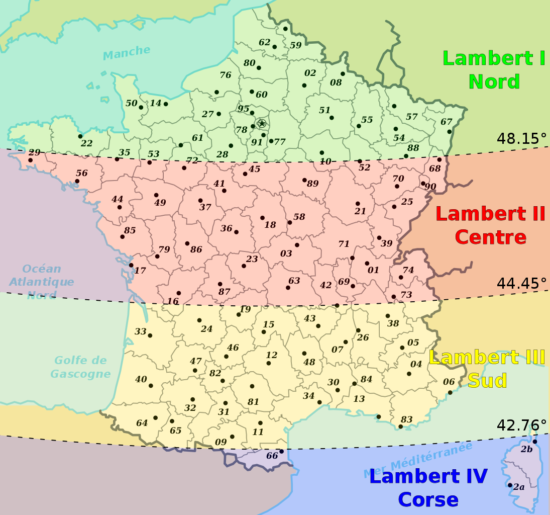
English: France divided in the 4 Lambert zones |
| Date | |
| Source | Own work based on: Départements de France.svg by Bayo |
| Author | {{|U|Tsaitgaist}} |
| SVG development |
Licensing
| This file is made available under the Creative Commons CC0 1.0 Universal Public Domain Dedication. | |
| The person who associated a work with this deed has dedicated the work to the public domain by waiving all of their rights to the work worldwide under copyright law, including all related and neighboring rights, to the extent allowed by law. You can copy, modify, distribute and perform the work, even for commercial purposes, all without asking permission.
|
File history
Click on a date/time to view the file as it appeared at that time.
| Date/Time | Thumbnail | Dimensions | User | Comment | |
|---|---|---|---|---|---|
| current | 18:13, 8 January 2010 | | 588 × 550 (282 KB) | wikimediacommons>Tsaitgaist | latitude of limits added |
File usage
The following page uses this file: