File:Early UK coverage growth 2005-2007.gif
Jump to navigation
Jump to search

No higher resolution available.
Early_UK_coverage_growth_2005-2007.gif (600 × 576 pixels, file size: 181 KB, MIME type: image/gif, looped, 28 frames, 15 s)
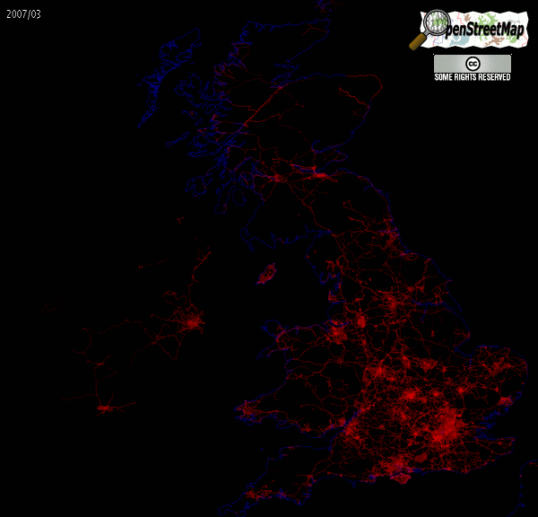
Animation showing the growth of data coverage in the UK between 2005 and early 2007 (This is very early in the History of OpenStreetMap)
Based on planet-070307.osm
I created this image. Tjpayne (talk) 13:33, 6 March 2022 (UTC)
![]()
Contains map data © OpenStreetMap contributors, made available under the terms of the Creative Commons Attribution-ShareAlike 2.0 (CC-BY-SA-2.0).
Author of image declared that their work is {{CC0-self}} [1]
![[1]](https://wiki.openstreetmap.org/w/index.php?title=File:Early_UK_coverage_growth_2005-2007.gif&diff=2276626&oldid=2276504)
File history
Click on a date/time to view the file as it appeared at that time.
| Date/Time | Thumbnail | Dimensions | User | Comment | |
|---|---|---|---|---|---|
| current | 21:09, 9 March 2007 | | 600 × 576 (181 KB) | Tjpayne (talk | contribs) | Based on planet-070307.osm |
You cannot overwrite this file.
File usage
There are no pages that use this file.