File:Landuse=farmland.jpg
Landuse=farmland.jpg (800 × 600 pixels, file size: 106 KB, MIME type: image/jpeg)
Modified version of File:Landuse=farmyard.jpg and landuse=farm.jpg. farm was replaced by farmland.
original description:
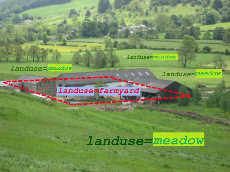
Illustration of Tag:landuse=farmyard and Tag:landuse=farmland by Harry Wood
Note: it is not the intention of this image to indicate the landuse=farmland polygon must be drawn around individual fields. Exactly where you draw the polygons is still up for discussion.
License
The photo was taken by Harry Wood during the Pately Bridge Mapping Party. Beautiful Nidderdale!
And the tagging bits added on top were also by Harry, but here a modification by User:Travelling salesman
![]()
![]()
The person who associated a work with this deed has dedicated the work to the public domain by waiving all of his or her rights to the work worldwide under copyright law, including all related and neighboring rights, to the extent allowed by law. You can copy, modify, distribute and perform the work, even for commercial purposes, all without asking permission.
File history
Click on a date/time to view the file as it appeared at that time.
| Date/Time | Thumbnail | Dimensions | User | Comment | |
|---|---|---|---|---|---|
| current | 23:30, 29 June 2021 | | 800 × 600 (106 KB) | GoodClover (talk | contribs) | Correct tagging (the wiki page [https://wiki.openstreetmap.org/w/index.php?title=Tag:landuse%3Dfarmland&diff=2169884&oldid=2156185 admitted itself] :P) |
| 22:33, 5 May 2011 | 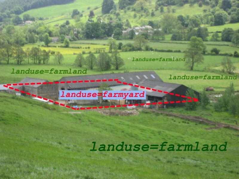 | 800 × 600 (82 KB) | Travelling salesman (talk | contribs) | Modified version of File:Landuse=farmyard.jpg. ''farm'' was replaced by ''farmland''. original description:</br> Illustration of Tag:landuse=farmyard and Tag:landuse=farmland by Harry Wood Note: it is not the intention o |
You cannot overwrite this file.
File usage
The following file is a duplicate of this file (more details):
The following 10 pages use this file: