File:Maghbazar, Dhaka, Bangladesh dense mapping.png
Jump to navigation
Jump to search

No higher resolution available.
Maghbazar,_Dhaka,_Bangladesh_dense_mapping.png (742 × 533 pixels, file size: 272 KB, MIME type: image/png)
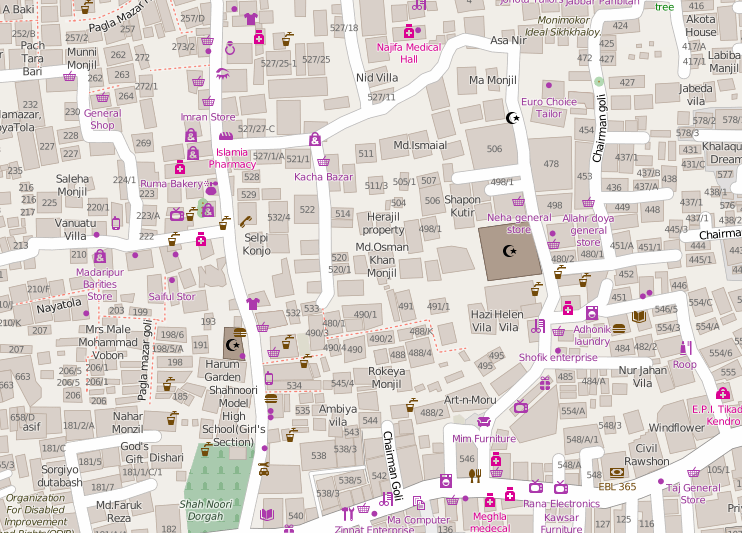
The Bangladesh OpenStreetMap community (facebook group) together with the Red Cross have been mapping the dense district Moghbazar in Dhaka
"standard" OSM style view of here on the map:http://www.openstreetmap.org/#map=18/23.75545/90.40802
File history
Click on a date/time to view the file as it appeared at that time.
| Date/Time | Thumbnail | Dimensions | User | Comment | |
|---|---|---|---|---|---|
| current | 23:41, 4 September 2016 | | 742 × 533 (272 KB) | Atikur Rahman atik (talk | contribs) | The Bangladesh OpenStreetMap community ([https://www.facebook.com/groups/152627941462625/ facebook group]) together with the Red Cross have been mapping the dense district Maghbazar in Dhaka "standard" OSM style view of here on the map:http:/... |
You cannot overwrite this file.
File usage
The following 2 pages use this file: