File:Paddington 09 cake.png
Jump to navigation
Jump to search


Size of this preview: 800 × 581 pixels. Other resolutions: 320 × 232 pixels | 640 × 465 pixels | 1,024 × 744 pixels | 1,352 × 982 pixels.
Original file (1,352 × 982 pixels, file size: 837 KB, MIME type: image/png)
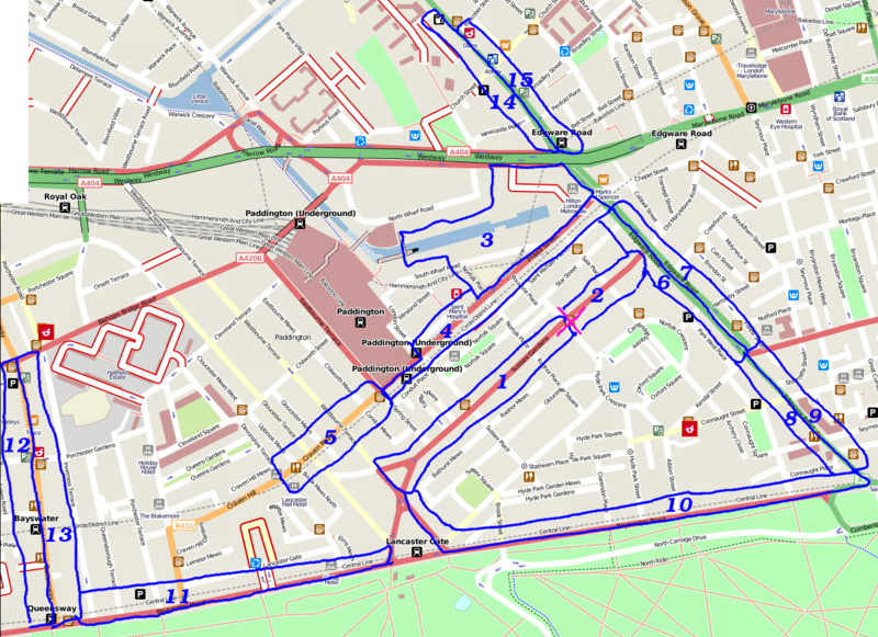
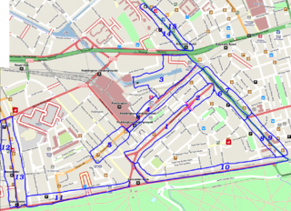
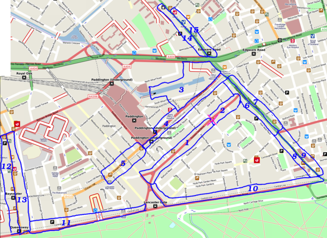
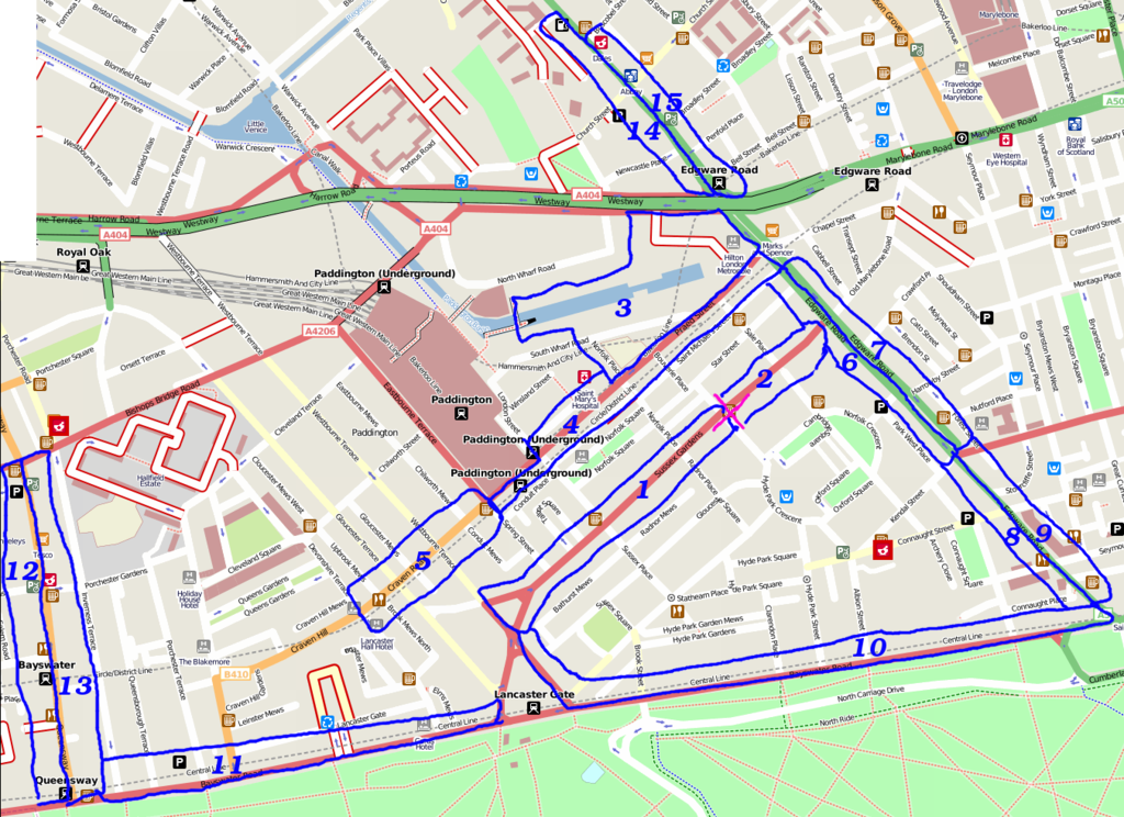
Cake diagram for the London/Summer 2009 Mapping Party Marathon. Paddington area (map) on Tuesday 28th September 2009
Attendees
Here's who signed up in advance
- Harry Wood - slice 7 (kebab shops!) - Meeting Michael at 6:30 Marble Arch to show him how we do mapping
- TomH - slice 10
- Matt - slice 8, if LWG doesn't carry on too long.
- Stephen - slice 9
- Wynndale - slice 5
...and many people who didn't sign up
Mapping later/earlier
- Rogers-Blant - Slice 3. Cannot attend actual party as I'm due to work that night, but I've visited the slice and mapped it out over the weekend. See diary for more specific info :)
- Attila - slice 1 - I will map it later this week as I'm sick at the moment, so I cannot join you guys...
- EAi can do slices 12 and/or 13 if nobody else wants to, as I live very nearby, but can't come on the day...
cake notes
This cake comes in many flavours:
- Areas 1 and 2 have lots of hotel node to add. Also a straightforward road to add addressing on
- Areas 6,7,8,9,14 & 15 is Edgware Road, with bazillions of little kebab shops and such like to add to the map (hence quite small slices)
- Area 4 and 5. Also quite a few scraggly little shops
- Areas 10 and 11 is Bayswater Road with hotels facing the park. Also some bus stops.
- Areas 12 and 13 is Queensway. Lots of little kebab shops and such like. Area 12 has Whiteleys a multi-level shopping mall. Tag shops above eachother?? could be fun
- Area 3. big new office blocks & canal plaza. Not on yahoo. might be interesting to try to do building outlines.
There's a few areas of shops nearby, where we'll surely be able to get some more node features onto the map. There may be a bit of NaPTAN/Surveying and Merging NaPTAN and OSM data to do in the area too.
File history
Click on a date/time to view the file as it appeared at that time.
| Date/Time | Thumbnail | Dimensions | User | Comment | |
|---|---|---|---|---|---|
| current | 16:10, 24 September 2009 | | 1,352 × 982 (837 KB) | Harry Wood (talk | contribs) | Cake diagram for the London/Summer 2009 Mapping Party Marathon. Paddington area ([http://www.openstreetmap.org/?lat=51.516631&lon=-0.170089&zoom=17 map]) on Tuesday 28th September 2009 |
You cannot overwrite this file.
File usage
There are no pages that use this file.