File:Side Trail (9224135427).jpg
Jump to navigation
Jump to search


Size of this preview: 400 × 600 pixels. Other resolutions: 160 × 240 pixels | 320 × 480 pixels | 512 × 768 pixels | 682 × 1,024 pixels | 1,365 × 2,048 pixels | 3,456 × 5,184 pixels.
Original file (3,456 × 5,184 pixels, file size: 15.54 MB, MIME type: image/jpeg)
This file and its description are from Wikimedia Commons.
Summary
| Description |
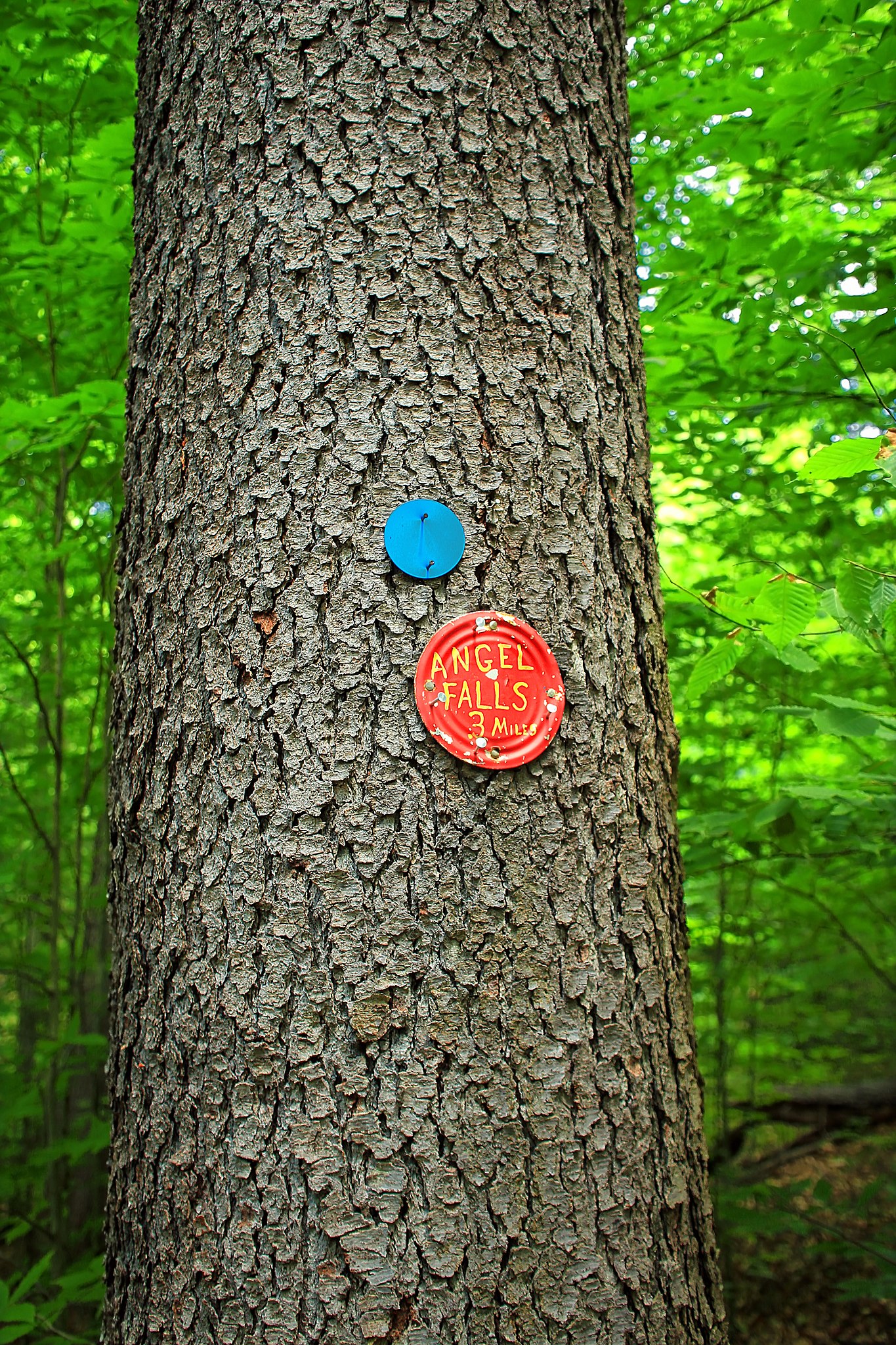
Loyalsock State Forest, Sullivan County. From the Loyalsock Trail, a blue-blazed side trail leads steeply downhill to the crest of Angel Falls. Accessing the bottom of the falls, as well as the other falls and cascades, is difficult but worth the effort. |
| Date | |
| Source | Side Trail |
| Author | Nicholas A. Tonelli from Northeast Pennsylvania, USA |
| Camera location | | View this and other nearby images on: OpenStreetMap |
|---|
.jpg¶ms=041.394501_N_-076.676223_E_globe:Earth_type:camera_source:Flickr_&language=en)
Licensing
This file is licensed under the Creative Commons Attribution 2.0 Generic license.
- You are free:
- to share – to copy, distribute and transmit the work
- to remix – to adapt the work
- Under the following conditions:
- attribution – You must give appropriate credit, provide a link to the license, and indicate if changes were made. You may do so in any reasonable manner, but not in any way that suggests the licensor endorses you or your use.
| This image was originally posted to Flickr by Nicholas_T at https://flickr.com/photos/14922165@N00/9224135427. It was reviewed on 18 August 2017 by FlickreviewR and was confirmed to be licensed under the terms of the cc-by-2.0. |
File history
Click on a date/time to view the file as it appeared at that time.
| Date/Time | Thumbnail | Dimensions | User | Comment | |
|---|---|---|---|---|---|
| current | 23:46, 18 August 2017 | | 3,456 × 5,184 (15.54 MB) | wikimediacommons>XXN | Transferred from Flickr via Flickr2Commons |
File usage
The following 31 pages use this file:
- Cs:Key:information
- Cs:Tag:tourism=information
- Key:information
- Pl:Key:information
- Pl:Tag:tourism=information
- Tag:information=route marker
- Tag:tourism=information
- Zh-hans:Key:information
- Zh-hans:Tag:tourism=information
- Wiki:Files used by data items/4
- Template:Az:Map Features:information
- Template:Cs:Map Features:information
- Template:DE:Map Features:information
- Template:FR:Map Features:information
- Template:IT:Map Features:information
- Template:JA:Map Features:information
- Template:Map Features:information
- Template:Pl:Map Features:information
- Template:RU:Map Features:information
- Template:Zh-hans:Map Features:information
- DE:Key:information
- DE:Proposed features/information
- DE:Tag:information=route marker
- DE:Tag:tourism=information
- FR:Key:information
- IT:Proposed features/information
- RU:Key:information
- RU:Tag:information=route marker
- RU:Tag:tourism=information
- JA:Key:information
- JA:Tag:tourism=information
.jpg)