File:StateOfGermanyChart.pdf
Jump to navigation
Jump to search
Size of this JPG preview of this PDF file: 423 × 599 pixels. Other resolutions: 169 × 240 pixels | 339 × 480 pixels | 542 × 768 pixels | 1,239 × 1,754 pixels.
Original file (1,239 × 1,754 pixels, file size: 12 KB, MIME type: application/pdf)
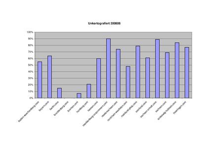
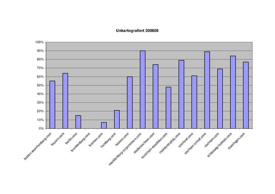
Grafische Darstellung der potenziell nicht kartografierten Orte in Deutschland nach Bundesländern.
File history
Click on a date/time to view the file as it appeared at that time.
| Date/Time | Thumbnail | Dimensions | User | Comment | |
|---|---|---|---|---|---|
| current | 15:05, 19 August 2008 |  | 1,239 × 1,754 (12 KB) | Gary68w (talk | contribs) | Grafische Darstellung der potenziell nicht kartografierten Orte in Deutschland nach Bundesländern. |
You cannot overwrite this file.
File usage
There are no pages that use this file.