File:Utility facility tagging.png
Jump to navigation
Jump to search

Size of this preview: 800 × 525 pixels. Other resolutions: 320 × 210 pixels | 640 × 420 pixels | 1,024 × 672 pixels | 1,351 × 887 pixels.
Original file (1,351 × 887 pixels, file size: 702 KB, MIME type: image/png)
Summary
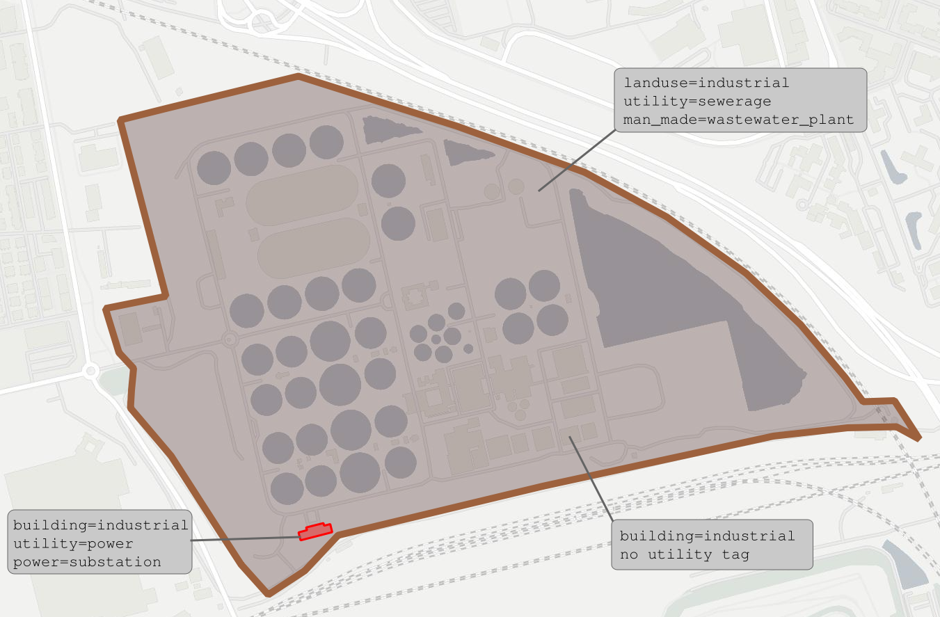
| Description | Practical example about utility facility tagging |
|---|---|
| Author | François Lacombe |
| Source | OpenStreetMap contributors - OpenMapTiles |
| Date | 2023-02-19 |
Licensing
![]()
![]()
![]()
This work is licensed under the Creative Commons Attribution-ShareAlike 4.0 License.
Attribution: François Lacombe
Attribution: François Lacombe
| Contains map data © OpenStreetMap contributors, made available under the terms of the Open Database License (ODbL).
The ODbL does not require any particular license for maps produced from ODbL data, produced maps may be subject also to other licences. |
File history
Click on a date/time to view the file as it appeared at that time.
| Date/Time | Thumbnail | Dimensions | User | Comment | |
|---|---|---|---|---|---|
| current | 22:36, 19 February 2023 | | 1,351 × 887 (702 KB) | Fanfouer (talk | contribs) | {{Information | description=Practical example about utility facility tagging | source=OpenStreetMap contributors - OpenMapTiles | date=2023-02-19 | author=François Lacombe | other_versions= }} |
You cannot overwrite this file.
File usage
The following 2 pages use this file: