File:Waterway hydropower pyrenees.png
Jump to navigation
Jump to search


Size of this preview: 800 × 478 pixels. Other resolutions: 320 × 191 pixels | 640 × 383 pixels | 1,024 × 612 pixels | 1,512 × 904 pixels.
Original file (1,512 × 904 pixels, file size: 791 KB, MIME type: image/png)
Summary
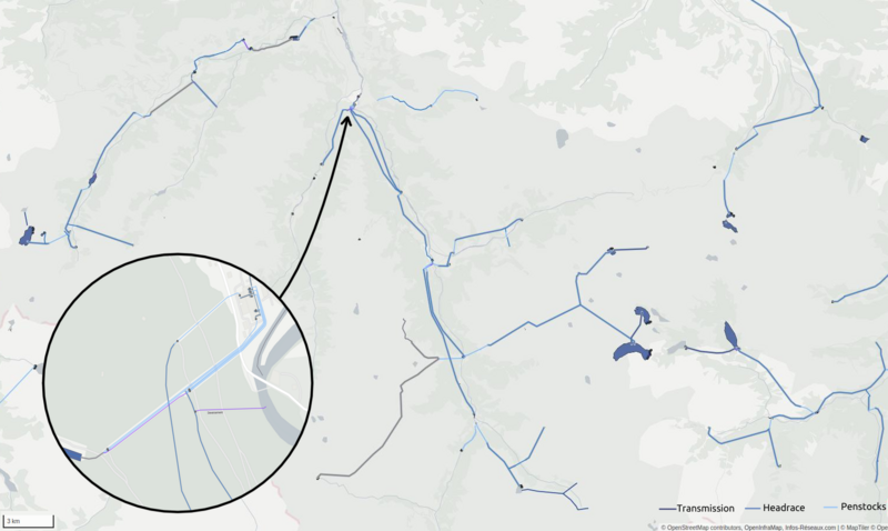
| Description | Hydropower mapping and render in French Pyrenées mountains |
|---|---|
| Author | François Lacombe |
| Source | OpenStreetMap contributors |
| Date | 2022-12-23 |
Licensing
- This media file was uploaded by author of the work and its copyright holder.
![]()
![]()
![]()
This work is licensed under the Creative Commons Attribution-ShareAlike 4.0 License.
Attribution: François Lacombe
Attribution: François Lacombe
| Contains map data © OpenStreetMap contributors, made available under the terms of the Open Database License (ODbL).
The ODbL does not require any particular license for maps produced from ODbL data, produced maps may be subject also to other licences. |
File history
Click on a date/time to view the file as it appeared at that time.
| Date/Time | Thumbnail | Dimensions | User | Comment | |
|---|---|---|---|---|---|
| current | 16:43, 23 December 2022 | | 1,512 × 904 (791 KB) | Fanfouer (talk | contribs) | {{Information | description=Hydropower mapping and render in French Pyrenées mountains | source=OpenStreetMap contributors | date=2022-12-23 | author=François Lacombe | other_versions= }} |
You cannot overwrite this file.
File usage
There are no pages that use this file.