File:Waterway manmade structures.png
Jump to navigation
Jump to search

Size of this preview: 800 × 343 pixels. Other resolutions: 320 × 137 pixels | 640 × 274 pixels.
Original file (1,400 × 600 pixels, file size: 77 KB, MIME type: image/png)
Summary
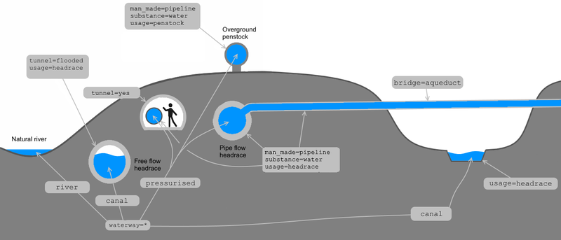
Illustration of infrastructure separation with waterway keys
François Lacombe - www.infos-reseaux.com
Licensing
![]()
![]()
![]()
This work is licensed under the Creative Commons Attribution-ShareAlike 3.0 License.
Attribution: François Lacombe www.infos-reseaux.com
Attribution: François Lacombe www.infos-reseaux.com
File history
Click on a date/time to view the file as it appeared at that time.
| Date/Time | Thumbnail | Dimensions | User | Comment | |
|---|---|---|---|---|---|
| current | 10:06, 20 February 2018 | | 1,400 × 600 (77 KB) | Fanfouer (talk | contribs) | |
| 16:33, 8 February 2018 | 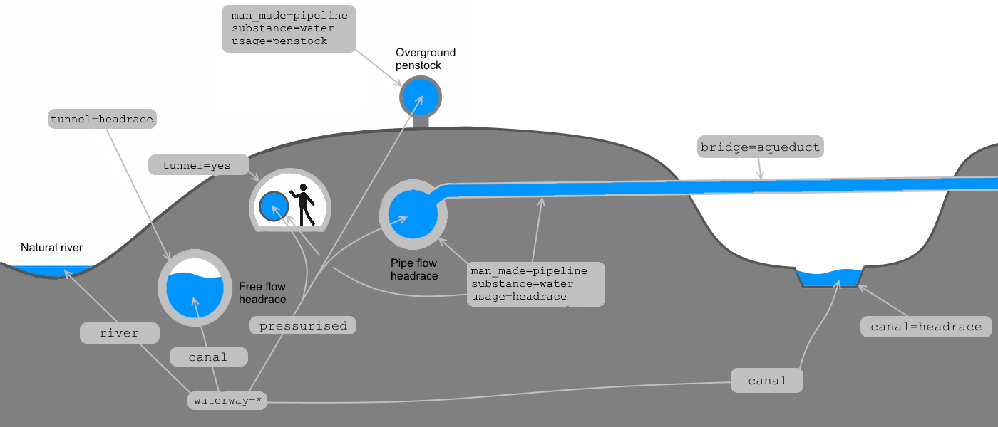 | 1,400 × 600 (76 KB) | Fanfouer (talk | contribs) | ||
| 17:53, 29 January 2018 |  | 1,400 × 600 (75 KB) | Fanfouer (talk | contribs) | ||
| 17:45, 27 January 2018 | 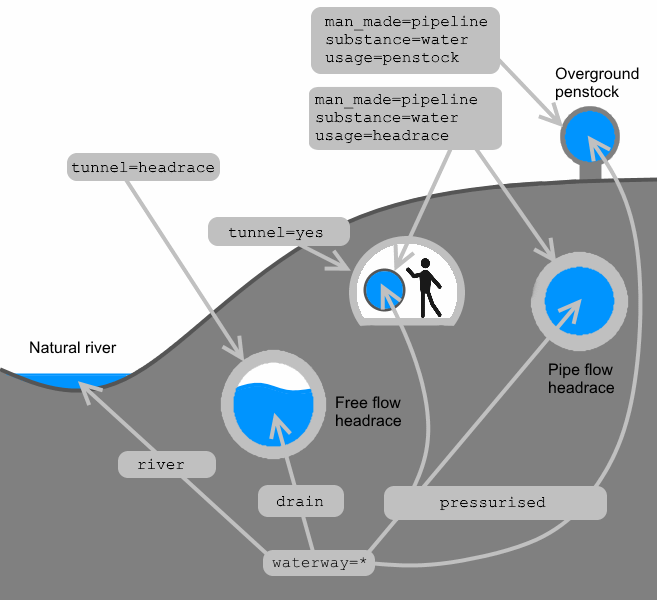 | 657 × 600 (29 KB) | Fanfouer (talk | contribs) | ||
| 17:40, 27 January 2018 | 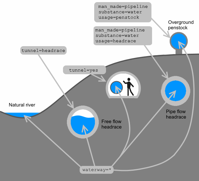 | 657 × 600 (28 KB) | Fanfouer (talk | contribs) | ||
| 22:34, 25 January 2018 | 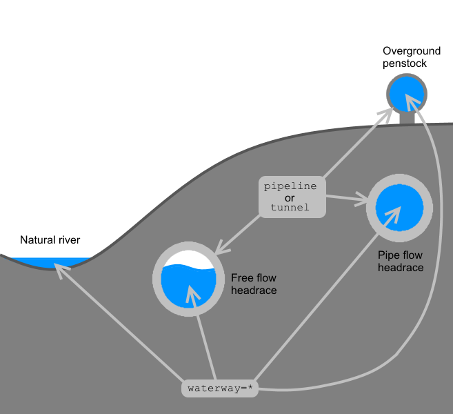 | 657 × 600 (36 KB) | Fanfouer (talk | contribs) | Illustration of infrastructure separation with waterway keys François Lacombe - www.infos-reseaux.com |
You cannot overwrite this file.
File usage
The following 3 pages use this file: