File:Wing Mountain Camping Area FR 9001P (36222563563).jpg

Original file (7,360 × 4,912 pixels, file size: 25.3 MB, MIME type: image/jpeg)
Summary
| Description |
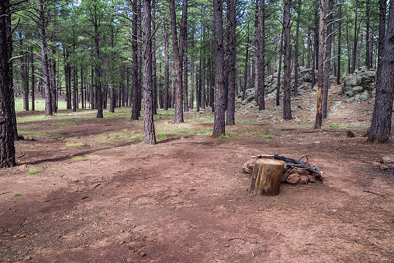
Forest Road (FR) 9001P in the Wing Mountain area offers a "camping corridor" east of FR 171. Motor vehicles may drive and park up to 300 feet from FR 9001P in the corridor. The road is narrow and rough, and best suited to tent and small trailer camping. The area is ponderosa pine forest and has several established campsites. The road gets rough, rocky, and narrow as it turns rights and climbs a hill approximately a quarter mile from FR 171. Only high clearance vehicles should venture beyond this point. The Wing Mountain area is southwest of the San Francisco Peaks. Many of the unpaved roads around Wing Mountain offer fantastic dispersed camping. Forest Roads 222, 171, and the western end of FR 222A (near FR 171) are suitable for tents, campers, and recreational vehicles. Wing Mountain is a prominent cinder cone volcano located approximately six miles southwest of the San Francisco Peaks, rising to an elevation of 8,560 feet. The mountain is surrounded by ponderosa pine forest on fairly level terrain at approximately 7,600 feet. Photo taken August 2017 by Deborah Lee Soltesz. Source: U.S. Forest Service, Coconino National Forest. Visit <a href="https://www.fs.usda.gov/recarea/coconino/recarea/?recid=82550" rel="nofollow">Wing Mountain Dispersed Camping</a> and <a href="http://coconinonationalforest.us/" rel="nofollow">Coconino National Forest</a> for more information. |
| Date | |
| Source | Wing Mountain Camping Area: FR 9001P |
| Author | Coconino National Forest |
| Camera location | | View this and other nearby images on: OpenStreetMap |
|---|
.jpg¶ms=035.275865_N_-111.832431_E_globe:Earth_type:camera_source:Flickr_&language=en)
Licensing
| This image was originally posted to Flickr by Coconino National Forest at https://flickr.com/photos/42034606@N05/36222563563 (archive). It was reviewed on 8 September 2018 by FlickreviewR 2 and was confirmed to be licensed under the terms of the Public Domain Mark. |
This image or file is a work of a United States Department of Agriculture employee, taken or made as part of that person's official duties. As a work of the U.S. federal government, the image is in the public domain.
|
 |
File history
Click on a date/time to view the file as it appeared at that time.
| Date/Time | Thumbnail | Dimensions | User | Comment | |
|---|---|---|---|---|---|
| current | 02:47, 8 September 2018 | | 7,360 × 4,912 (25.3 MB) | wikimediacommons>Tyler ser Noche | Transferred from Flickr via #flickr2commons |
File usage
The following 3 pages use this file:
.jpg)