Geoalert Open Urban Mapping
![]()
![]()
See Import/Guidelines and Automated Edits code of conduct for more information. Imports/automated edits which do not follow these guidelines might be reverted!
At Geoalert we apply ML/CV algorithms to Earth Observation data.
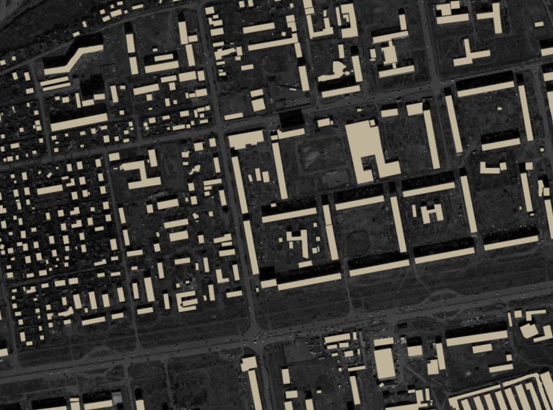
In 2019 our technology prototype was applied to derive [ https://medium.com/geoalert-platform-urban-monitoring/urban-mapping-54-m-buildings-in-russia-10dc942ac2c4 approx 54 mln building footprints over Russia][1].
As we continue to validate and extend auto-generated buildings coverage we look forward to contributing to the community to fill the data gaps.
Open Urban Mapping
Based in Russia, we've picked it as our testing ground. Open datasets are released by regions according to the priority of highest Geoalert / OSM count ratio.
All data is extracted from "Mapbox Satellite" since it's the only source which is explicitly permitted for processing by algorithms for non-commercial use (see license). However we look forward to providing more accurate data powered by other earth observation sources.
Data download
Download datasets from our project's Github page.
As Mapbox satellite has comparatively poor quality for Russian territory (too old, a lot of snow, clouds, only panchrome etc.), the data should be validated quite carefully and updated based on some premium imagery available for the manual mapping.
Mapping contribution
You can use this data to contribute to OSM and accelerate your mapping process. Since the data is generated automatically it shouldn't be imported before you check and validate. You can preview this data using Quantum GIS, Openstreetmap ID ("custom Map Data"), whatever you want, and edit it locally (JOSM etc.)
Data accuracy
Our metrics show that in the vast majority of cases the quality is at least as good as hand digitized buildings in OpenStreetMap. It is not perfect, particularly in dense urban areas but it is still awesome
Yes, we can call after Microsoft about our metrics and our belief in our data awesomeness. But... really. We aim to provide sustainable segmentation output even if the input imagery is not so good as MS or Facebook may have.
https://cdn-images-1.medium.com/max/1440/1*kyvtjKx3yvftW3UjuSVn0Q.png
The more detailed description will be provided as we get through more experiments.
License
The "Open Urban Mapping" project data is licensed under the Open Database License (ODbL) to be compatible with OSM. The input data is copyrighted by the data providers. The Mapbox Terms of Service states that
You may use Studio or third-party software to trace Mapbox maps solely comprised of satellite imagery ("Mapbox Satellite Imagery") and produce derivative vector datasets for non-commercial purposes and for OpenStreetMap. (http://www.mapbox.com.s3-website-us-east-1.amazonaws.com/tos/#[YmuSEapb])
Technical details
- Coordinate reference system - EPSG: 4326
- Data format - GeoPackage or GeoJSON
Changeset tags
If you edit and import this data to OSM, please refer to
source = Mapbox/Geoalert