MychOSM/Kingston upon Hull
Kingston upon Hull, ![]() United Kingdom
United Kingdom
Mapping in Kingston upon Hull
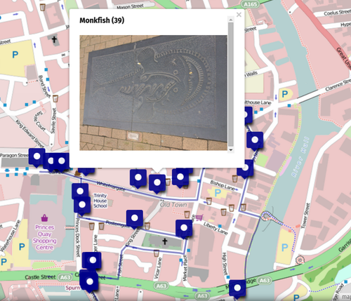
On Monday 29th September the UK team welcomed students and colleagues from Germany, Spain, Turkey and Romania to take part in a range of OSM mapping activities. During their stay the students successfully mapped buildings in the Old Town area of Hull city centre and collected locational data for each of the 41 items on the Seven Seas Fish Trail.
Mapping the Fish Trail, Ale Trail and Old Town
preparing the students
 Mapping in Hull's Old Town. |
 Students surveying land use in Hull's Old Town. |
|---|
Fishtrail
The Seven Seas Fish Trail consists of 41 pieces of sculpture made from traditional materials. The trail provides a unique tour of Hull's historic old town. During the visit to Hull students and teachers from the partnership schools mapped the Fish Trail using a GPS tracker. This involved the students following the trail and geotagging each sculpture on the trail.
| When we returned to Archbishop Sentamu Academy this information was then uploaded to the OSM database. With the Overpass Turbo Wizzard we generated the following query
<osm-script output="json" timeout="25">
  <id-query into="searchArea" ref="3600060148" type="area"/>
  <union into="_">
    <query into="_" type="node">
      <has-kv k="tourism" modv="" v="artwork"/>
      <area-query from="searchArea" into="_" ref=""/>
    </query>
    <query into="_" type="way">
      <has-kv k="tourism" modv="" v="artwork"/>
      <area-query from="searchArea" into="_" ref=""/>
    </query>
    <query into="_" type="relation">
      <has-kv k="tourism" modv="" v="artwork"/>
      <area-query from="searchArea" into="_" ref=""/>
    </query>
  </union>
  <print e="" from="_" geometry="skeleton" limit=""
mode="body" n="" order="id" s="" w=""/>
  <recurse from="_" into="_" type="down"/>
  <print e="" from="_" geometry="skeleton" limit=""
mode="skeleton" n="" order="quadtile" s="" w=""/>
</osm-script>
|
|
| We created a relation and the relation appers directly on Waymarked Trails. The (minimum) tags we need is explained here. |
|
| We have recently imported the GPS data for the route and the sculptures into uMap and are adding photographs of each location. You can see the results in the Fish Trail Map we have developed. |
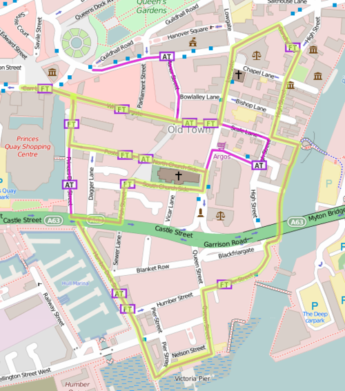
Ale Trail
| The Ale Trail is a route that takes you to some of Hull's most historic public houses. The trail comprises a unique tour of Hull's historic old town. During the visit to Hull students and teachers The image on the left shows the results of this.
|


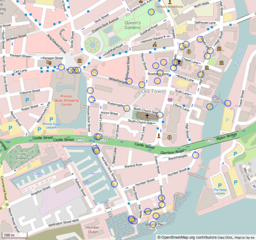
Old Town
| Following a guided tour of Hull's Old Town the students were provided with blank base maps which they used to record geospatial data in the field. Once the students had collected this information This involved mapping buildings that had not already been included through the use aerial |

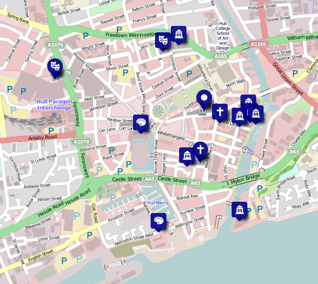
Hull City of Culture
The map below shows an extract from a map being created by students in Hull to identify the locations of attractions and venues associated with the 2017 City of Culture. The map continues to be updated as attractions and venues are announced.
uMap from York
The map below was created as the result of members of the group gathering data from the field then using OSM and UMap to develop an interactive map featuring historical and cultural attractions in our neighbouring city of York.


