OSM Map On Garmin/QLandkarte
QLandkarte and the successors Qlandkarte GT and Qlandkarte M are tools to view map sets on a PC as well as on a portable device such as PPCs. While Qlandkarte only worked with pre-created Garmin map image files (see FAQ entry), Qlandkarte GT and Qlandkarte M in addition also support Geotiff.
Since about year 2014 QLandkarte GT development has come to an end. The successor software from the same author is: QMapShack.
Qlandkarte GT
Qlandkarte GT is the successor to Qlandkarte. It supports Geotiff, has a much more advanced map viewer (2d/3d), and can read Garmin Typ files.
- The main project site can be found here: New: http://www.qlandkarte.org/
QLandkarte GT is the ultimate outdoor aficionado's tool. It supports GPS maps in GeoTiff format as well as Garmin's img vector map format. Additional it is the PC side front end to QLandkarte M, a moving map application for mobile devices. And it fills the gap Garmin leaves in refusing to support Linux. QLandkarte GT is the proof that writing portable applications for Unix, Windows and OSX is feasible with a minimum of overhead. No excuses!
QLandkarte GT does replace the original QLandkarte with a much more flexible architecture. It's not limited to a map format or device. Thus if you think your Magellan GPS or other should be supported, join the team.
Additionally it is a front end to the GDAL tools, to make georeferencing scanned maps feasible for the normal user. Compared to similar tools like QGis, it's target users are more on the consumer side than on the scientific one. QLandkarte GT might not let you select every possible feature of the GDAL tools, but it will simplify their use to the demands of most users. (source www.qlandkarte.org as of 08 December 2008)
QLandkarte cannot read Garmin .img files directly. You need a .tdb file (mkgmap option --tdbfile) to open .img files.
Installing
Linux
On Debian
- QLandkarte GT is available directly via the Debian repositories. http://packages.debian.org/qlandkarte, cf. QA page on http://packages.qa.debian.org/q/qlandkartegt.html
- You probably want to use a skin to make the maps look more like they will on a Garmin. copy /usr/share/doc/qlandkarte/skin/skin.txt.gz to ~/.config/QLandkarte and uncompress it.
On Ubuntu
- Packages are readily available http://packages.ubuntu.com/qlandkarte
Ubuntu 10.10
Qlandkarte GT comes in version 0.18.3 with 10.10. This version is recommended if you intend to use it with Garmin maps in .img format.
As Ubuntu's version of Qlandkarte GT is heavily old, use this PPA:
https://launchpad.net/~mms-prodeia/+archive/qlandkarte
It compiles QLGT against GDAL 1.8 and has support for WMS-Maps, etc. ...
Ubuntu 10.04
Qlandkarte GT comes in version 0.17.1 with 10.04. This version is not well adapted to Garmin maps (it is slow), so you should compile QlandkarteGT from source (see below; version 0.18.2 or higher is recommendable if you intend to use it with Garmin maps in .img format) or download the Debian packages from here:
Compiling under Ubuntu
This is an installation guide for Qlandkarte GT under Ubuntu 8.10 (Intrepid Ibex), 9.04 (Jaunty Jackelope), and 10.04 (Lucid Lynx),
- Ubuntu 8.10 warning: There is a problem (https://bugs.launchpad.net/ubuntu/+source/gdal/+bug/271670) with the gdal package in 8.10. You should configure the qgis-ppa (https://launchpad.net/~qgis/+archive/ppa). This problem DOES NOT affect 9.04. libproj-dev and proj-bin are only needed with 10.04
Install the following packages to satisfy the dependencies of QLandkarte GT, and ensure you have the compilation tools required:
sudo aptitude install cmake cmake-curses-gui gdal-bin libgdal1-1.5.0 libgdal-dev libqt4-dev libusb-dev subversion build-essential libproj-dev imagemagick libexif-dev libdmtx-dev
After installing the required packages you are able to install Qlandkarte GT - you can use standard setting when asked by cmake what to do (press "c" then press "g").
cd /opt
svn co https://qlandkartegt.svn.sourceforge.net/svnroot/qlandkartegt/QLandkarteGT/trunk QLandkarteGT
mkdir build_QLandkarteGT
cd build_QLandkarteGT
ccmake ../QLandkarteGT
make
sudo make install
The final step is to install the Garmin device drivers.
cd /opt
svn co https://qlandkartegt.svn.sourceforge.net/svnroot/qlandkartegt/GarminDev/trunk GarminDev
mkdir build_GarminDev
cd build_GarminDev
ccmake ../GarminDev
make
sudo make install
Now you can start Qlandkarte Gt with
/opt/build_QLandkarteGT/bin/qlandkartegt
You will need to configure your GPS unit before before you can communicate with it. From the menu at the top, select Setup→General and then select the Device & Xfer tab. From the top drop-down menu, select Garmin. Then select your model from the Type drop-down menu (example: GPSMap 76Cx).
If you get a warning below the Type field saying "No plugins found. I expect them in: /usr/local/lib/qlandkartegt", you should copy your compiled library files into your main /usr/local/ directory, which is the recommended place to put software files which are not provided by your distribution. lib/ is the directory for storing library files.
sudo cp -av /opt/build_GarminDev/qlandkartegt/ /usr/local/lib/
OS X and Windows XP
Download the installation files from the Sourceforge project page.
Qlandkarte M
"This is a moving map application for mobile devices. As QLandkarte GT it will display mapsets of different resolutions and point to your current location. Additionally it will record your location data for further use by QLandkarte GT. It's user interface is optimized to the few buttons of a typical PDA." (source www.qlandkarte.org as of 08 December 2008)
Qlandkarte (deprecated)
There is no more reason to use Qlandkarte anymore. Use QlandkarteGT instead.
Old project site: http://qlandkarte.sourceforge.net/ .
- screenshots
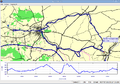
showing the GPX data of a cycle tour (through Weimar, Jena, Apolda) on OSM map data
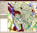
Utrecht in QLandkarte

