Proposal:Glaciers tags
| Glacier tags | |
|---|---|
| Proposal status: | Abandoned (inactive) |
| Proposed by: | Ocirne94 |
| Tagging: | glacier:*=number/string |
| Applies to: | |
| Definition: | Tags related to glaciers' features |
| Statistics: |
|
| Rendered as: | Colour differences |
| Draft started: | 2012-11-22 |
| RFC start: | 2012-11-24 |
| Vote start: | Not Set |
| Vote end: | Not Set |
Proposal
Glaciers have got lots of attributes which deserve to be mapped. The tag glacier:*=value would be very useful for describing these features.
Rationale
Length, volume, gradient, surface, etc. are properties which can have a huge impact on the appearance, physical behaviour and environmental impact of a glacier; they are therefore very important for studying climate or geography, for understanding a region, but also for planning visits/trips/etc. Those bits of information are almost always available in the public domain and in most cases get outdated only very slowly.
Examples
The Miage Glacier is a "black glacier", being covered with debris: [1]
The Rhone Glacier doesn't quite look like a black glacier: [2]
The Bossons Glacier is a huge alpine icefall: [3]
The Mer de Glace, 6 km far, is an alpine glacier too, but quite a flat one: [4]
The Hubbard Glacier isn't an alpine glacier, it ends in the ocean: [5]
Tagging
| Main tags | |||
|---|---|---|---|
| key | value | notes | Taginfo |
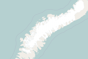
| glacier:type=* | See below | Glacier's morphology: alpine, tidewater, ice cap etc. Could be worth rendering: more white for ice caps ([6]), the current light blue for alpine glaciers ([7]), maybe more waves for icefalls, which generally have more crevasses. | |
| glacier:status=* | As defined by the NSIDC: uncertain, marked retreat, slight retreat, stationary, slight advance, marked advance, possible surge, known surge, oscillating | Current behaviour of the glacier's front. | |
| Values for glacier:type=* | |||||
|---|---|---|---|---|---|
| value | definition | notes | example | check out also | Taginfo |
| icecap | Ice masses, dome shaped, with radial flow, see Wikipedia | Further distinction of ice sheets is only defined by size and therefore not really necessary. | The Vatnajökull glacier | icefield, plateau | |
| icefield | Ice masses significantly covering underlying topography but constrained by mountains (in contrast to ice caps which lie on top of them), see Wikipedia | Distinction from ice cap is somewhat fuzzy | The Southern Patagonian Ice Field | icecap, plateau | |
| plateau | Wide and mostly flat areas, located at relatively high elevations, totally covered with generally very thick ice, without evident signs of ice flow, often above the snow line (i.e. permanently covered with snow), and giving birth to one or more ice tongues. Generally called "plateau" or "eismeer" | Similar to (but usually smaller than) icefield, but this is a flat area. It doesn't include interconnected valley glaciers | The Vallée Blanche in the Mont Blanc massif | icecap, icefield | |
| valley | Valley glaciers are glaciers at the bottom of a single valley flowing downward | Can originate from an ice field or be connected to other valley glaciers | The Mer de Glace in the Mont Blanc massif | outlet, tidewater, mountain | |
| outlet | Outlet glaciers are glaciers draining ice caps or ice fields | Distinction from valley glacier only by originating from an ice cap or ice field (so could be determined from the data) | valley, tidewater | ||
| tidewater | Valley or outlet glaciers reaching the ocean | Like for outlet glaciers easy to determine from the map data (shared nodes with coastline) | The Perito Moreno glacier | valley, outlet | |
| mountain | All smaller glaciers that do not fill a whole valley | Could be further distinguished into cirque, niche etc. but less clearly defined | The Tré-les-Eaux glacier | valley, hanging | |
| hanging | Glaciers hanging on mountain slopes; extremely steep, they don't generally have deep crevassing. | The Weisshorn glacier | mountain | ||
| icefall | Valley or mountain glacier with strong slope leading to breakup of the ice | No clear definition, usually only applies to a section of a glacier. | The Glacier des Bossons (Mont Blanc massif) | mountain, hanging | |
| mouth | Used on a node to indicate the mouth of the glacier, where there usually is an ice cavern and the main river flows out. It's generally (but not always) the lowest point of the glacier. | ||||
| rock | Flowing ice masses not originating from snow usually containing significant amounts of soil/rocks | ||||
| shelf | Ice shelves are larger areas of thick, permanent glacier ice floating on the ocean | Could include Ice tongue | The Ross ice shelf | tidewater | |
| remnant | Ice bodies which got isolated from the main glacier's body after a rupture; they are no more fed by snow accumulation or by the glacier's flow; sometimes called "dead glaciers" | Generally remnants disappear in few years: an old aerial view may not represent them accurately | The lower tongue of the Argentière glacier (Mont Blanc massif) | ||
| ice_tongue | A long and narrow sheet of ice projecting out from the coastline | Often surrounded by seasonal sea ice, which isn't to be mapped | The Erebus ice tongue, Antarctica | shelf | |
| Other specific tags | |||
|---|---|---|---|
| key | value | notes | Taginfo |
| glacier:volume=* | <N> (cubic metres) | Ice volume expressed in cubic metres. | |
| glacier:max_thickness=* | <N> (metres) | Maximum thickness of the ice cover expressed in metres. | |
| glacier:ele_top=* | <N> (metres) | Elevation of the highest point of the glacier expressed in metres. | |
| glacier:ele_bottom=* | <N> (metres) | Elevation of the lowest point of the glacier (usually the glacier's mouth) expressed in metres. | |
| glacier:slope=* | <N> (%) | Average slope of the glacier. | |
| glacier=mouth | Used on a node to indicate the mouth of the glacier, where there usually is an ice cavern and the main river flows out. It's generally (but not always) the lowest point of the glacier. | ||
| ref:wgi_id=* | <N> | Glacier's id at the World Glacier Inventory. | |
| glacier:edge=* | calving_line or grounding_line | Use on ice shelves: calving_line if the edge is between ice shelf and ocean, grounding_line if it is between land and ice shelf. | |
| natural=snowfield | A permanent snow patch: it is permanent if it has been present for at least two years. NOTE: the presence of a snow patch in a satellite image doesn't imply that it is permanent. | ||
| Already existent tags which can be useful | ||
|---|---|---|
| key | value | notes |
| length=* | <N> (metres) | The glacier's length: "maximum length of the glacier in kilometers measured along the most important flowline in a horizontal projection", according to NSIDC. |
| wikipedia=* | <name> | Most glaciers have got an article on Wikipedia. As stated on the relevant page, the link "should be to the article in the primary language for the subject". Concerning glaciers, then, the linked article should be from the Wikipedia in the main language of the country in which the glacier is located. For many glaciers, though, the best article is in another language, especially English; a good use of the wikipedia tag for the Baltoro glacier (Pakistan) would then be wikipedia=pnb:بالتورو_گلیشیئر, with - optionally - the addition of wikipedia:en=en:Baltoro_Glacier, as the English article is broader and features deeper insight. When the article in the primary language is unavailable (Greenland?) or there isn't a well-defined primary language (Antarctica), you may consider linking to the English article. See wikipedia=* for further information. |
| natural=scree, surface=scree and geological=moraine | Used for debris cover on or surrounding a glacier (see this page for details). | |
| source=* | <name> | Data set / aerial imagery provider / map from which the data were taken. |
| source:date=* | <YYYY[-MM-DD]> | Date of the data source, important since glaciers are constantly evolving. |
| direction=* | <N> (degrees) or <cardinal (N, NW, SE, etc.)> | The orientation of the glacier, i.e. the direction it faces; it affects the sun radiation received, the average temperatures and the overall behaviour of the glacier. |
| And, of course, | ||
| natural=glacier | ||
| Deprecated tags | ||||
|---|---|---|---|---|
| tag | value | notes | reason(s) | Taginfo |
| glacier:area=* | <N> (sq. km) | Ice-covered area expressed in square kilometres | Rarely known; not always precisely and unanimously defined; can be machine-computed from the outline of the OSM area object. See also the discussion. | |
| glacier:average_advancing_speed=* | N (metres/day) | Average advancing speed of the glacier (usually a few metres/day) | Almost never known; usually variable across different sectors of the glaciers. See also the discussion. | |
| glacier:gradient=* | <N> (%) | Average glacier gradient | Replaced by glacier:slope=*. See also the discussion. | |
| glacier:length=* | <N> (km) | Maximum glacier length expressed in metres | No advantage compared to length=*. See also the discussion. | |
| glacier:debris_cover=* | none/scarce/partial/predominant/total | Amount of debris (dark) materials covering the ice surface. The best candidate for rendering, applying a grey overlay in case of debris (have you seen that picture of the Miage Glacier?) | Superseded by surface=* and geological=moraine, which would be applied to an area drawn on the glacier. See also the discussion. | |
| glacier:orientation=* | N/NE/E/SE/etc. | The main orientation. Quite interesting because it affects the amount of received solar radiation. Not easy to compute automatically, especially for small glaciers for which SRTM and ASTER data don't have sufficient resolution. | Superseded by direction=* and by glacier=mouth. See also the discussion. | |
Rendering
Ice caps such as the Vatnajökull, Greenland and the Antarctica get a very good look if rendered like this: main background, currently #b5d0d0, as white (#ffffff); ice waves, currently #abbfbf, as #bfe5ea; ice borders kept as they are now (#a9d2f9, but varying because of antialiasing). Comparison (click for larger versions, best seen at full size as ice waves' size remains constant in Mapnik):
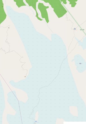
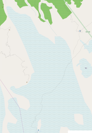
Icefalls such as the Bossons Glacier or the Trient Glacier are better represented with more ice waves (click for larger versions):
Discussion
Please comment on the talk page: Talk:Proposed_features/Glaciers_tags


