Rehab City Mapping Party September 2009
Jump to navigation
Jump to search
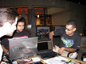
This series of mapping parties intends to produce a complete map of the Rehab City Residential Complex. Of particular interest is tagging the main and service roads as cycleways due to their cycle-friendliness. The first party was organized Saturday September 5th.
Mappers

The following mappers attended:
- Abdelrahman Hassan on bicycle
- Hani Morsi on bicycle
- Nora Mortagui on bicycle (her first party)
- Hollis Ball on foot (his first party)
- Ahmed Hamdy on foot
Work done
The following was mapped:
- about 80% of the main road network
- about 15% of residential ways
- two residential clusters, including building outlines, parking spaces, and footways
- most of the main restaurant area
Before


