Uploads by Ahlzen
Jump to navigation
Jump to search
This special page shows all uploaded files.
| Date | Name | Thumbnail | Size | Description | Versions |
|---|---|---|---|---|---|
| 19:16, 19 August 2015 | Osm-boston.jpg (file) |  |
13 KB | OpenStreetMap-Boston Meetup Group logo | 1 |
| 19:19, 27 June 2013 | Lonely buildings demo.png (file) |  |
122 KB | Example of the "Lonely Buildings" challenge proposal for MapRoulette. | 1 |
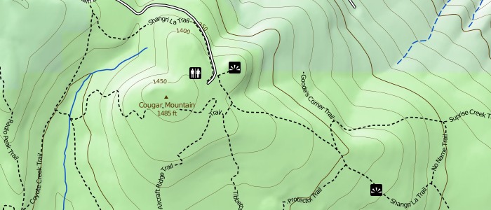
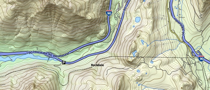
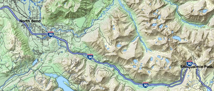
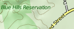
| 02:35, 26 February 2010 | Toposm-example-trails.jpg (file) |  |
63 KB | Example of hiking trails and related features rendered on TopOSM. | 1 |
| 02:34, 26 February 2010 | Toposm-example-symbols.png (file) |  |
18 KB | Some of the map symbols used on the TopOSM map. | 1 |
| 02:34, 26 February 2010 | Toposm-example-nhd2.jpg (file) |  |
109 KB | Example of data from the USGS National Hydrographic Dataset used on TopOSM. | 1 |
| 02:34, 26 February 2010 | Toposm-example-nhd1.jpg (file) |  |
142 KB | Example of data from the USGS National Hydrographic Dataset used on TopOSM. | 1 |
| 02:33, 26 February 2010 | Toposm-example-us-shields.jpg (file) |  |
68 KB | Example of US highway shield, rendered on TopOSM. | 1 |
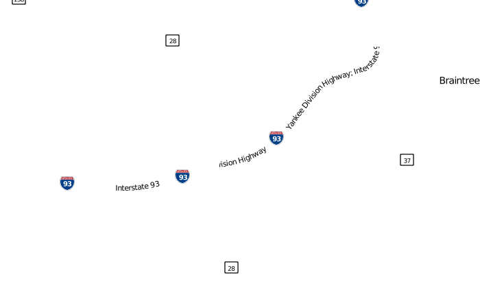
| 02:33, 26 February 2010 | Toposm-example-interstate-shields.jpg (file) |  |
77 KB | Example of US interstate shields rendered on TopOSM. | 1 |
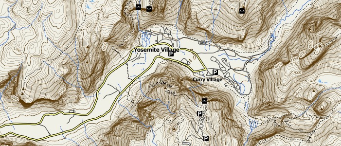
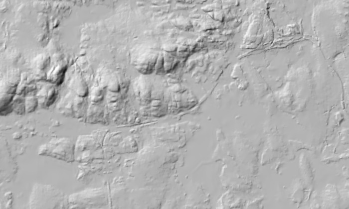
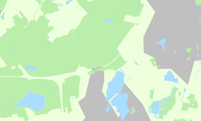
| 02:32, 26 February 2010 | Toposm-example-hillshade-only.jpg (file) |  |
95 KB | TopOSM example. Yosemite valley with map features and hillshading only. The contour lines layer has been turned off. | 1 |
| 02:31, 26 February 2010 | Toposm-example-contours-only.jpg (file) |  |
133 KB | TopOSM example. Yosemite valley with contour lines and map features only. The hillshading layer has been turned off. | 1 |
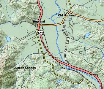
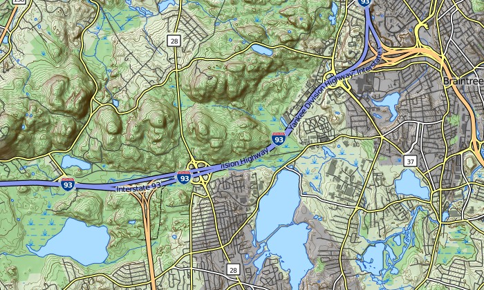
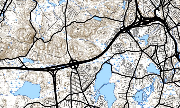
| 02:30, 26 February 2010 | Toposm-example-z13.jpg (file) |  |
119 KB | TopOSM example, at zoom level 13. | 1 |
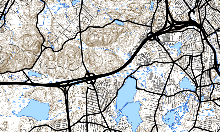
| 02:29, 26 February 2010 | Toposm-example-z11.jpg (file) |  |
134 KB | TopOSM example, at zoom level 11. | 1 |
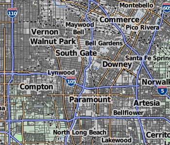
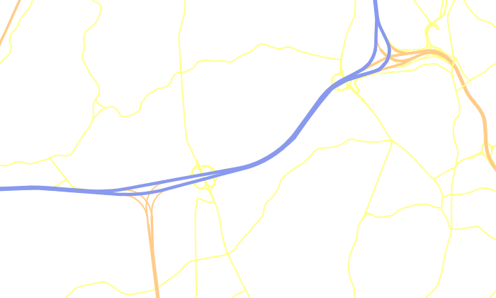
| 02:29, 26 February 2010 | Toposm-example-z7.jpg (file) |  |
109 KB | TopOSM example, at zoom level 7. | 1 |
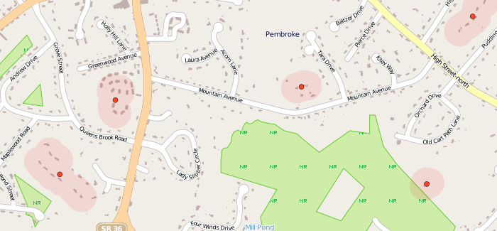
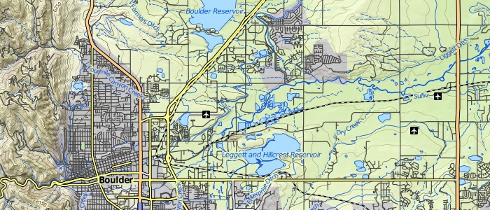
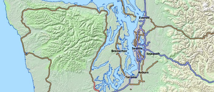
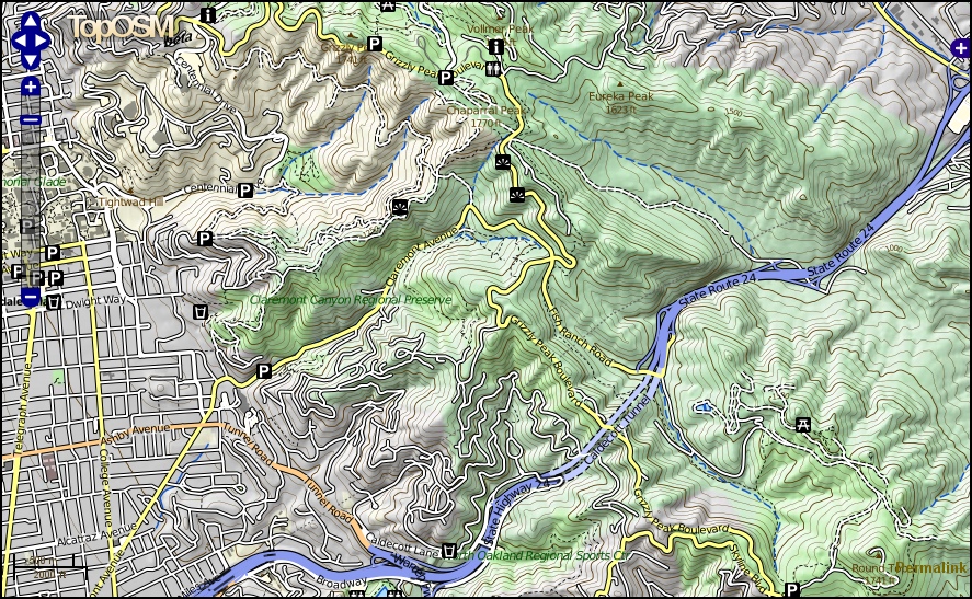
| 02:28, 26 February 2010 | Toposm-example-oakland-berkeley.jpg (file) |  |
405 KB | TopOSM example, near Berkeley/Oakland, CA. | 1 |
| 02:27, 26 February 2010 | Toposm-logo.jpg (file) | 13 KB | The TopOSM project logo. | 1 | |
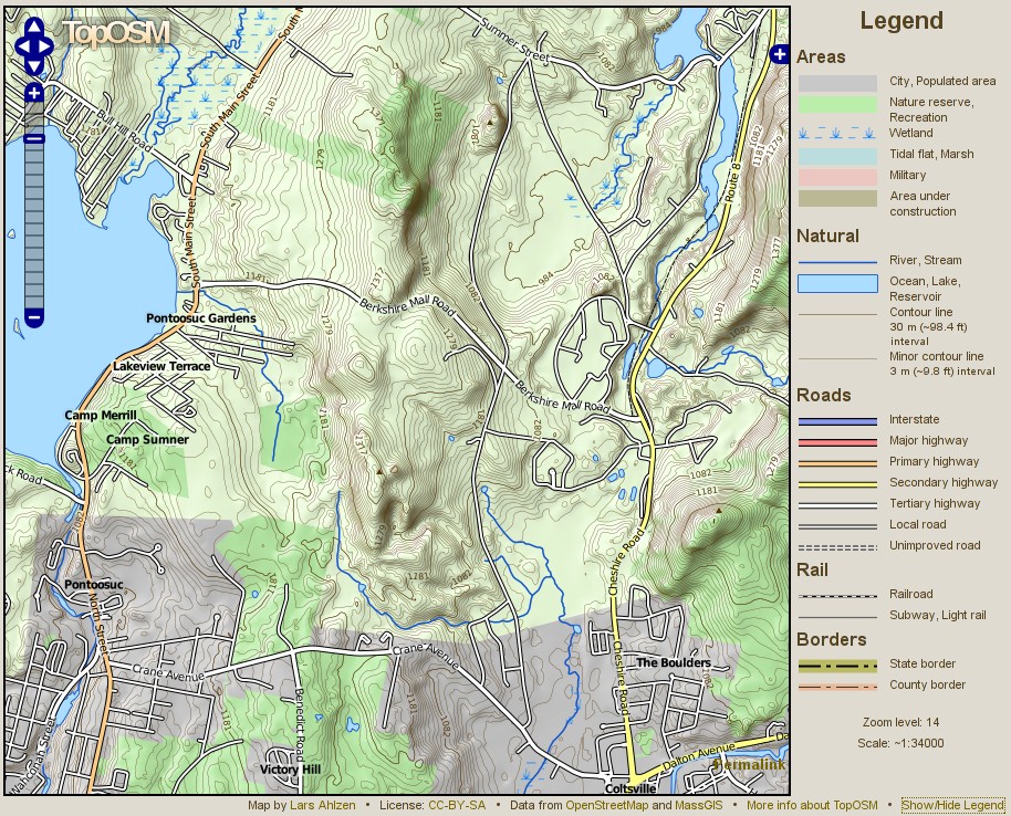
| 22:12, 26 June 2009 | Toposm with legend.jpg (file) |  |
306 KB | Screenshot of TopOSM with map legend visible. | 1 |
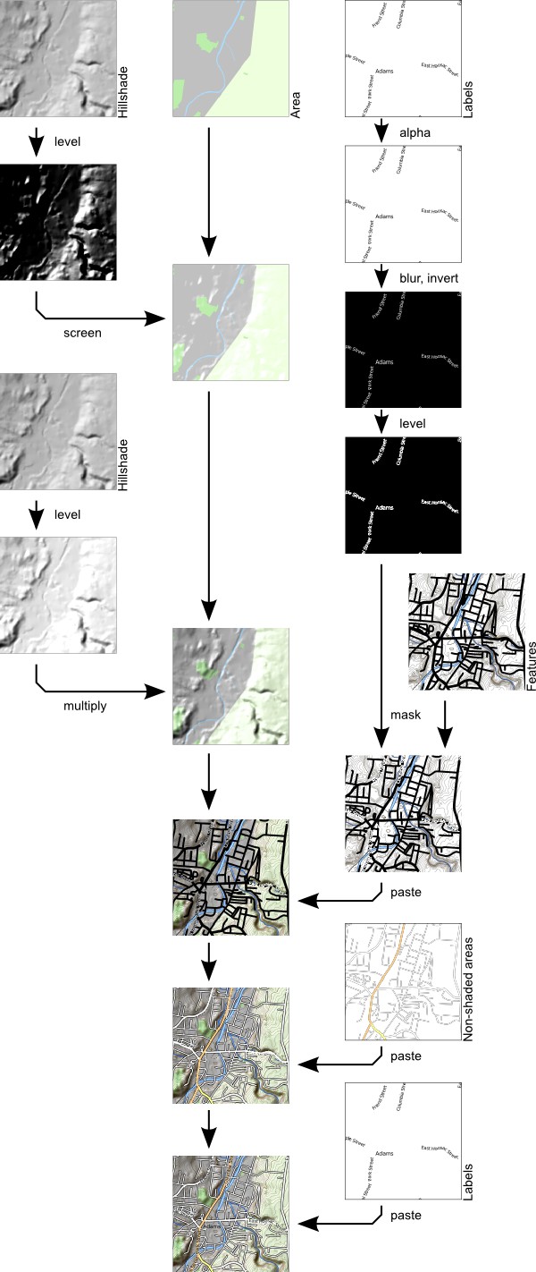
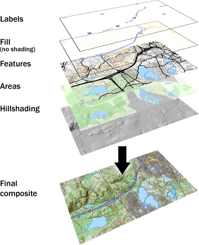
| 23:46, 2 May 2009 | Toposm compositing.jpg (file) |  |
137 KB | Illustration of how a final composite TopOSM map tile is created from the individual images. | 1 |
| 23:43, 2 May 2009 | Toposm label-halo-closeup.png (file) |  |
14 KB | 1 | |
| 23:40, 2 May 2009 | Toposm layer labels.png (file) |  |
17 KB | 1 | |
| 23:40, 2 May 2009 | Toposm layer hillshade.jpg (file) |  |
55 KB | 1 | |
| 23:40, 2 May 2009 | Toposm layer final.jpg (file) |  |
175 KB | 1 | |
| 23:39, 2 May 2009 | Toposm layer features.jpg (file) |  |
138 KB | 1 | |
| 23:39, 2 May 2009 | Toposm layer features.png (file) |  |
632 KB | 1 | |
| 23:38, 2 May 2009 | Toposm layer areansh.png (file) |  |
48 KB | 1 | |
| 23:38, 2 May 2009 | Toposm layer area.png (file) |  |
63 KB | 1 | |
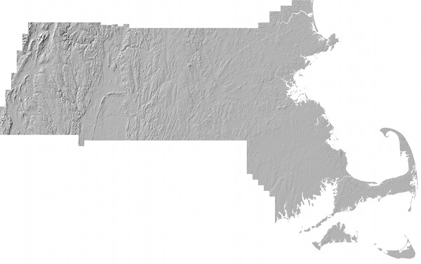
| 23:34, 2 May 2009 | Toposm relief after.jpg (file) |  |
30 KB | MassGIS shaded relief layer, after modifications. | 1 |
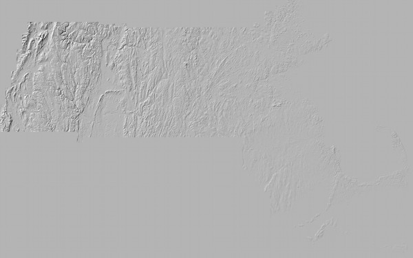
| 23:34, 2 May 2009 | Toposm relief before.jpg (file) |  |
36 KB | MassGIS shaded relief layer. | 1 |
| 23:31, 2 May 2009 | Layer-stack.jpg (file) |  |
66 KB | Illustration of the individual images used to create a TopOSM map tile. | 1 |
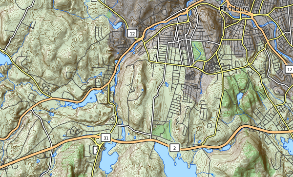
| 23:17, 2 May 2009 | Toposm map1 crop.jpg (file) |  |
111 KB | Example screenshot of the TopOSM map. | 1 |
| 23:14, 2 May 2009 | Toposm map1 crop.png (file) |  |
586 KB | Example screenshot of the TopOSM map. | 1 |