Uploads by DaCor
Jump to navigation
Jump to search
This special page shows all uploaded files.
| Date | Name | Thumbnail | Size | Description | Versions |
|---|---|---|---|---|---|
| 16:22, 12 February 2018 | Youtubeplaceholder.png (file) |  |
105 KB | 1 | |
| 15:29, 12 February 2018 | Mapillarystart.png (file) |  |
212 KB | 1 | |
| 13:29, 12 February 2018 | Quest selection.png (file) |  |
234 KB | 1 | |
| 10:42, 12 February 2018 | Learnosm logo.png (file) | 5 KB | 1 | ||
| 10:41, 12 February 2018 | Wikilogo.png (file) |  |
29 KB | 1 | |
| 10:35, 12 February 2018 | Taginfo logo.png (file) | 7 KB | 1 | ||
| 10:28, 12 February 2018 | Fieldpaperslogo.png (file) |  |
6 KB | 1 | |
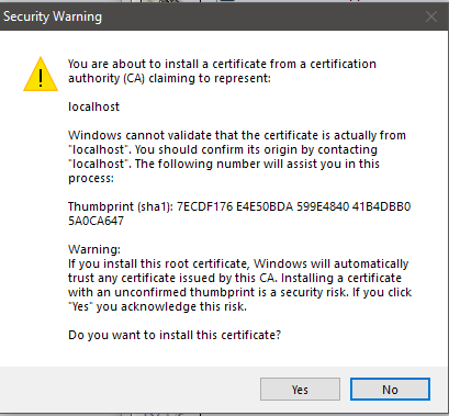
| 10:16, 12 February 2018 | Josm remote control3.png (file) |  |
16 KB | 1 | |
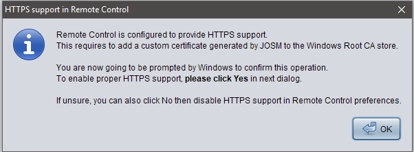
| 10:12, 12 February 2018 | Josm remote control2.png (file) |  |
16 KB | 1 | |
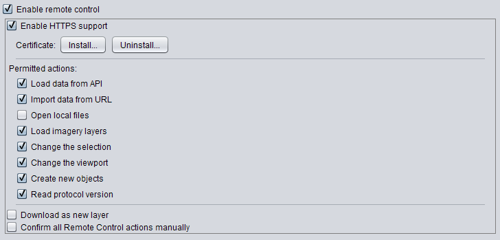
| 10:09, 12 February 2018 | Josm remote control.png (file) |  |
16 KB | 1 | |
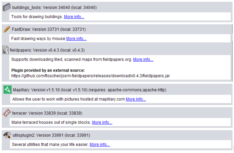
| 09:55, 12 February 2018 | Plugins.PNG (file) |  |
109 KB | 1 | |
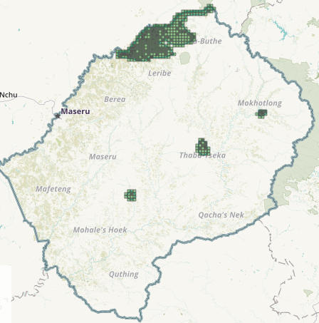
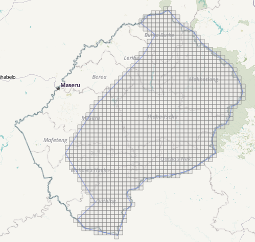
| 16:39, 9 February 2018 | Task 1169.PNG (file) |  |
135 KB | #MapLesotho HOT Tasking Manager Task #1169 | 1 |
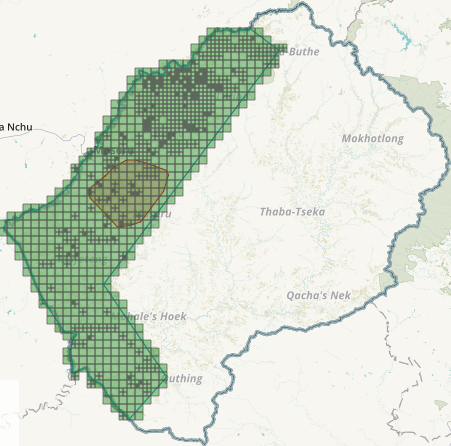
| 16:39, 9 February 2018 | Task 894.PNG (file) |  |
149 KB | #MapLesotho HOT Tasking Manager Task #894 | 1 |
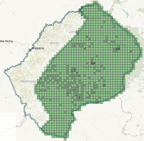
| 16:38, 9 February 2018 | Task 599.PNG (file) |  |
163 KB | #MapLesotho HOT Tasking Manager Task #599 | 1 |
| 16:37, 9 February 2018 | Task 597.PNG (file) |  |
130 KB | #MapLesotho HOT Tasking Manager Task #597 | 1 |
| 08:04, 16 February 2017 | OpenStreetMap1.pdf (file) |  |
185 KB | Permission to use Lesotho Land Adminstration Authority datasets | 1 |
| 21:19, 6 December 2016 | Regarding the use of CC-BY datasets on data.gov.ie.pdf (file) |  |
165 KB | Evidence of permission granted to Irish OSM community for use of CC-BY 4.0 datasets contained on data.gov.ie | 1 |
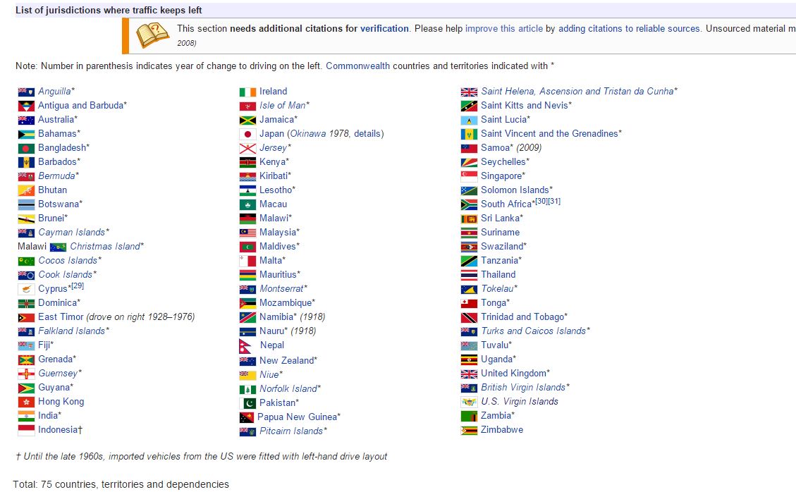
| 18:42, 6 March 2015 | Drive on left.JPG (file) |  |
120 KB | screenshot of wikipedia showing list of countries who drive on the left | 1 |
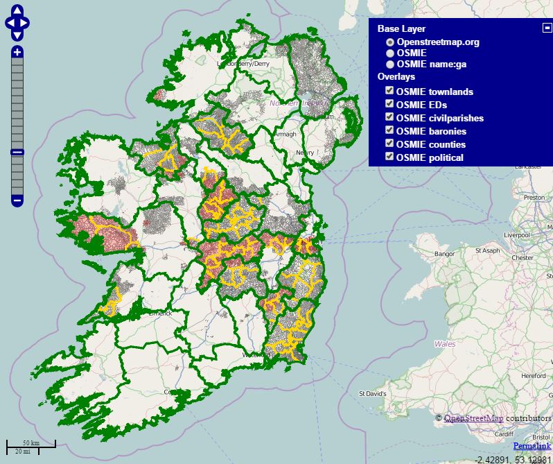
| 15:52, 6 March 2015 | Osm ie map server2.JPG (file) |  |
96 KB | Updated screenshot of rectification process | 1 |
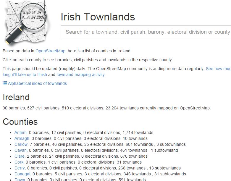
| 15:50, 6 March 2015 | Osm ie townlands.JPG (file) |  |
96 KB | screenshot of front page of Townlands.ie website | 1 |
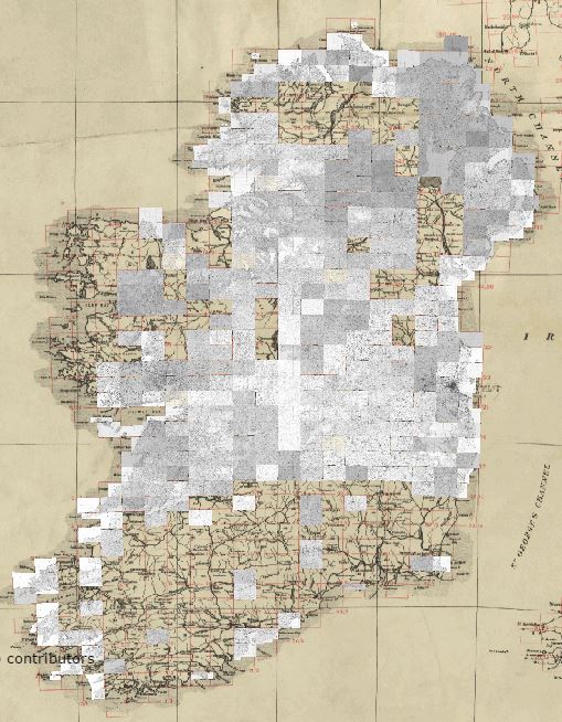
| 15:41, 6 March 2015 | Osmie Map-Server1.JPG (file) |  |
136 KB | OSM Ireland boundary layer showing mapped boundaries | 1 |
| 17:58, 25 February 2015 | MapLesotho on Lesotho TV.jpg (file) |  |
2.64 MB | OpenStreetMap Lesotho members on Lesotho National TV show talking about #MapLesotho | 1 |
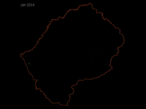
| 18:24, 8 January 2015 | 2014 a year of edits lesotho2.gif (file) |  |
1.68 MB | 1 | |
| 18:02, 8 January 2015 | 2014 a year of edits lesotho.gif (file) |  |
931 KB | 1 | |
| 13:28, 7 November 2014 | Townlands logo v2.png (file) | 86 KB | Logo for townlands.ie created by OSM user matze | 1 | |
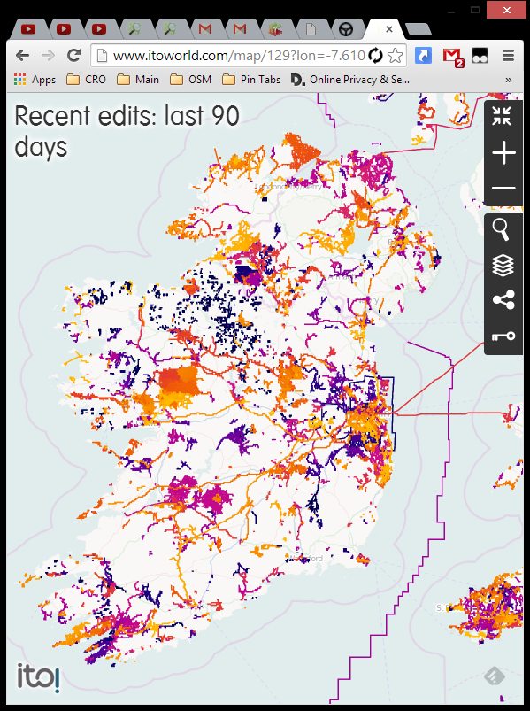
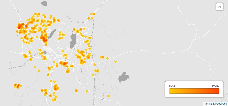
| 22:09, 12 October 2014 | 90daysofedits.png (file) |  |
296 KB | screenshot of 90 dyas of edits heatmap from ITOworld.com which is useful in identifying where you last edited | 1 |
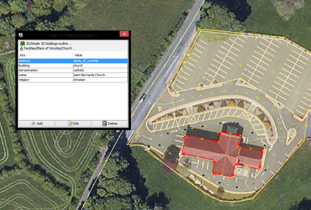
| 21:53, 12 October 2014 | Townlandchurch.PNG (file) |  |
1.16 MB | Church & tagging window | 1 |
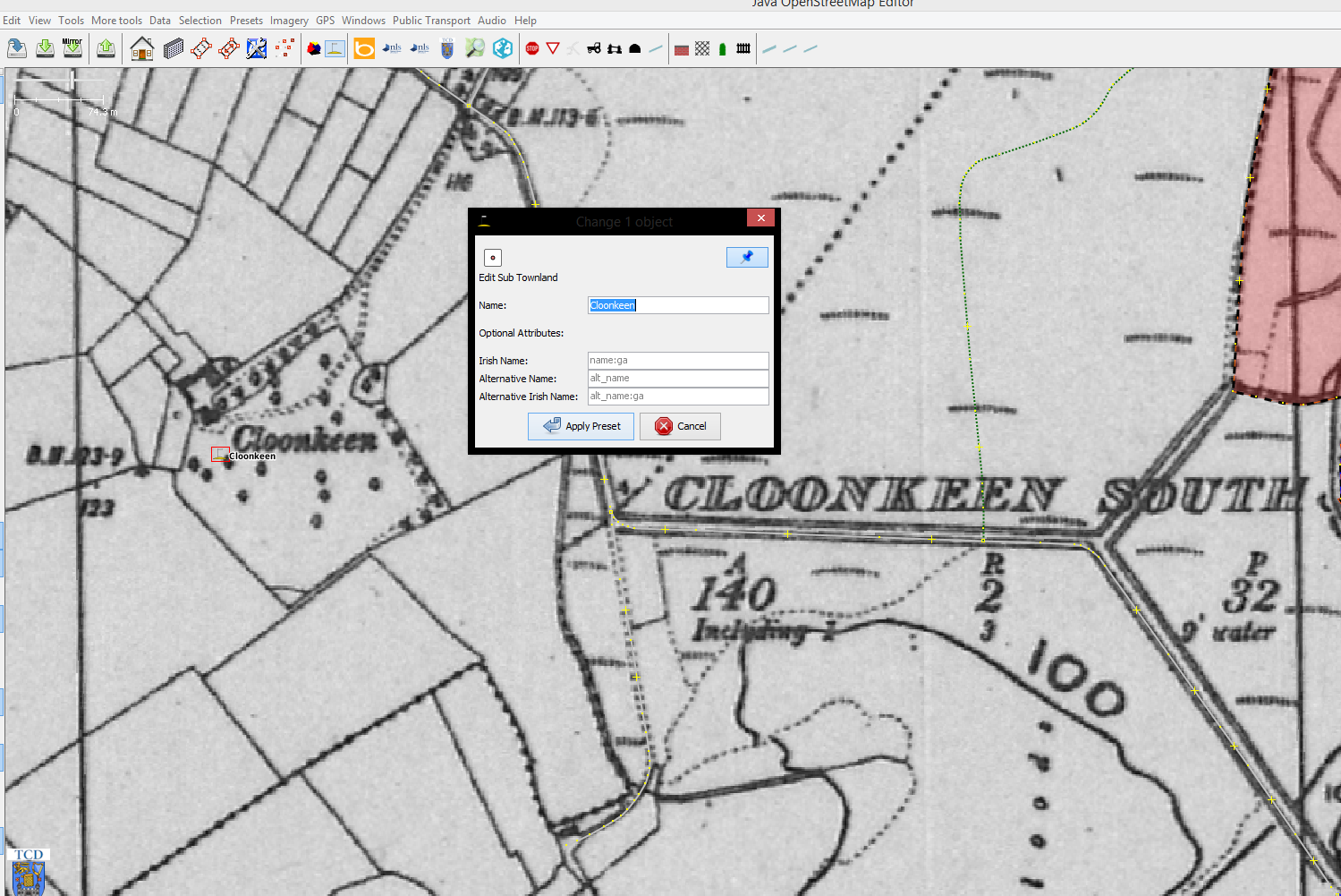
| 21:33, 12 October 2014 | Subtownland.PNG (file) |  |
845 KB | Screenshot of JOSM with Sub-Townland Preset in use | 1 |
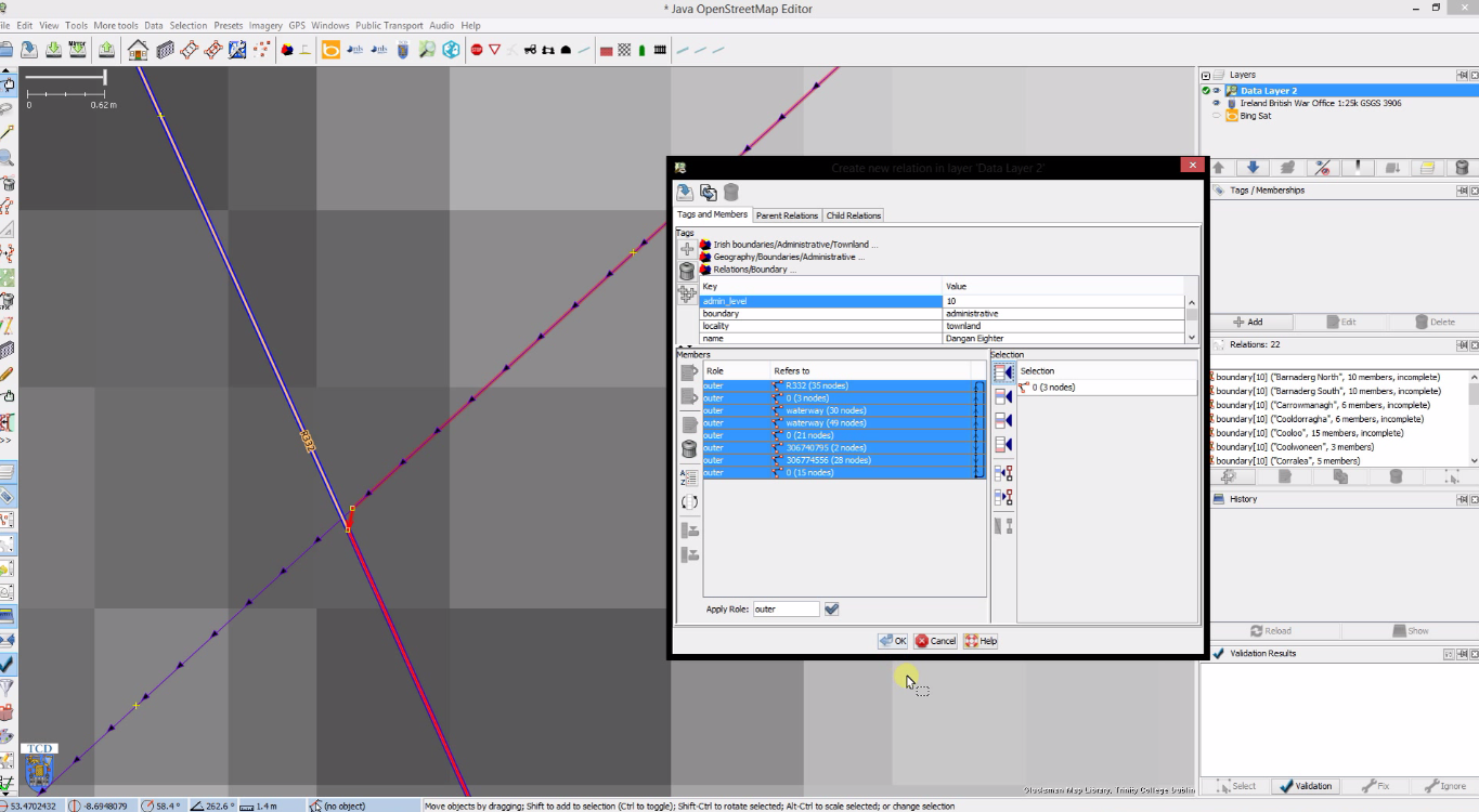
| 18:42, 12 October 2014 | Townland relations issues.png (file) |  |
378 KB | Screenshot of JOSM relations window | 1 |
| 11:50, 1 October 2014 | Townlandflowfinal1.png (file) |  |
163 KB | 1 | |
| 10:01, 1 October 2014 | Fermanagh.png (file) |  |
214 KB | 1 | |
| 09:23, 1 October 2014 | Fixedflow.png (file) |  |
156 KB | 1 | |
| 09:15, 1 October 2014 | Josm mapping townlands.png (file) |  |
1.68 MB | 1 | |
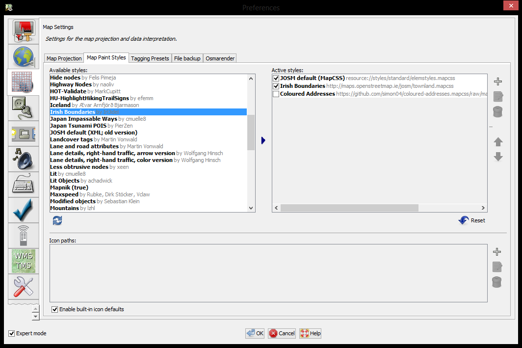
| 09:12, 1 October 2014 | Josm map settings window.png (file) |  |
92 KB | 1 | |
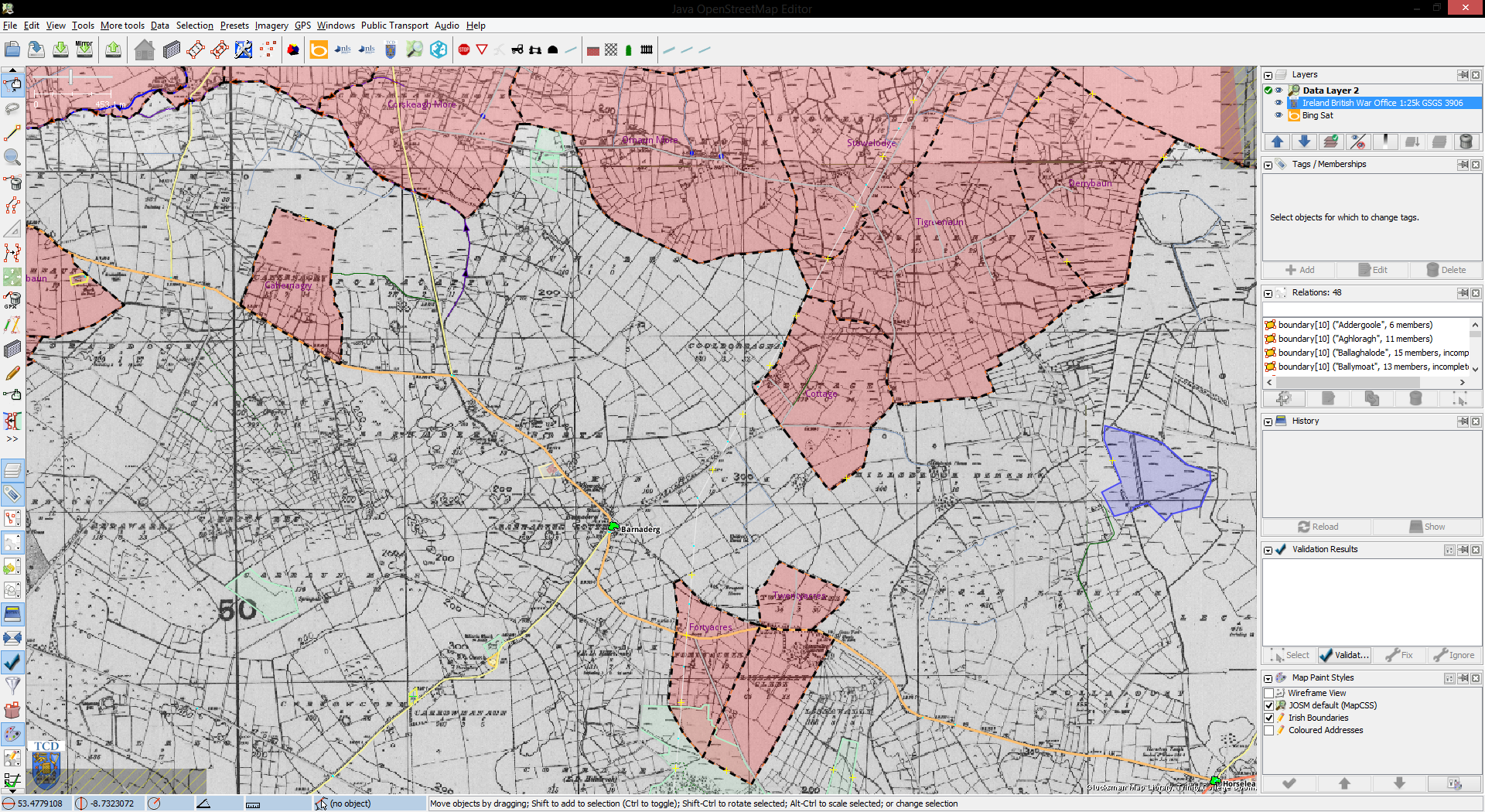
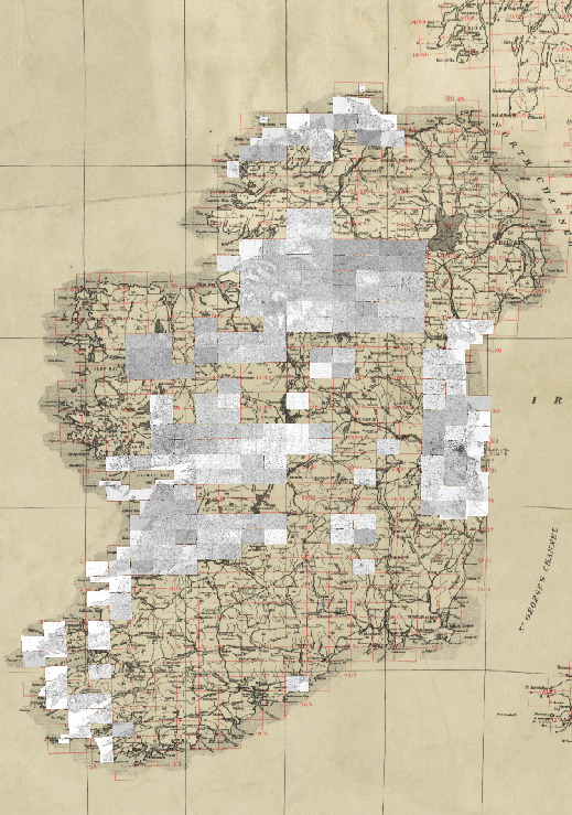
| 09:02, 1 October 2014 | Irish map server.png (file) |  |
540 KB | Screen shot of current progress of TCD map sheets being rectified | 1 |
| 08:58, 1 October 2014 | Slide1234565.PNG (file) |  |
107 KB | 1 | |
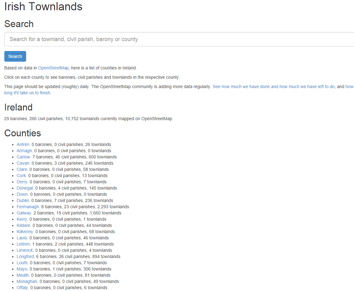
| 08:54, 1 October 2014 | Townlands site.png (file) |  |
115 KB | 1 | |
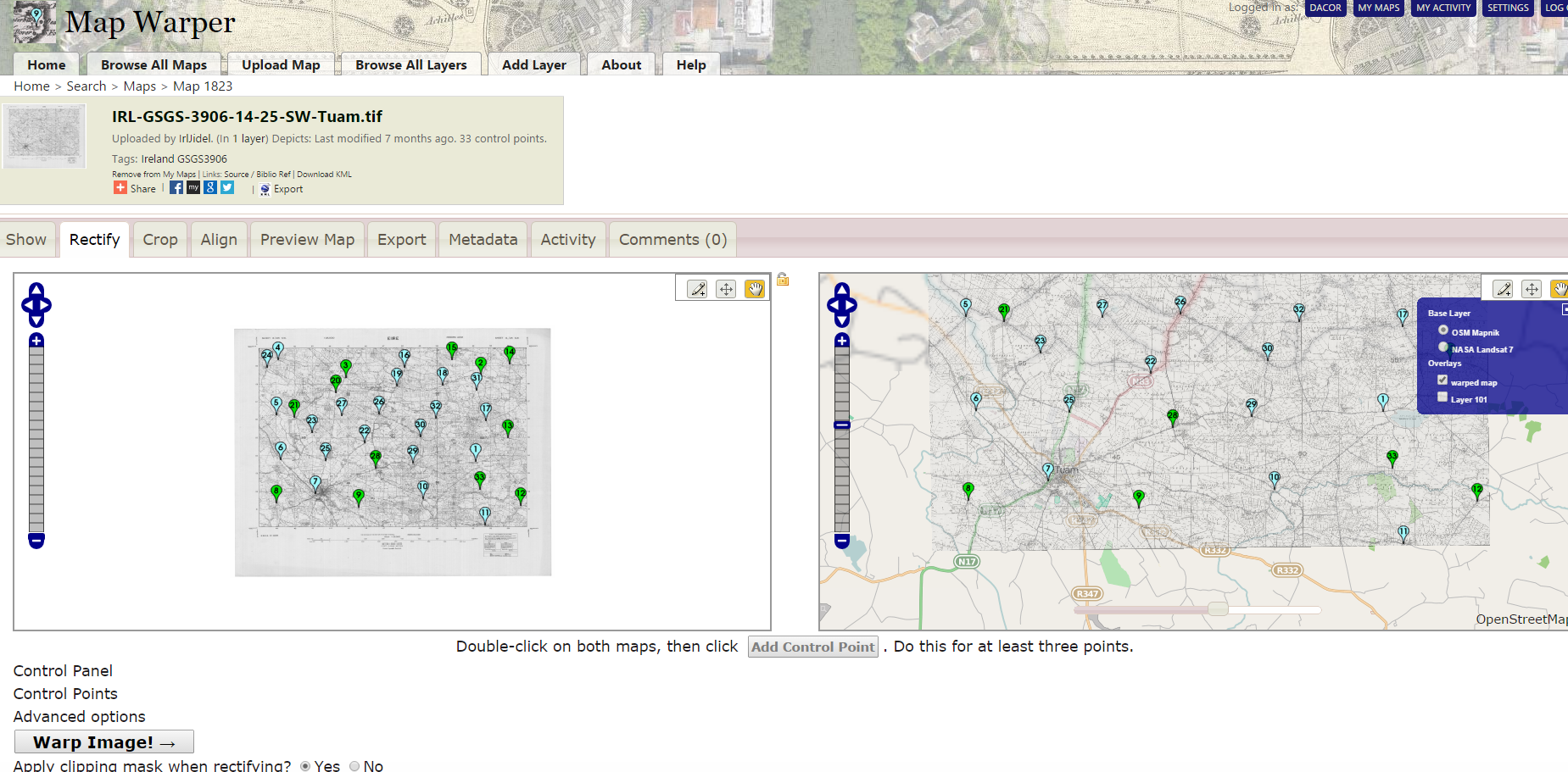
| 08:47, 1 October 2014 | Rectify on mapwarper.png (file) |  |
842 KB | 1 | |
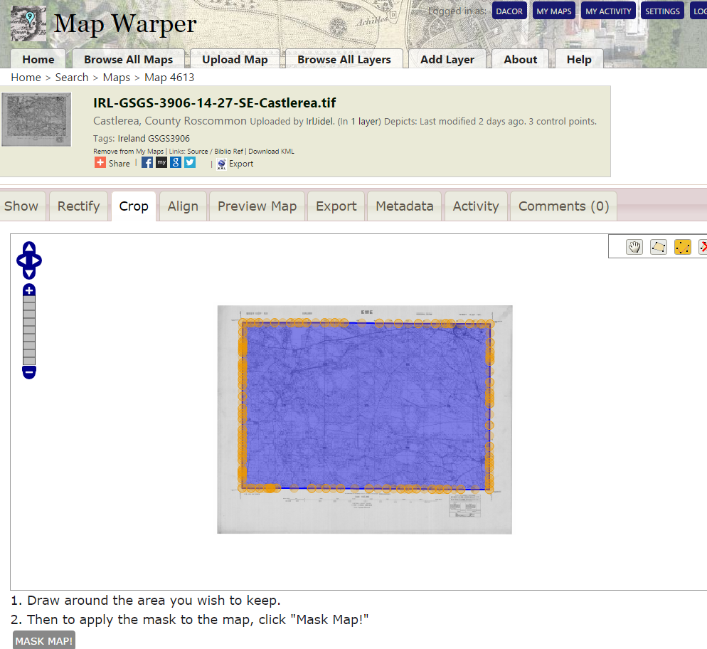
| 08:35, 1 October 2014 | Mapwarper crop window.png (file) |  |
354 KB | Fine tuning of the cropping of a map sheet in MapWarper.net | 1 |
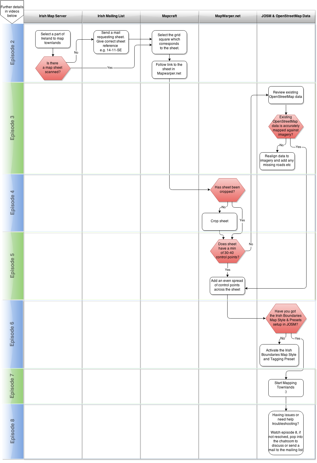
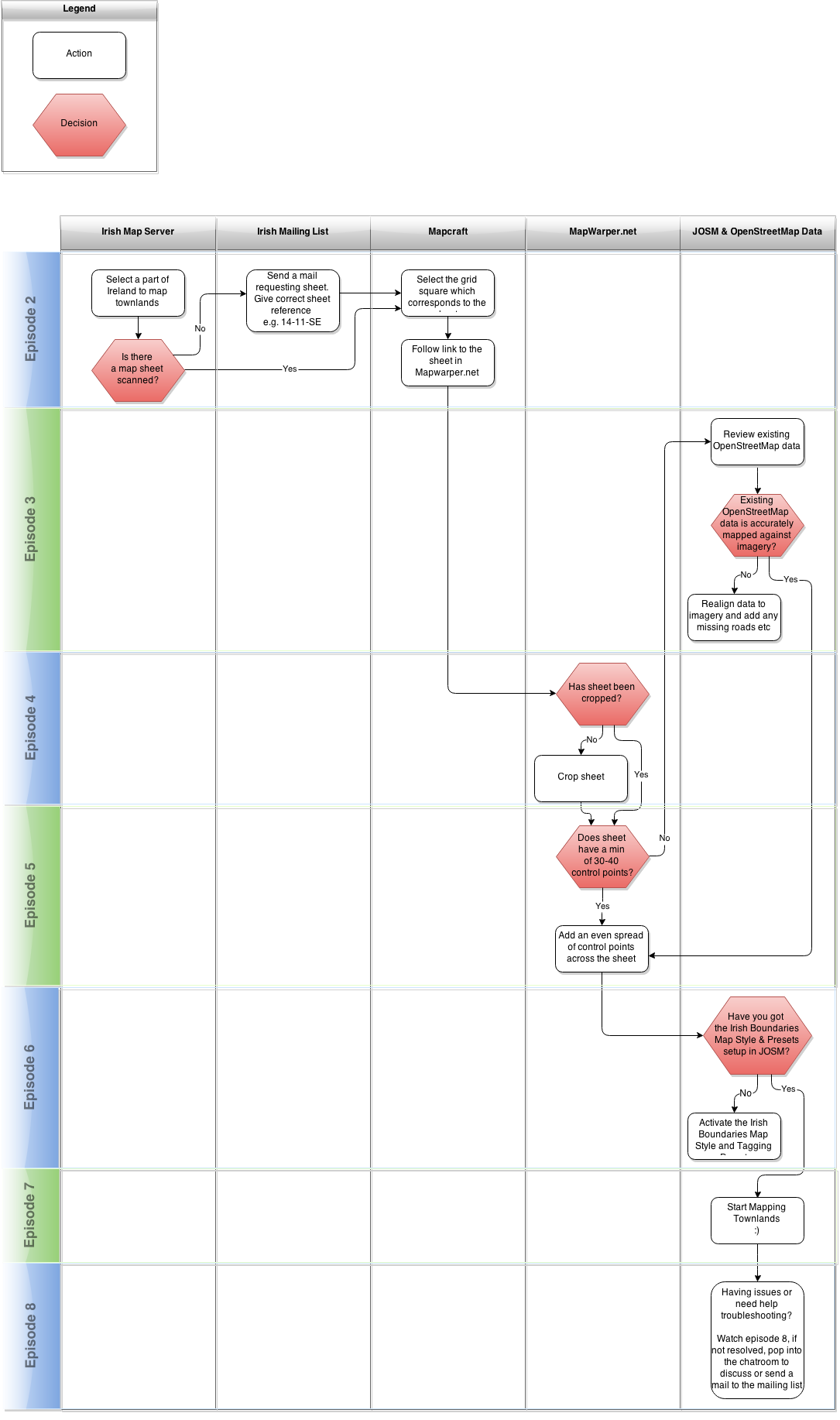
| 08:04, 1 October 2014 | Townlandflow6.png (file) |  |
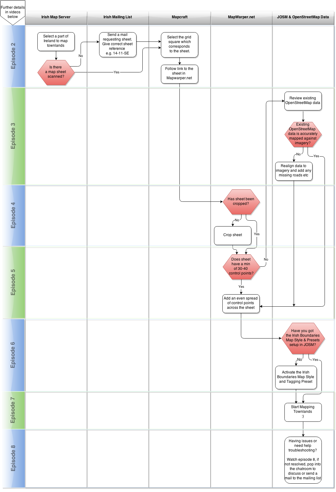
156 KB | Process flow for mapping townlands in Ireland | 1 |
| 07:44, 1 October 2014 | Townland workflow.png (file) |  |
162 KB | A sample of the irish townland mapping workflow | 1 |
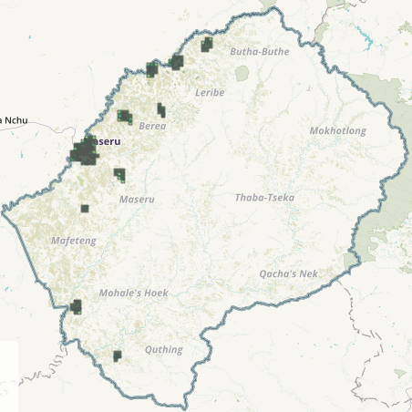
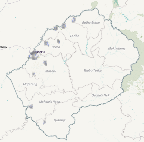
| 01:59, 24 July 2014 | Lesotho urban.PNG (file) |  |
73 KB | Lesotho urban task | 1 |
| 01:57, 24 July 2014 | Lesotho rural.PNG (file) |  |
99 KB | screenshot of Lesotho rural task | 1 |
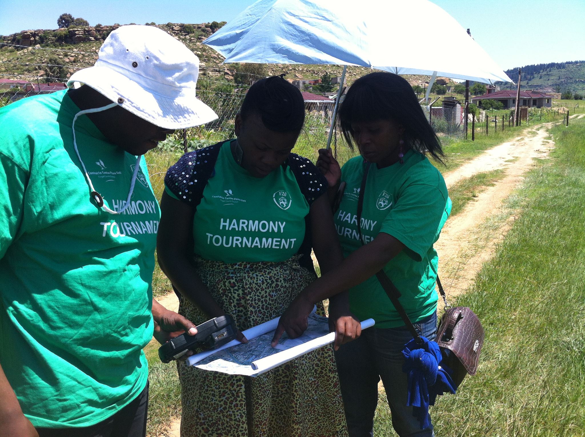
| 09:21, 29 June 2014 | Lesotho mappers surveying.jpg (file) |  |
575 KB | Local Lesotho mappers performing surveys prior to adding data to OSM | 1 |
| 09:18, 29 June 2014 | Maf121212.jpg (file) |  |
64 KB | OSM data used to highlight buildings under construction in Mafeteng | 1 |
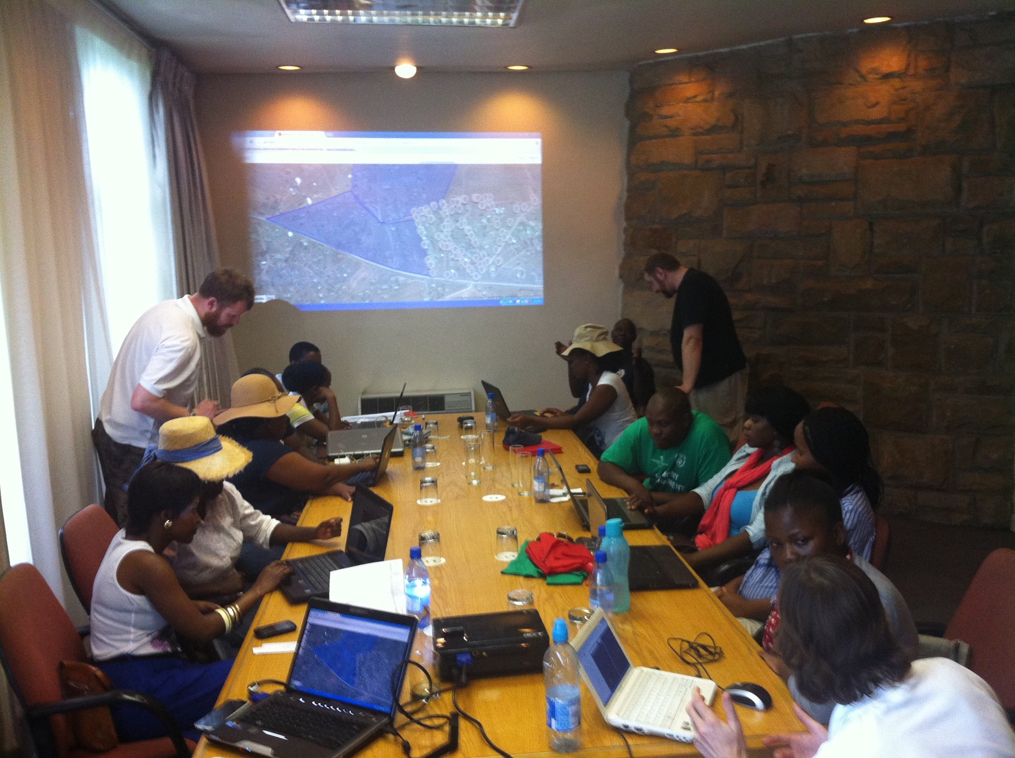
| 09:12, 29 June 2014 | Lesotho mappers.jpg (file) |  |
528 KB | Irish & Lesotho mappers looking at how OSM can be used for the benefit of their country. | 1 |
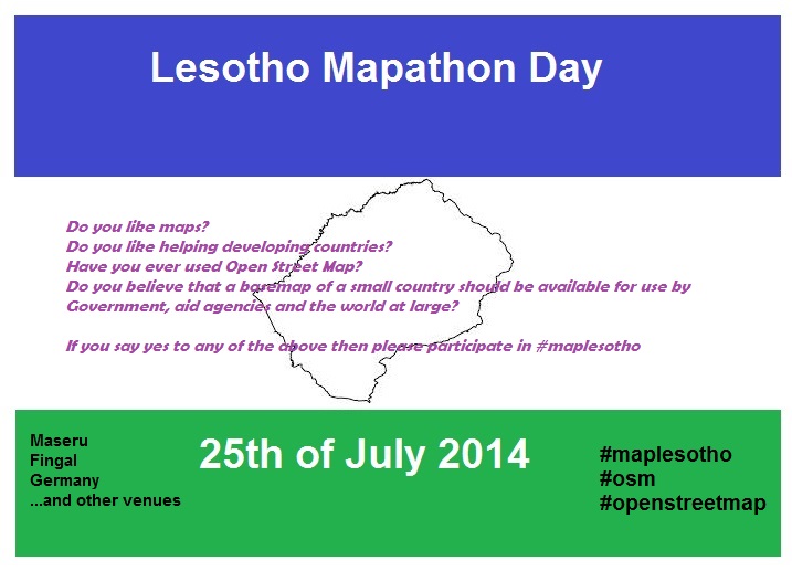
| 08:58, 29 June 2014 | Lesotho poster.jpg (file) |  |
81 KB | Poster for #MapLesotho event created by Lesotho mappers | 1 |