Uploads by JeroenvanderGun
Jump to navigation
Jump to search
This special page shows all uploaded files.
| Date | Name | Thumbnail | Size | Description | Versions |
|---|---|---|---|---|---|
| 21:45, 9 April 2024 | Vienna Convention road sign A8-symbol.svg (file) |  |
5 KB | {{Information | description=Symbol for dirt | source=Vienna Convention on Road Signs and Signals {{Derived from|File:Vienna Convention road sign Aa-8-V1.svg}} | author=United Nations }} | 1 |
| 23:32, 8 April 2024 | Vienna Convention road sign E7-symbol.svg (file) |  |
1 KB | {{Information | description=Symbol for {{Tag|urban|yes}} | source=Vienna Convention on Road Signs and Signals {{Derived from|File:Vienna Convention road sign G14-V1-1.svg}} | author=United Nations | other_versions=x32px }} | 1 |
| 23:15, 8 April 2024 | Vienna Convention road sign E8-symbol.svg (file) |  |
2 KB | {{Information | description=Symbol for {{Tag|urban|no}} | source=Vienna Convention on Road Signs and Signals | author=United Nations | source={{Derived from|Vienna Convention road sign G14-V1-1.svg}} | other_versions=File:Vienna Convention road sign E7b-V1.svg }} | 1 |
| 19:22, 1 October 2023 | SymbolDualCarriageway.svg (file) |  |
486 bytes | {{Information | description=Dual carriageway symbol. | source=Own work. Derived from [https://commons.wikimedia.org/wiki/File:AB-AS.svg motorway exit symbol]. | date=2023-10-01 | author=Jeroen van der Gun }} | 1 |
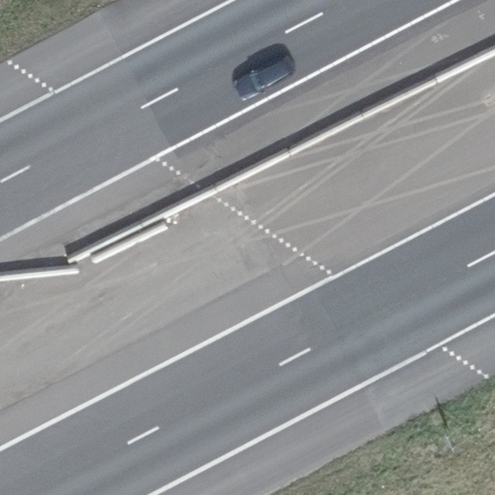
| 18:38, 21 March 2023 | NL-BE border.jpeg (file) |  |
175 KB | {{Information | description=The Dutch-Belgian border marked with plus signs on the asphalt of the E34 motorway. | source=[https://www.beeldmateriaal.nl/ Beeldmateriaal Nederland] }} | 1 |
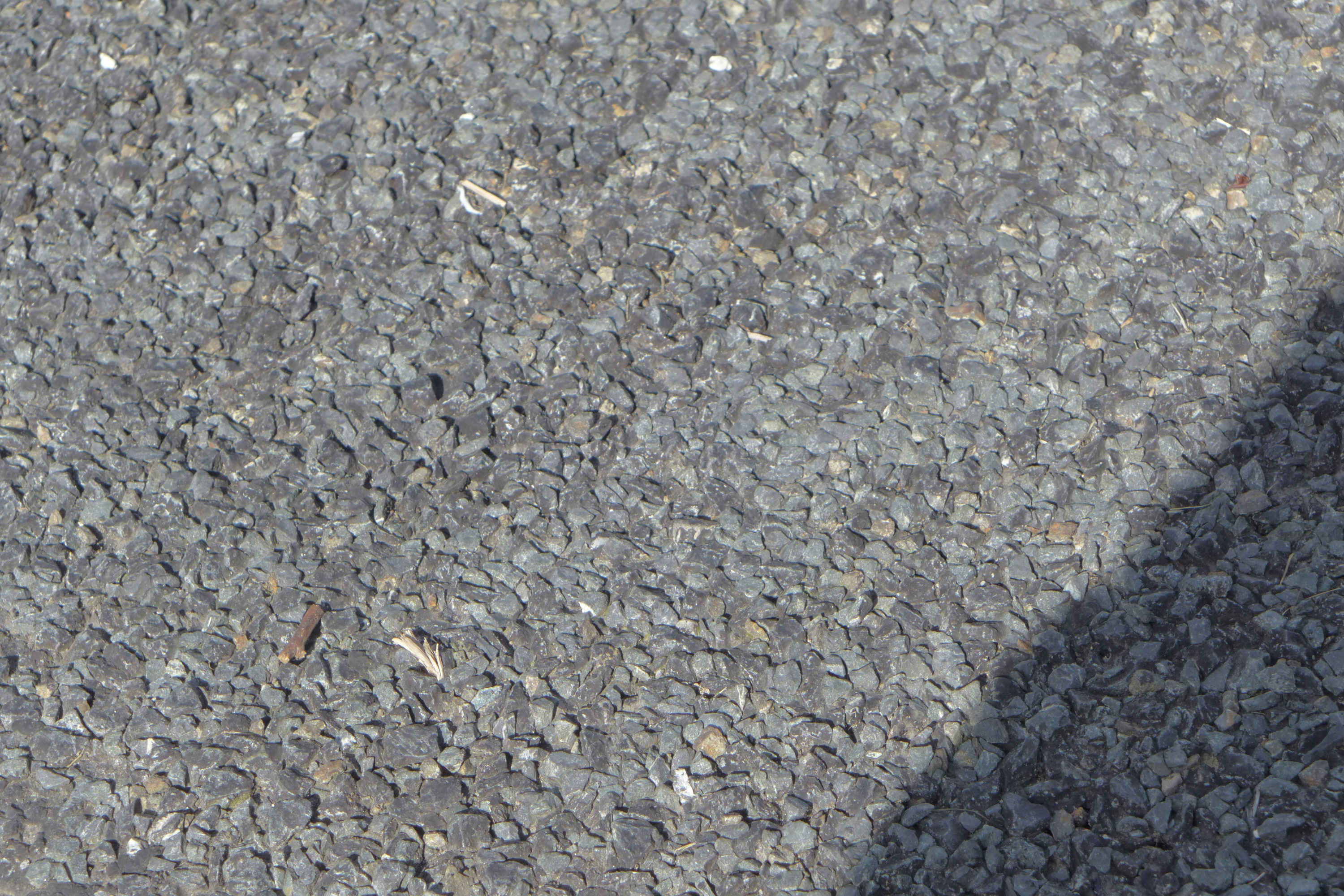
| 15:02, 1 March 2023 | Chipseal surface close-up view.jpg (file) |  |
1.79 MB | {{Information |Description = A close-up view of chipseal road surface |Source = wikipedia:File:Chipseal surface close-up view.jpg |Date = 2017 |Author = wikipedia:User:Xf8 }} | 1 |
| 16:27, 27 February 2023 | Thin noise-reducing layer.jpg (file) |  |
217 KB | more recent image from after the last replacement of the asphalt surface | 2 |
| 13:45, 27 February 2023 | Stone mastic asphalt.jpg (file) |  |
220 KB | {{Information | description=Stone mastic asphalt (SMA-NL) on Verkeersplein Kooimeer (N9, road operator: Rijkswaterstaat) in Alkmaar, The Netherlands. | source=Mapillary (photo), KernGis droog (asphalt type) | date=2021-03-01 | author=Lowiekse }} | 1 |
| 22:08, 12 December 2022 | Nederlands verkeersbord E8c.png (file) |  |
167 KB | {{Information | description=Dutch traffic sign E8c from RVV 1990 (valid as of 1 Jan 2023). | source=[https://zoek.officielebekendmakingen.nl/stb-2022-413.html Staatsblad 2022, 413] | author=Staat der Nederlanden }} This image is in the ''public domain'', because there is no copyright on laws, decisions, and decrees issued by public authorities in the Netherlands ([https://wetten.overheid.nl/jci1.3:c:BWBR0001886&hoofdstuk=I¶graaf=3&artikel=11&z=2022-10-01&g=2022-10-01 Article 11 Dutch Cop... | 1 |
| 21:08, 12 October 2022 | NL shields Americana.png (file) |  |
663 KB | Nieuwere versie met A10 als RING | 2 |
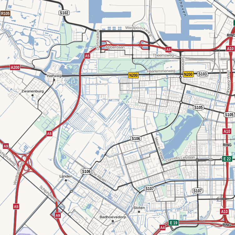
| 20:48, 11 October 2022 | Basiskaart Wegen A0 20211019.svg (file) |  |
51.68 MB | {{Information | description=''Wegenkaart Nederland 2021'' - official road map of the Netherlands from Rijkswaterstaat (Dutch national road authority) | source=[https://downloads.rijkswaterstaatdata.nl/wegenkaart/geogegevens/pdf/versie%202021/Basiskaart_Wegen_A0_20211019.pdf] | date=2021-10-19 | author=Rijkswaterstaat Centrale Informatievoorziening [https://downloads.rijkswaterstaatdata.nl/wegenkaart/productinfo/metainfo/wegenkaart_2021.xml (source)] | permission=[http://creativecommons.org/pu... | 1 |
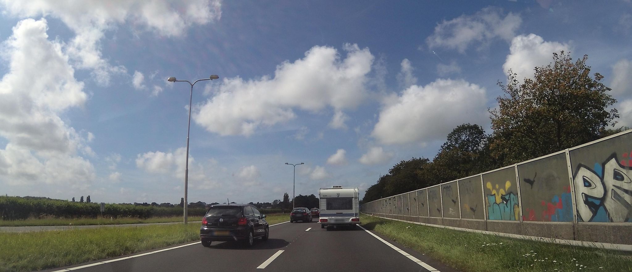
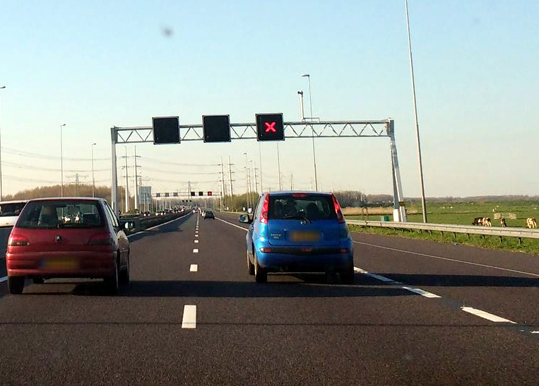
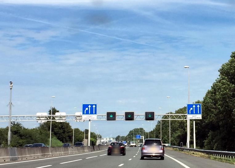
| 14:36, 19 September 2022 | Vluchtstrook spitsstrook gesloten.jpg (file) |  |
348 KB | {{Mapillary}} {{CC-BY-SA-4.0|thetornado76 (image has been modified)}} Mapillary image key: 800754913889206 | 1 |
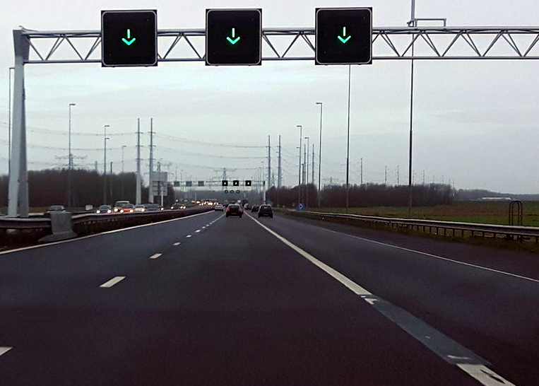
| 14:35, 19 September 2022 | Vluchtstrook spitsstrook open.jpg (file) |  |
319 KB | == Summary == {{Mapillary}} {{CC-BY-SA-4.0|advin__ (image has been modified)}} Mapillary image key: 1027990911067201 | 1 |
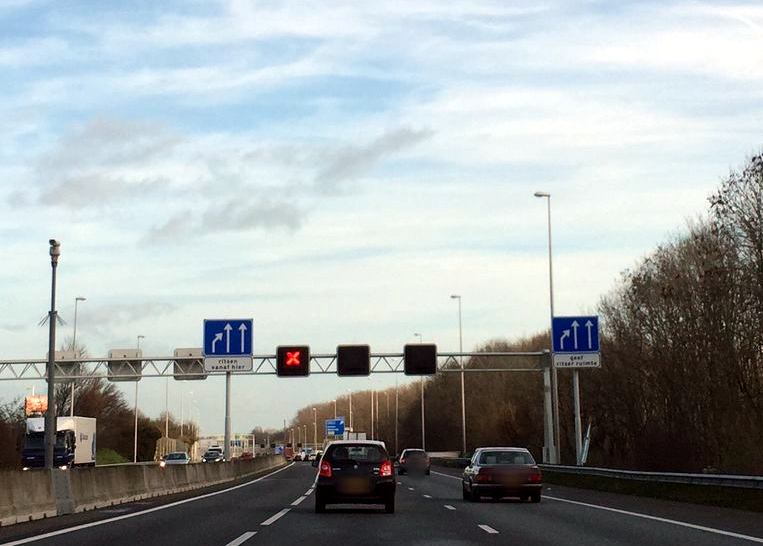
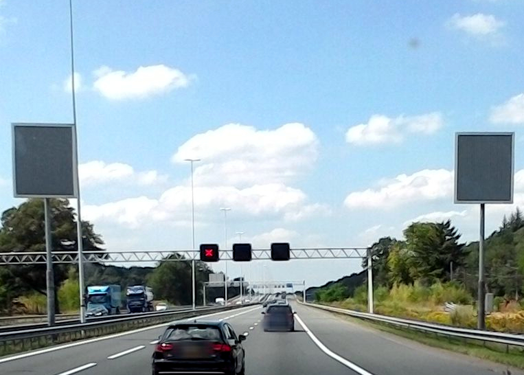
| 12:10, 16 September 2022 | Oversteek spitsstrook gesloten.jpg (file) |  |
328 KB | {{Mapillary}} {{CC-BY-SA-4.0|madel (image has been modified)}} Mapillary image key: 236268438300095 | 1 |
| 12:08, 16 September 2022 | Oversteek spitsstrook open.jpg (file) |  |
275 KB | == Summary == {{Mapillary}} {{CC-BY-SA-4.0|madel (image has been modified)}} Mapillary image key: 2634826316815351 | 1 |
| 11:41, 16 September 2022 | Einde plusstrook open.jpg (file) |  |
340 KB | {{Mapillary}} {{CC-BY-SA-4.0|it_s_so_funny (image has been modified)}} Mapillary image key: 1950916811741339 | 1 |
| 11:40, 16 September 2022 | Einde plusstrook gesloten.jpg (file) |  |
320 KB | {{Mapillary}} {{CC-BY-SA-4.0|it_s_so_funny (image has been modified)}} Mapillary image key: 959086578161562 | 1 |
| 11:11, 16 September 2022 | Einde spitsstrook gesloten.jpg (file) |  |
357 KB | {{Mapillary}} {{CC-BY-SA-4.0|wvdp (image has been modified)}} Mapillary image key: 453016522429673 | 1 |
| 11:10, 16 September 2022 | Einde spitsstrook open.jpg (file) |  |
257 KB | {{Mapillary}} {{CC-BY-SA-4.0|thewizard (image has been modified)}} Mapillary image key: 778206562838266 | 1 |
| 10:30, 16 September 2022 | Spitsstrook afrit gesloten.jpg (file) |  |
404 KB | {{Mapillary}} {{CC-BY-SA-4.0|it_s_so_funny (image has been modified)}} Mapillary image key: 457421685370684 | 1 |
| 10:29, 16 September 2022 | Spitsstrook afrit open.jpg (file) |  |
402 KB | {{Mapillary}} {{CC-BY-SA-4.0|it_s_so_funny (image has been modified)}} Mapillary image key: 497025261493233 | 1 |
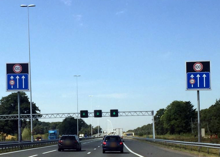
| 12:49, 15 September 2022 | Plusstrook open.jpg (file) |  |
310 KB | {{Mapillary}} {{CC-BY-SA-4.0|canadarunner (image has been modified)}} Mapillary image key: 801534484106627 | 1 |
| 12:47, 15 September 2022 | Plusstrook gesloten.jpg (file) |  |
303 KB | {{Mapillary}} {{CC-BY-SA-4.0|mprins (image has been modified)}} Mapillary image key: 968532043916285 | 1 |
| 20:37, 26 August 2022 | Rijksweg 783.jpeg (file) |  |
347 KB | {{Mapillary}} {{CC-BY-SA-4.0|toho}} [https://scontent-frx5-1.xx.fbcdn.net/m1/v/t6/An9j8L926UOwt0JEwNzp7Mu5zCJ9BBQZFEZeBpHxZc-vPwGQKuuA_DSlWB0v_whWNFoSUROQGYOyIoa_Q2pSRMPquasEtE_HxqlZUsUXh0ECisJlWIDCWkow8CvRFid6kn4e_sRGNSc4xgpD_511CA?stp=s2048x1152&ccb=10-5&oh=00_AT9jwfqItCOIL6IErXNlcJdfyU8XdltfESxlmTvdezfztA&oe=630F059C&_nc_sid=122ab1] | 1 |
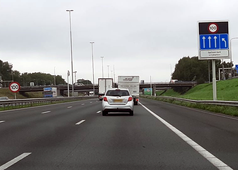
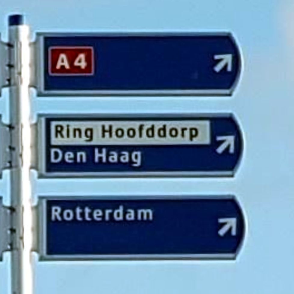
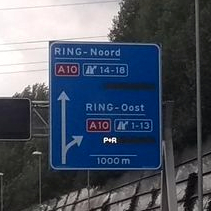
| 20:20, 1 July 2022 | NL Ring 3e.jpeg (file) |  |
453 KB | == Summary == {{Information | description=Signs seen when driving on the Hoofddorp ring road. Photo modified from original. | source=https://www.mapillary.com/app/?lat=52.285199899999&lng=4.7133898999988&z=17&pKey=224830789771547&focus=photo&x=0.5542887940888531&y=0.2484105168712889&zoom=0.8006430868167208 | date=Feb 5, 2022 (original photo) | author=Lowiekse (original photo) }} == Licensing == {{Mapillary}} {{CC-BY-SA-4.0|Lowiekse (changes have been made)}} | 1 |
| 19:56, 1 July 2022 | NL Ring 3d.jpeg (file) |  |
310 KB | == Summary == {{Information | description=Sign seen when driving on the Alkmaar ring road. Photo modified from original. | source=https://www.mapillary.com/app/?lat=52.647365061389&lng=4.7324856461112&z=17&pKey=340677880721563&focus=photo&x=0.320016111640745&y=0.5145027114160291&zoom=1.06511245155599 | date=Sep 7, 2015 (original photo) | author=Garmin VIRBXE (original photo) }} == Licensing == {{Mapillary}} {{CC-BY-SA-4.0|Garmin VIRBXE (changes have been made)}} | 1 |
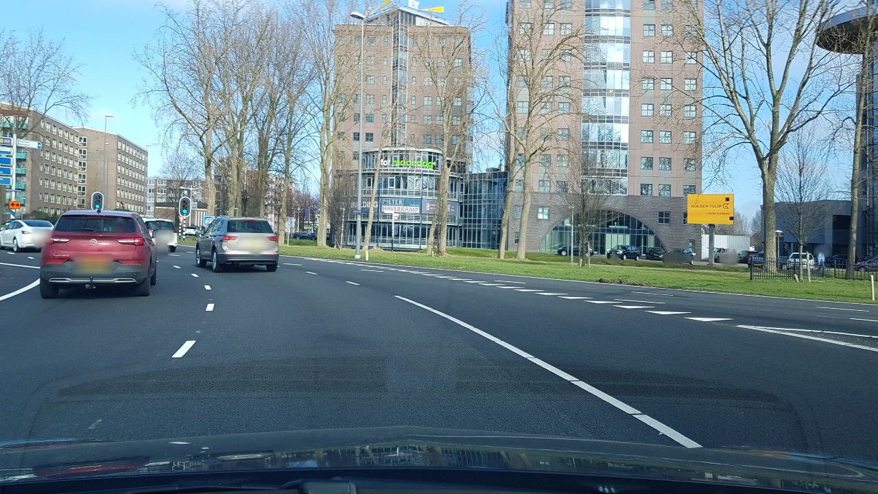
| 20:28, 30 June 2022 | NL Ring 3c.jpeg (file) |  |
187 KB | == Summary == {{Information | description=Sign seen when driving on the Eindhoven boundary road. Photo modified from original. | source=https://www.mapillary.com/app/?lat=51.404347040000005&lng=5.503704169999992&z=19.470048070110266&pKey=167716901931595&focus=photo&x=0.3168517237197117&y=0.30895495197616235&zoom=0.8006430868167208 | date=Dec 26, 2016 (original photo) | author=it_s_so_funny (original photo) }} == Licensing == {{Mapillary}} {{CC-BY-SA-4.0|it_s_so_funny (changes have been made)}} | 1 |
| 20:14, 30 June 2022 | NL Ring 3b.jpeg (file) |  |
54 KB | == Summary == {{Information | description=Sign seen when driving on the Parkstad ring road. Photo modified from original. | source=https://www.mapillary.com/app/?lat=50.928269984803&lng=5.8862713658738&z=17&pKey=900366867479762&focus=photo&x=0.4803206856907601&y=0.31616773348925065&zoom=0 | date=Sep 17, 2020 (original photo) | author=madel (original photo) }} == Licensing == {{Mapillary}} {{CC-BY-SA-4.0|madel (changes have been made)}} | 1 |
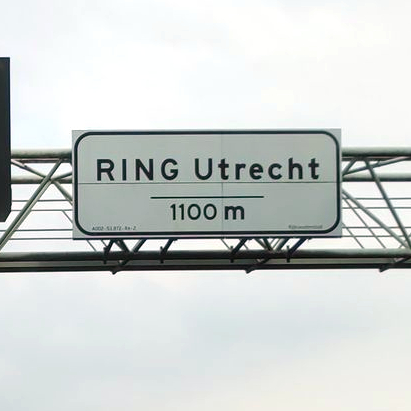
| 20:00, 30 June 2022 | NL Ring 3a.jpeg (file) |  |
336 KB | == Summary == {{Information | description=Sign seen when driving on the Utrecht ring road. Photo modified from original. | source=https://www.mapillary.com/app/?lat=52.05278537222202&lng=5.065023573055555&z=19.9&pKey=138275225012517&focus=photo | date=Feb 5, 2020 (original photo) | author=hbogner (original photo) }} == Licensing == {{Mapillary}} {{CC-BY-SA-4.0|hbogner (changes have been made)}} | 1 |
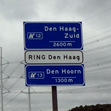
| 19:50, 30 June 2022 | NL Ring 1b.jpeg (file) |  |
111 KB | == Summary == {{Information | description=Announcement sign seen when approaching the The Hague ring road. Photo modified from original. | source=https://www.mapillary.com/app/?lat=51.98060000000001&lng=4.331947000000014&z=19.225287926763944&pKey=280676700370970&focus=photo&x=0.4930752725810148&y=0.5128560126774959&zoom=0 | date=Jul 16, 2016 (original photo) | author=it_s_so_funny (original photo) }} == Licensing == {{Mapillary}} {{CC-BY-SA-4.0|it_s_so_funny (changes have been made)}} | 1 |
| 19:32, 30 June 2022 | NL Ring 1a.jpeg (file) |  |
100 KB | {{Information | description=Announcement sign seen when approaching the Utrecht ring road. Photo modified from original. | source=https://www.mapillary.com/app/?lat=52.13670839448301&lng=5.007068961985965&z=18.27566466294177&pKey=516934549622727&focus=photo&x=0.5079547149853236&y=0.43047463590846&zoom=0 | date=Jun 5, 2019 (original photo) | author=samjakbal (original photo) }} {{Mapillary}} {{CC-BY-SA-4.0|samjakbal}} | 1 |
| 22:02, 19 May 2022 | NL-Carto-boundary.png (file) |  |
17 KB | crop | 2 |
| 21:37, 19 May 2022 | NL-Nominatim.png (file) |  |
18 KB | Nominatim search result for a place in the Kingdom of the Netherlands. | 1 |
| 21:27, 19 May 2022 | NL-Carto-countryname.png (file) |  |
35 KB | Standard tile layer screenshot of the country name of the Kingdom of the Netherlands. | 1 |
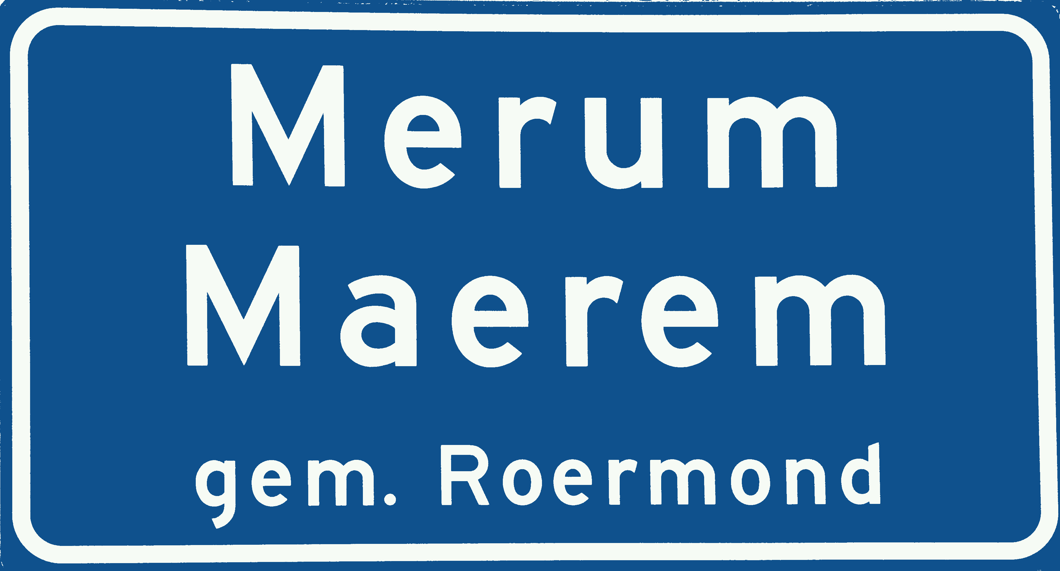
| 18:54, 16 February 2022 | Merum (Roermond) tweetalig plaatsnaambord cropped.JPG (file) | _tweetalig_plaatsnaambord_cropped.JPG) |
791 KB | Replace colours with standard blue+white from https://commons.wikimedia.org/wiki/Category_talk:Diagrams_of_road_signs_of_the_Netherlands | 3 |
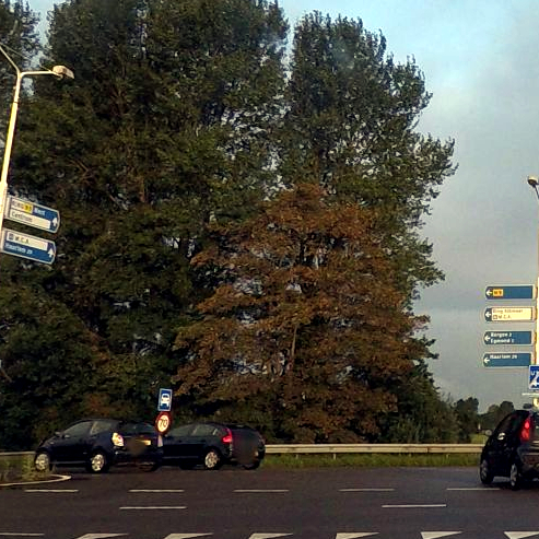
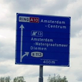
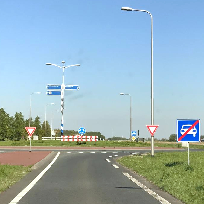
| 21:47, 10 December 2021 | NL Ring 3.jpeg (file) |  |
84 KB | Fork sign seen when driving on the Amsterdam ring road. This image is derived from a photo uploaded to Mapillary. The original metadata from Mapillary was: * Captured by: '''Lowiekse''' * Captured on: May 23, 2021 * Captured with: samsung SM-G950F * Shared under the CC BY-SA 4.0 license | 1 |
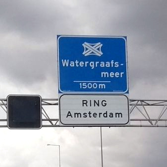
| 21:44, 10 December 2021 | NL Ring 2.jpeg (file) |  |
61 KB | Fork sign seen when approaching the Amsterdam ring road. This image is derived from a photo uploaded to Mapillary. The original metadata from Mapillary was: * Captured by: '''meloentje''' * Captured on: Oct 16, 2021 * Captured with: motorola Moto G (5) * Shared under the CC BY-SA 4.0 license | 1 |
| 21:41, 10 December 2021 | NL Ring 1.jpeg (file) |  |
84 KB | Announcement sign seen when approaching the Amsterdam ring road. This image is derived from a photo uploaded to Mapillary. The original metadata from Mapillary was: * Captured by: **meloentje** * Captured on: Oct 16, 2021 * Captured with: motorola Moto G (5) * Shared under the CC BY-SA 4.0 license | 1 |
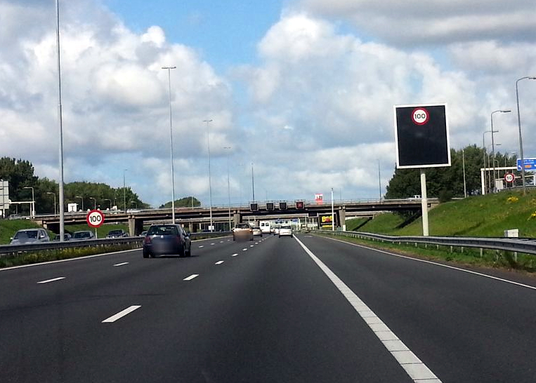
| 14:53, 21 July 2021 | RingCuracao.jpg (file) |  |
377 KB | Ring road of Curaçao. Example of situation where speed limit signs are used with a value higher than the legal default. Edited photo. Original photo published on Mapillary: user ost360vr_Joscelin, 11 Feb 2020, https://www.mapillary.com/app/?lat=12.114523924992&lng=-68.937608673168&z=17&pKey=395064278314633&x=0.24081922413171675&y=0.5009882751804495&zoom=1.1938171883755324&focus=photo | 1 |
| 13:29, 18 May 2021 | Nederlandse verkeersborden G2G4G1G3.svg (file) |  |
33 KB | 1 | |
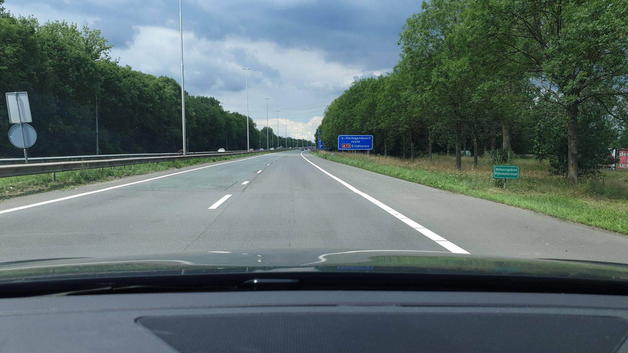
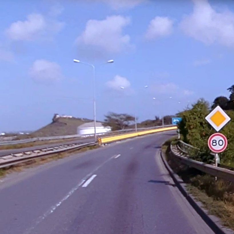
| 13:23, 18 May 2021 | N255.jpg (file) |  |
291 KB | N255 bij Wissenkerke. Voorbeeld van onderbreking in autowegstatus die als highway=trunk motorroad=no getagd wordt. Bewerkte foto. Oorspronkelijke foto gepubliceerd op Mapillary: gebruiker elton4711, 4 mei 2018 13:16, https://www.mapillary.com/app/?lat=51.576546150804404&lng=3.7564713349054273&z=17&pKey=vXK2lU43dGSYIco4VVp6og&focus=photo | 1 |