Uploads by Jnicho02
Jump to navigation
Jump to search
This special page shows all uploaded files.
| Date | Name | Thumbnail | Size | Description | Versions |
|---|---|---|---|---|---|
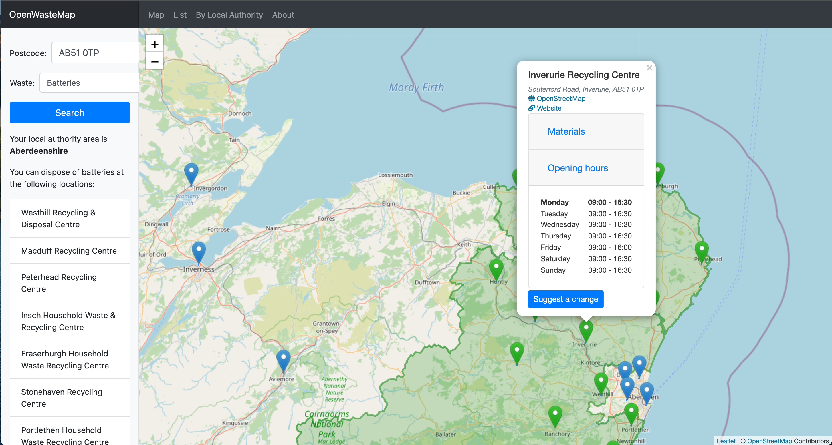
| 10:08, 4 October 2021 | OpenWasteMap.png (file) |  |
2.76 MB | Screenshot of a view from OpenWasteMap. A user can enter their postcode with the type of waste they wish to recycle and OSM data is used to identify recycling locations. | 1 |
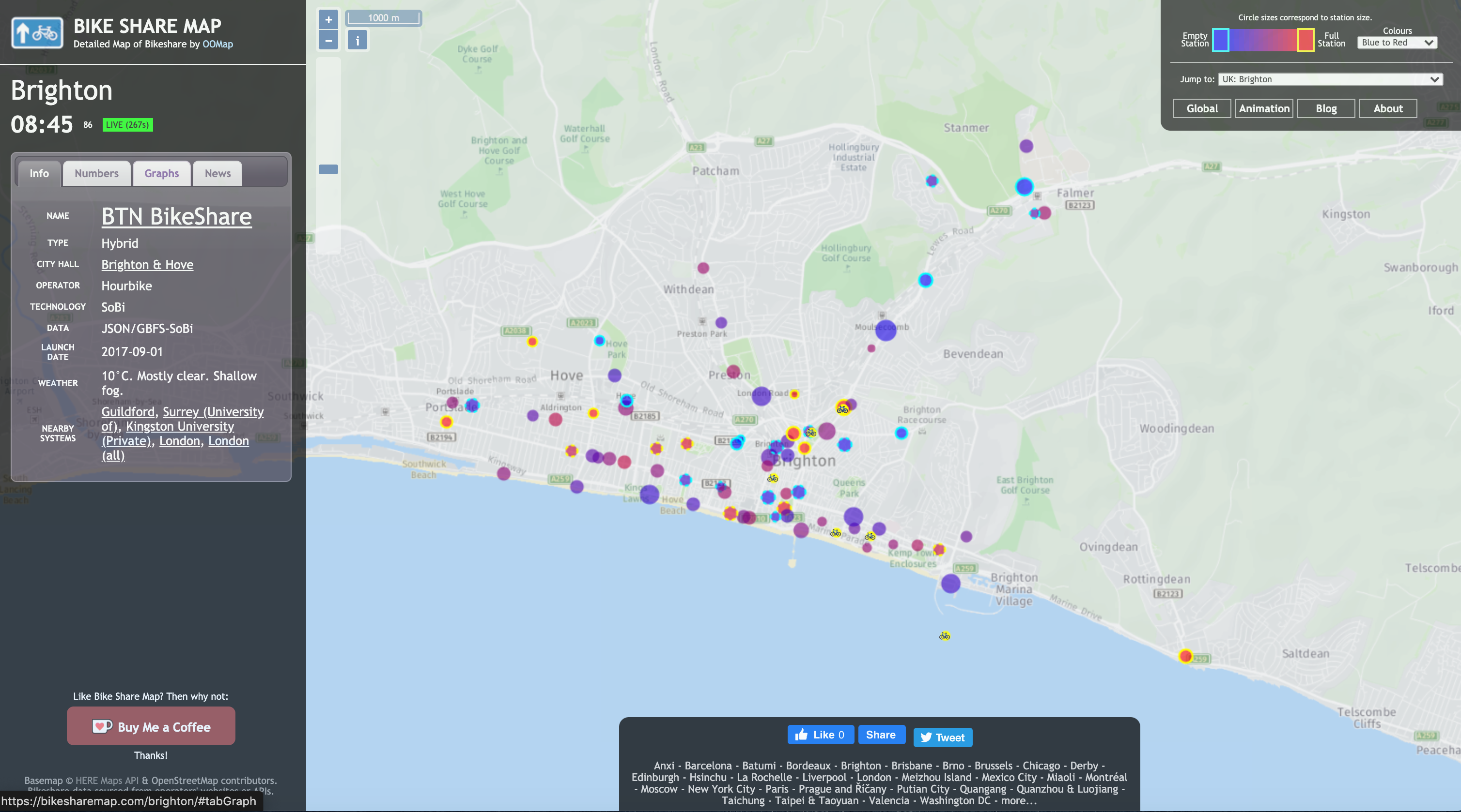
| 08:53, 11 November 2020 | BikeShareMap Brighton 2020111.png (file) |  |
2.64 MB | Screenshot of the Bike Share Map view of Brighton on 11 Nov 2020 https://bikesharemap.com/brighton/#/14.047015466292692/-0.1375/50.8254/ | 1 |
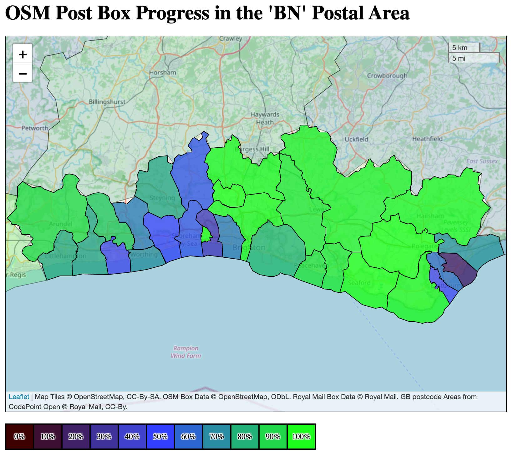
| 08:29, 11 November 2020 | Posthoc BN stats 20201111.png (file) |  |
2 MB | Screenshot from https://osm.mathmos.net/postboxes/progress/BN/ showing completion statistics for Royal Mail postbox locations in Brighton & Hove on 11 Nov 2020 | 1 |
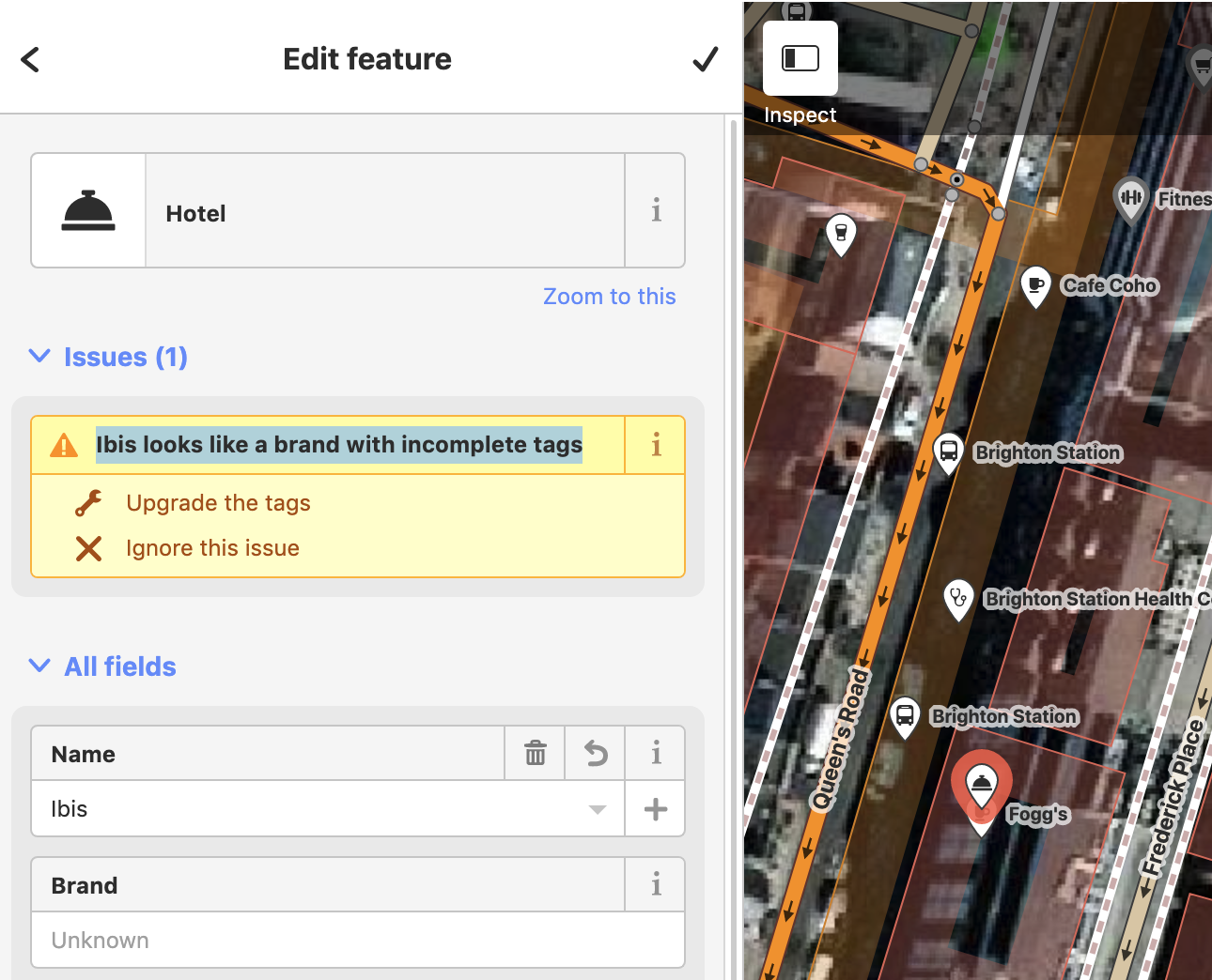
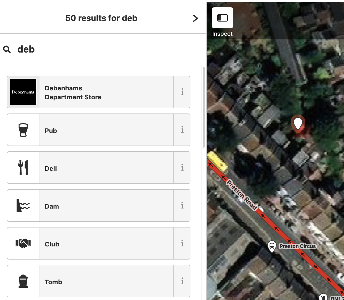
| 09:07, 5 November 2019 | Incomplete-tags-id-2019-11-05.png (file) |  |
1,009 KB | Screengrab from the iD editor as a UK editor selects an existing feature which matches a brand on the Name Suggestion Index 2019-11-04 | 1 |
| 19:27, 4 November 2019 | Name-suggestion-debenhams-id-2019-11-04.png (file) |  |
1.04 MB | Screengrab of the Name Suggestion Index in action in the iD editor 2019-11-04 | 1 |
| 18:00, 4 November 2019 | Osm-community-index-uk-on-id-2019-11-04.png (file) |  |
234 KB | Screengrab from the iD editor after an editor made by a UK editor 2019-11-04 showing display of OSM Community Index data | 1 |
| 17:57, 4 November 2019 | Openstreetmap-community-website-2019-11-04.png (file) |  |
943 KB | Screengrab from the https://openstreetmap.community/ website on 2019-11-04 showing a detail for UK communities | 1 |
| 07:37, 3 October 2019 | Screenshot 2019-10-03 at 8.33.11 am.png (file) |  |
198 KB | screengrab of http://resultmaps.neis-one.org/osm-notes-country?c=United%20Kingdom for 03 Oct 2019 | 1 |
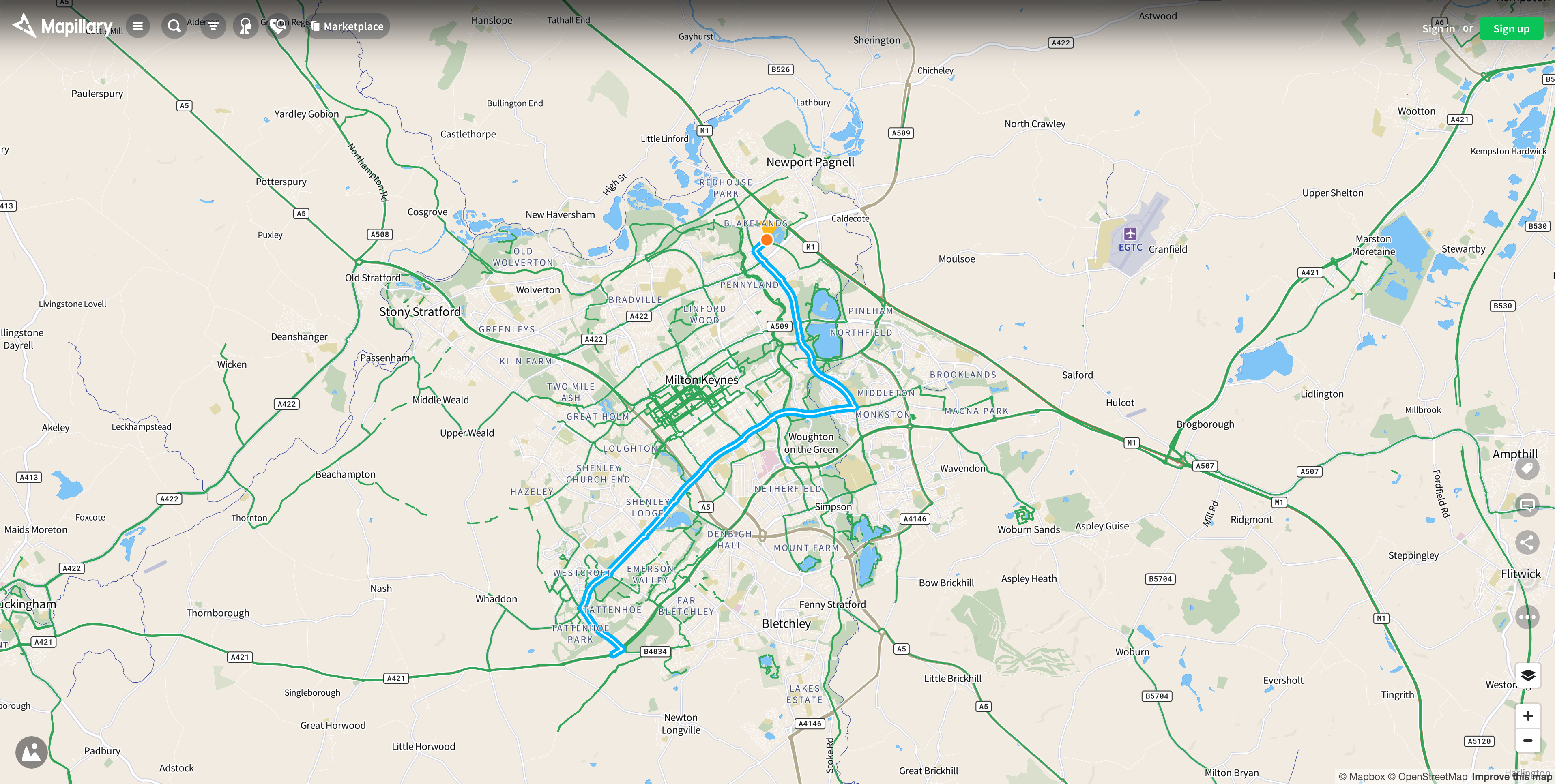
| 17:20, 12 June 2019 | Mapillary Milton Keynes.png (file) |  |
3.57 MB | screengrab of Mapillary coverage for Milton Keynes South area | 1 |
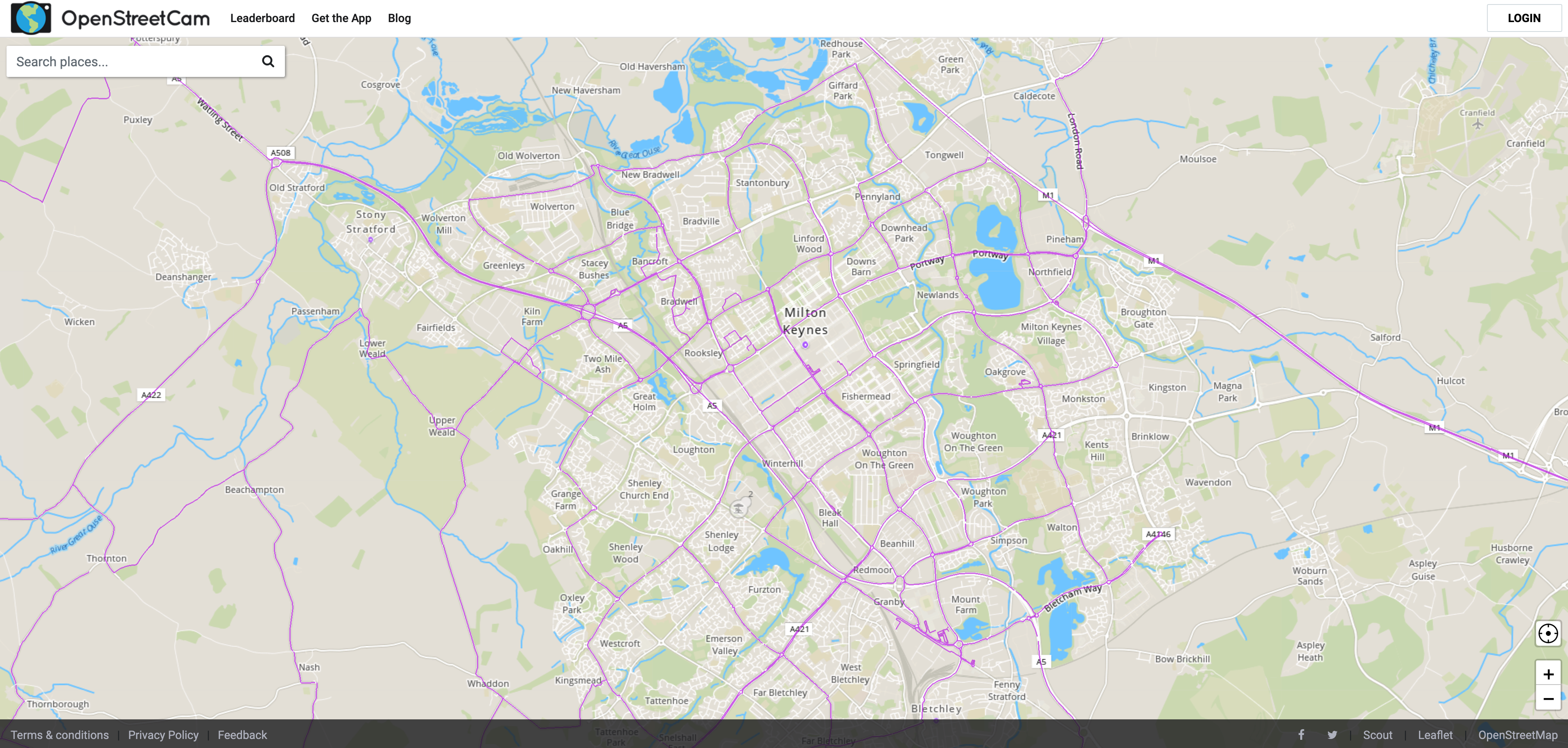
| 16:59, 12 June 2019 | OpenStreetCam MiltonKeynes.png (file) |  |
5.43 MB | a screen capture of OpenStreetCam coverage of the Milton Keynes South area | 1 |
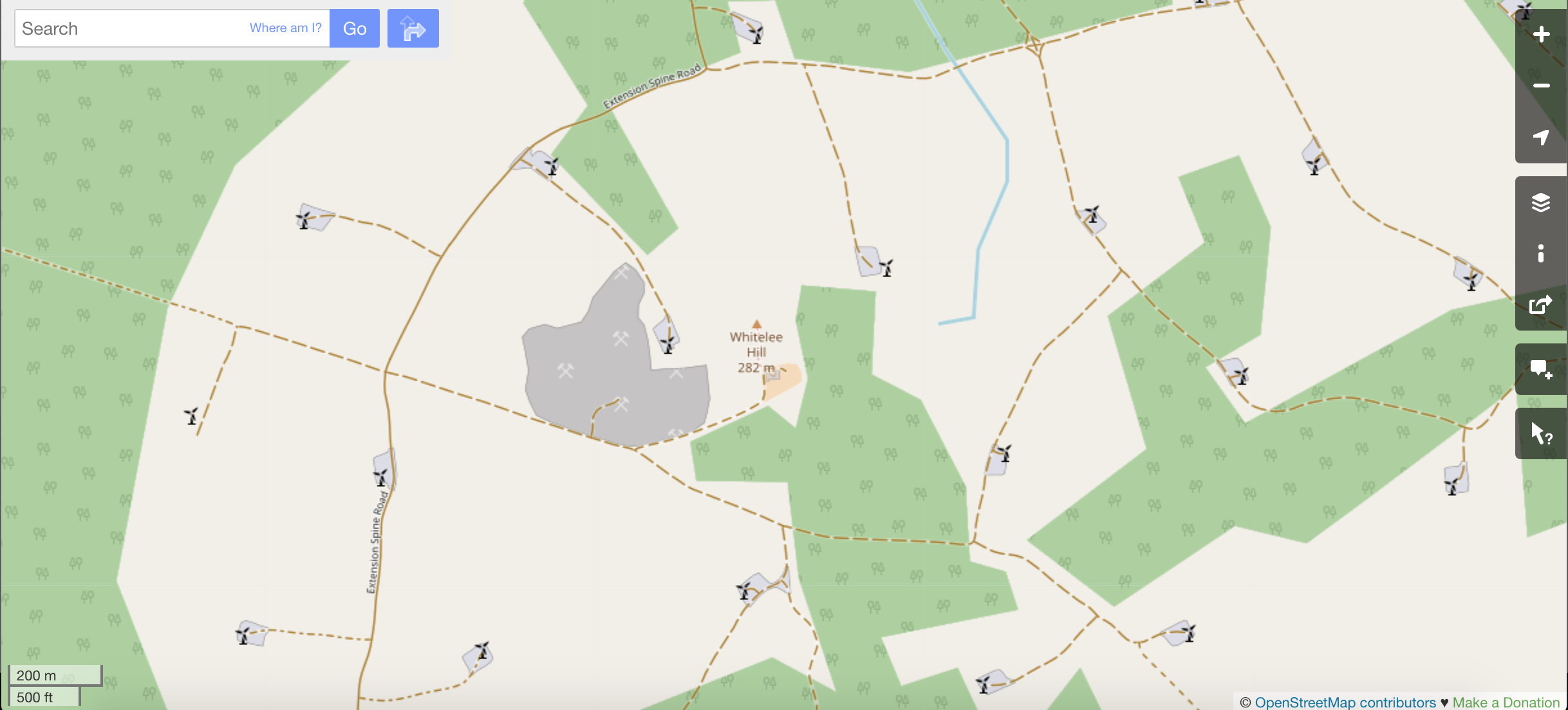
| 11:54, 15 December 2018 | Whitelee Wind Farm Open Street Map.png (file) |  |
709 KB | standard render on OSM. Turbines displayed at zoom level 15 | 1 |
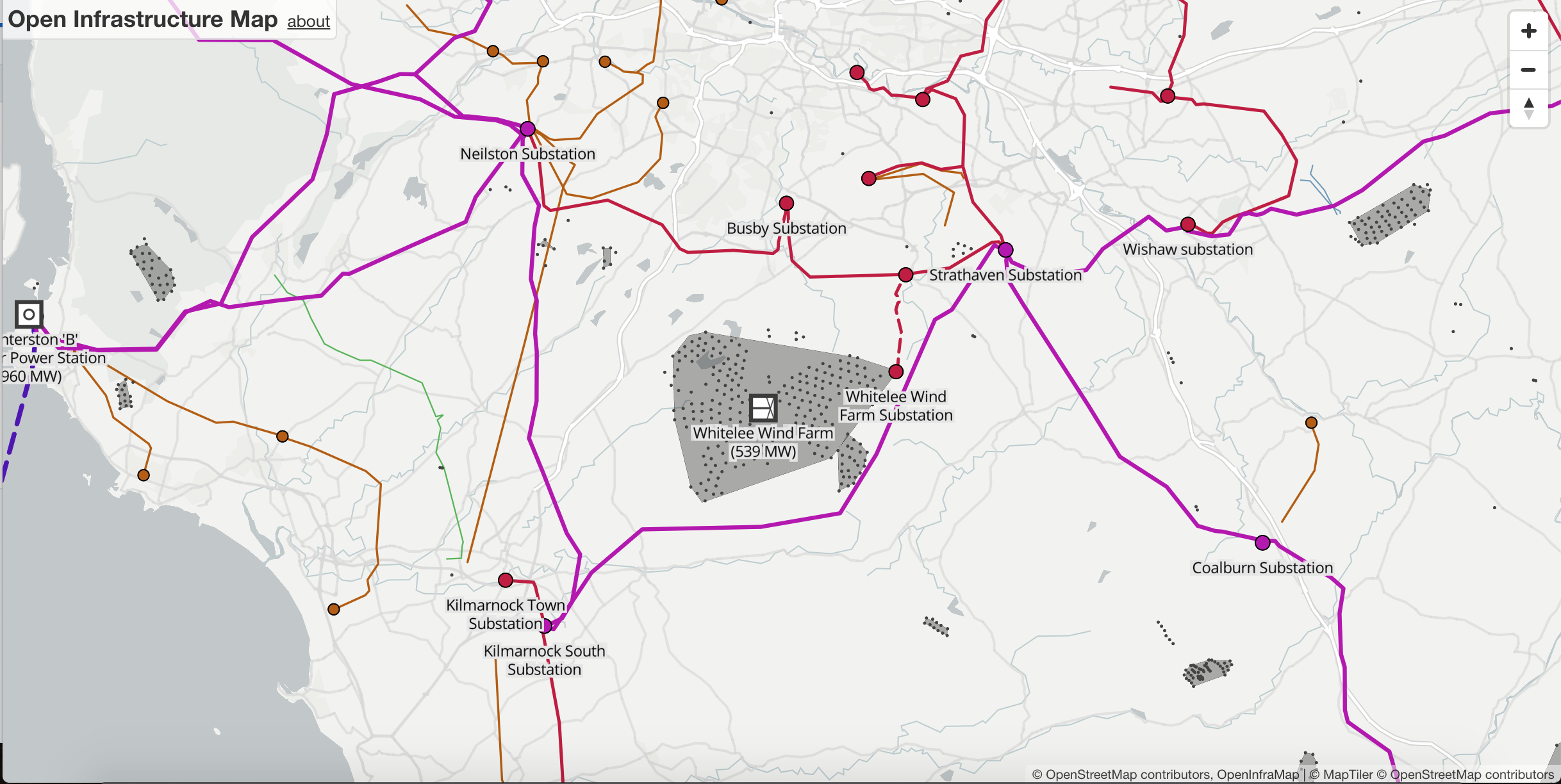
| 11:29, 14 December 2018 | Whitelee Wind Farm on Open Infrastructure Map.png (file) |  |
1.05 MB | Whitelee onshore wind farm in the UK renedered in the Open Infrastructure Map | 1 |
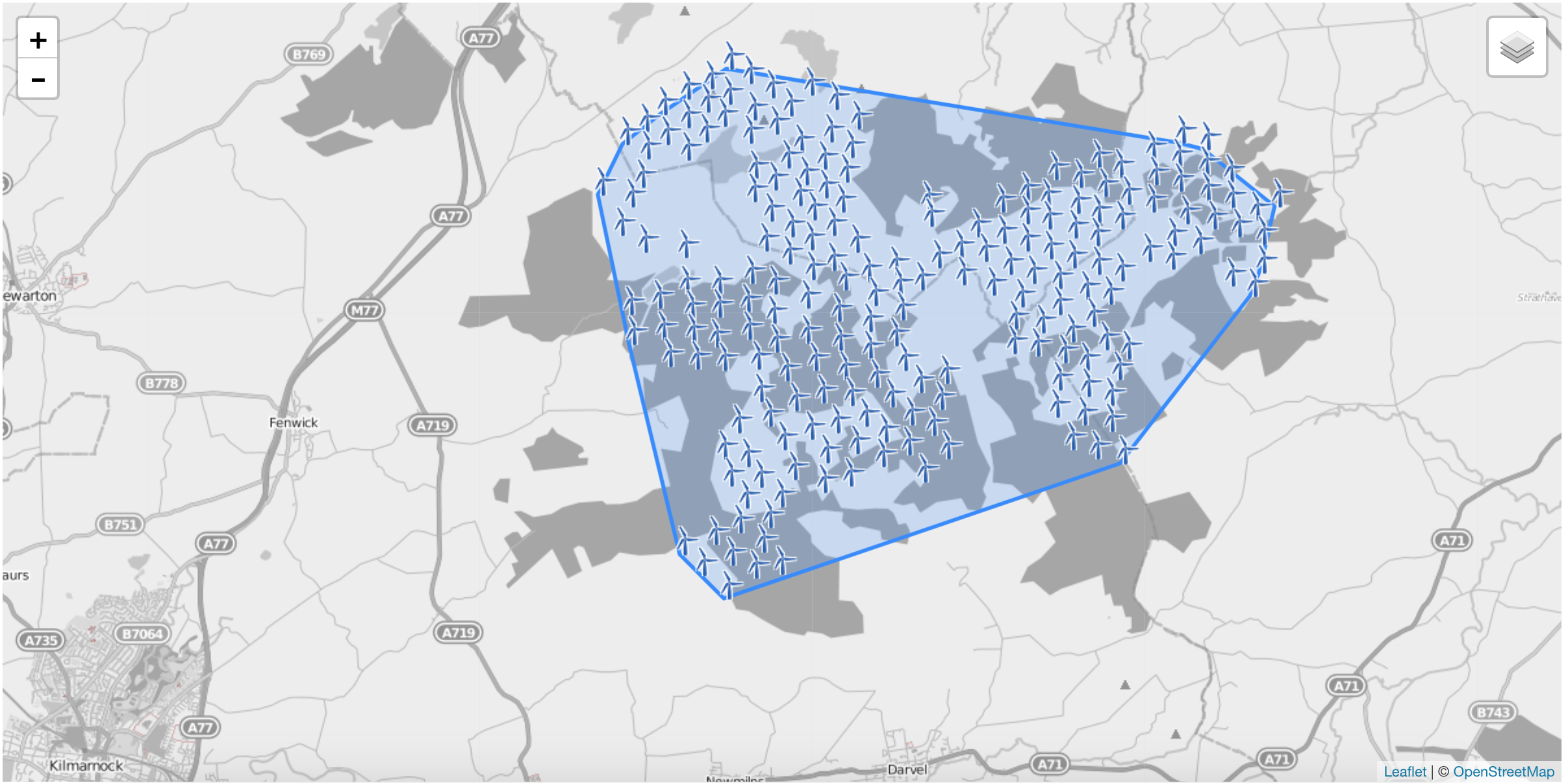
| 11:21, 14 December 2018 | Whitelee Wind Farm.png (file) |  |
1.15 MB | An onshore wind farm in the UK showing how to create a polygon from the relation of wind turbines | 1 |
| 08:17, 19 October 2018 | Monorails in the United Kingdom.png (file) |  |
959 KB | Overpass Turbo image of monorail locations in the UK. Needs updating once all relations have been created and Alton Towers labelling updated. | 1 |