Uploads by SergioAJV
Jump to navigation
Jump to search
This special page shows all uploaded files.
| Date | Name | Thumbnail | Size | Description | Versions |
|---|---|---|---|---|---|
| 21:10, 23 September 2019 | B11-Jaquirana-vetor-x-mapbiomas.jpg (file) |  |
411 KB | Comparação método vetorização x mapbiomas (http://plataforma.mapbiomas.org/map) | 1 |
| 21:04, 7 February 2019 | Email-2019-02-01-Descritivo-CRS.png (file) |  |
182 KB | Email-2019-02-01-Descritivo-CRS | 1 |
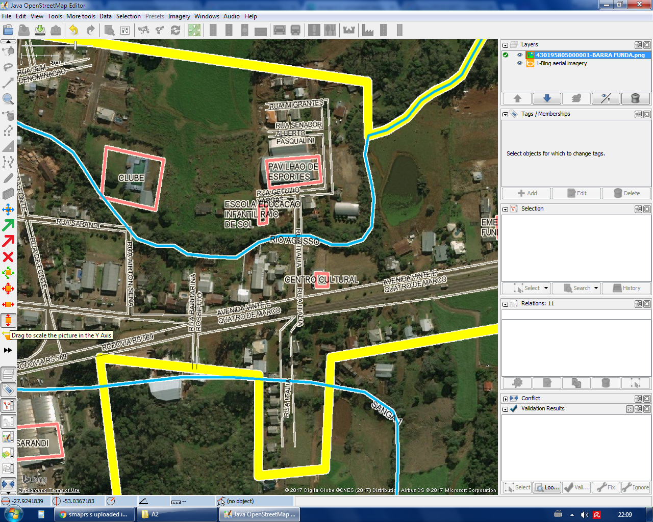
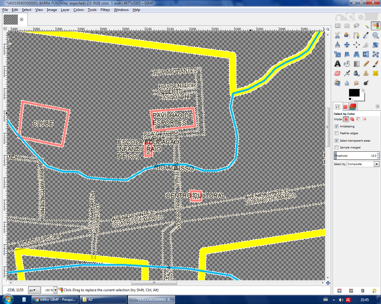
| 18:39, 5 February 2019 | 4-ADDR-REMOVIDOS-SMF-EXISTENTES-OSM.jpg (file) |  |
301 KB | Importação da camada de numeração de endereços da PMPA - IMAGEM 5 | 1 |
| 18:38, 5 February 2019 | 3-ADDR-COMPARA-DMWEB-SHP-OSM-2.jpg (file) |  |
790 KB | Importação da camada de numeração de endereços da PMPA - IMAGEM 4 | 1 |
| 18:38, 5 February 2019 | 2-ADDR-DELTA NUMFIN-NUM1-NUM2.jpg (file) |  |
431 KB | Importação da camada de numeração de endereços da PMPA - IMAGEM 3 | 1 |
| 18:37, 5 February 2019 | 1-ADDR-DELTA NUMFIN-NUM-NUM2-X-Y.jpg (file) |  |
255 KB | Importação da camada de numeração de endereços da PMPA - IMAGEM 2 | 1 |
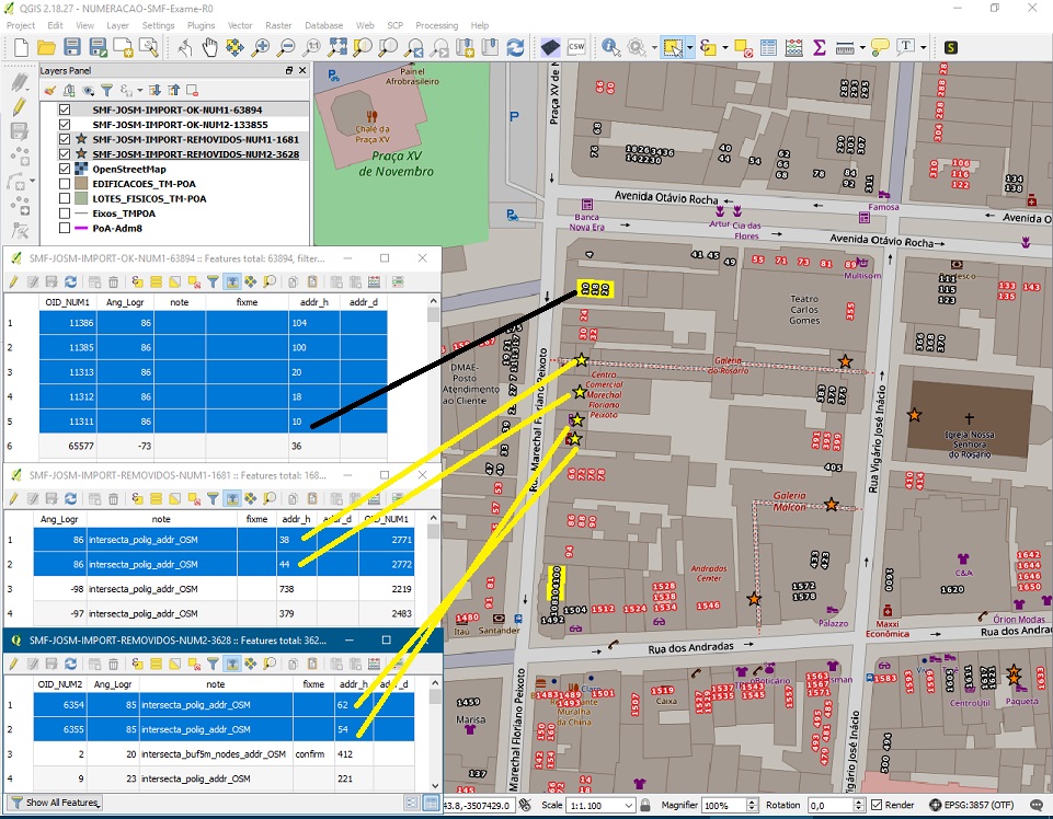
| 18:37, 5 February 2019 | 0-ADDR-DESPACHO.jpg (file) |  |
241 KB | Importação da camada de numeração de endereços da PMPA - IMAGEM 1 | 1 |
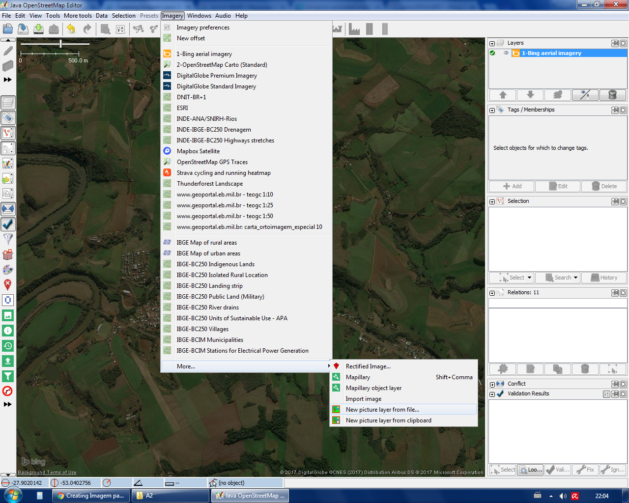
| 16:00, 29 October 2018 | Editor iD pt-br.png (file) |  |
925 KB | Editor iD pt-br | 1 |
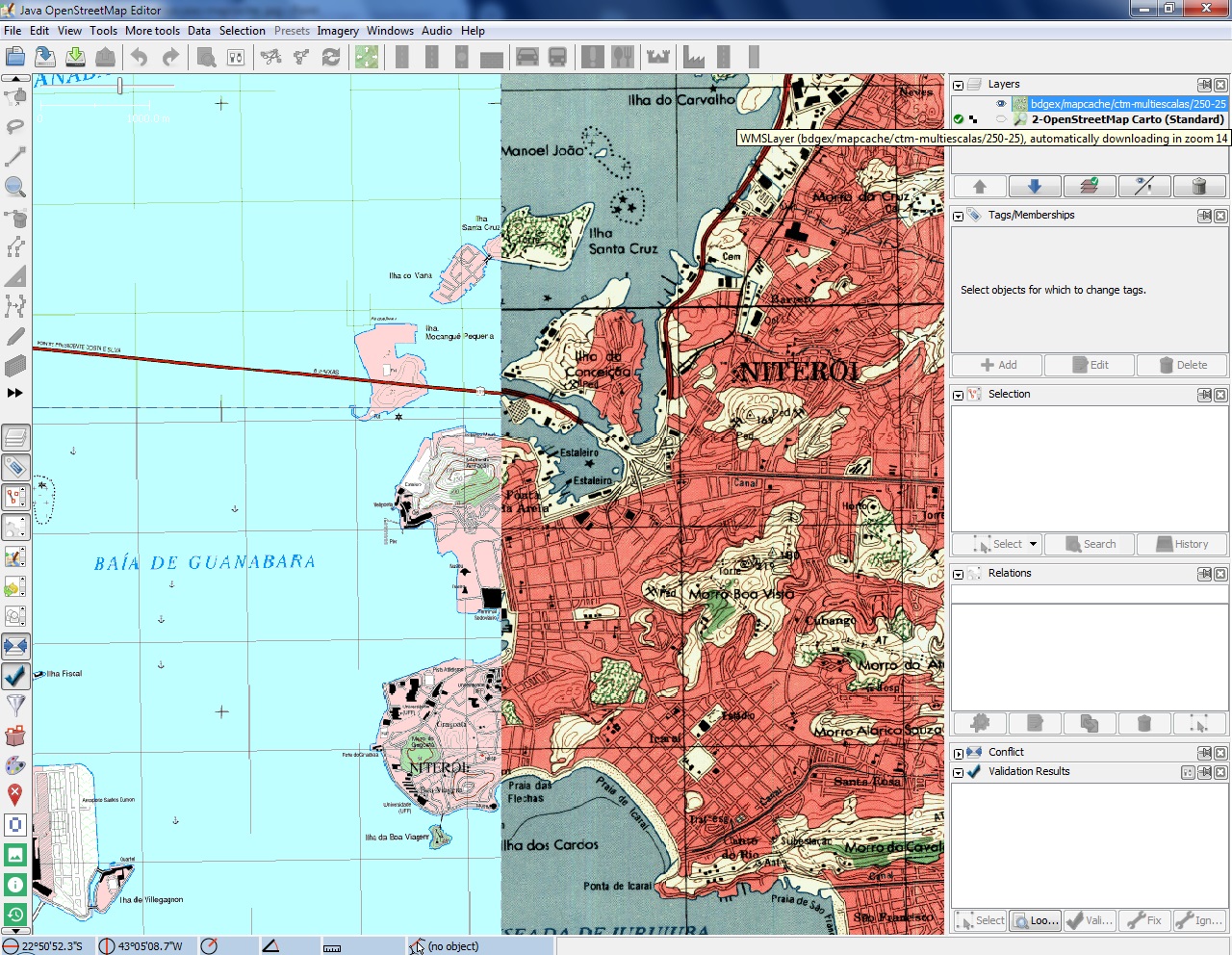
| 12:39, 14 October 2018 | Ctmmultiescalas-mapcache .jpg (file) |  |
554 KB | BDGEx-ctm-multiescalas http://bdgex.eb.mil.br/mapcache?FORMAT=image/png&TRANSPARENT=TRUE&VERSION=1.1.1&SERVICE=WMS&REQUEST=GetMap&LAYERS=ctmmultiescalas_mercator&STYLES=&SRS=%7Bproj%7D&WIDTH=%7Bwidth%7D&HEIGHT=%7Bheight%7D&BBOX=%7Bbbox%7D | 1 |
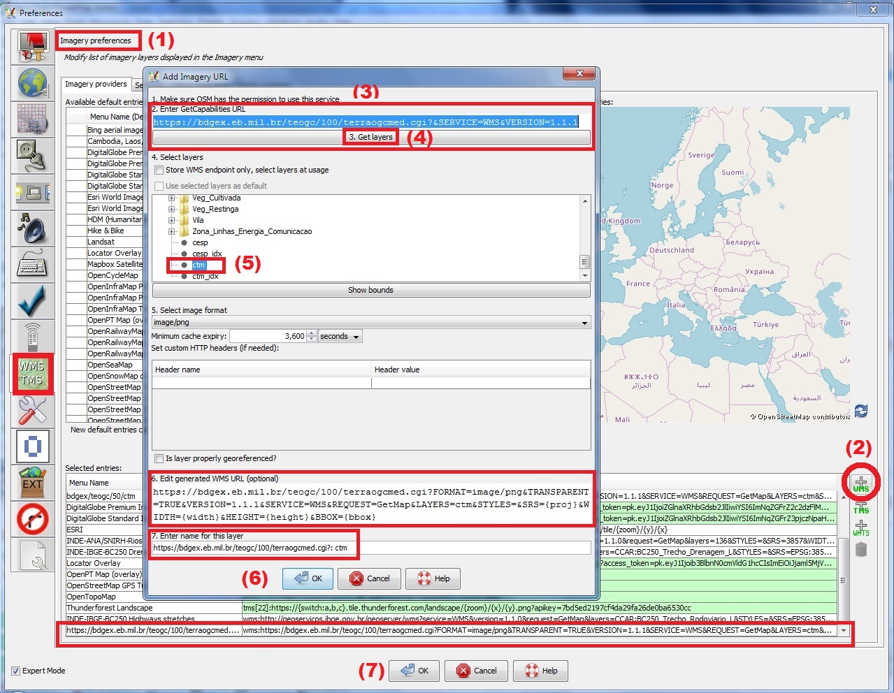
| 14:39, 5 October 2018 | TUTORIAL BDGEx-JOSM.jpg (file) |  |
434 KB | TUTORIAL BDGEx-JOSM | 1 |
| 14:24, 5 October 2018 | BDGEx-CTM-todas escalas.jpg (file) |  |
268 KB | Cobertura completa das Cartas Topográficas Matriciais (ctm) do Banco de Dados Geográfico do Exército Brasileiro (BDGEx) em todas as escalas disponíveis | 1 |
| 14:15, 5 October 2018 | Relatorio-Pedido-BDGEx-2018.pdf (file) | 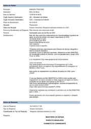 |
317 KB | Resposta positiva do BDGEx autorizando o uso das camadas WMS do Exército Brasileiro para o mapeamento no OSM, encaminhada à comunidade OSM do Brail pelo usuário https://www.openstreetmap.org/user/DressyPear4 | 1 |
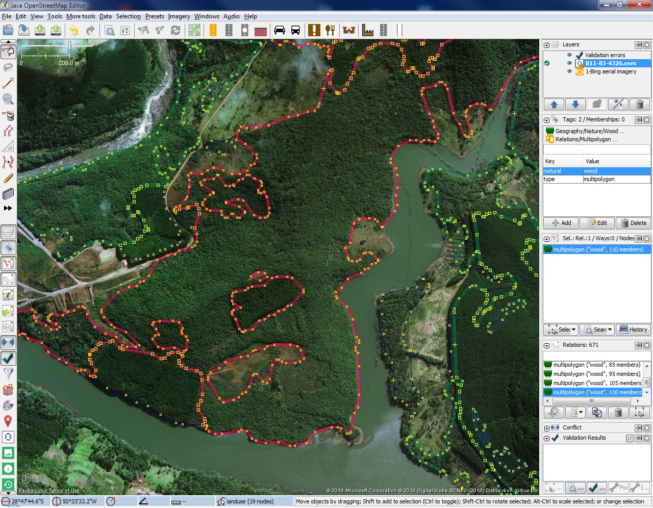
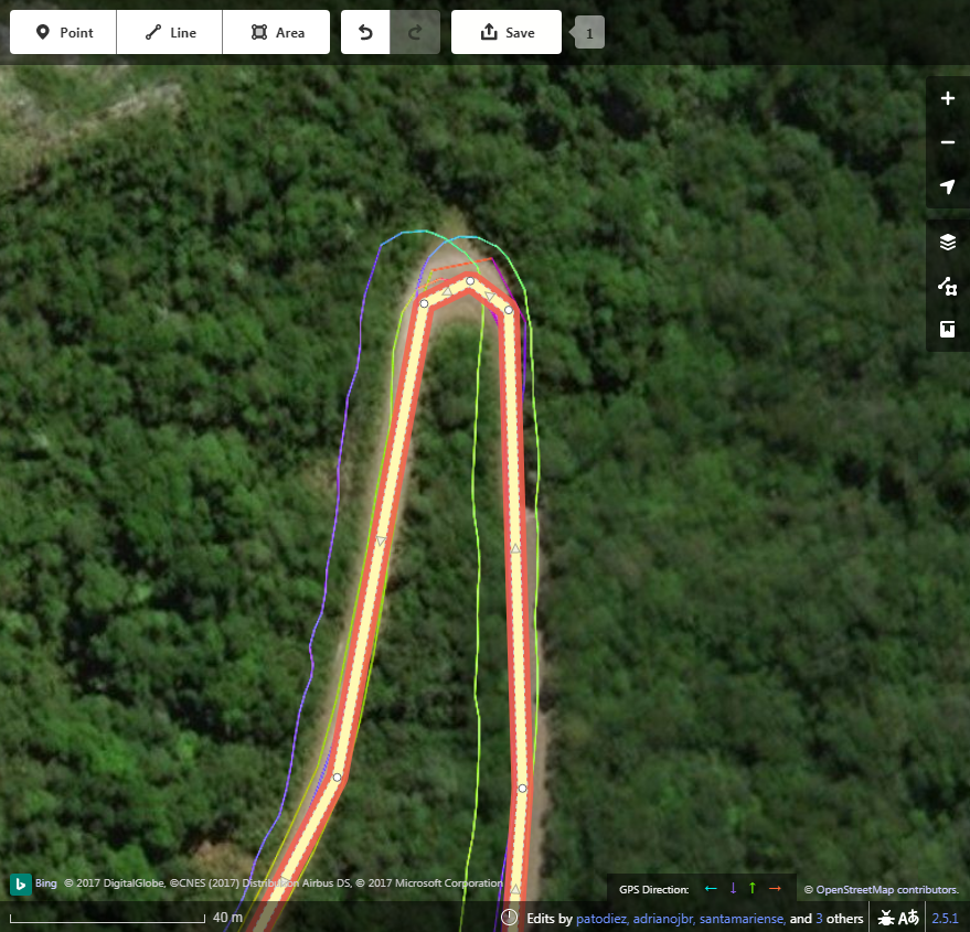
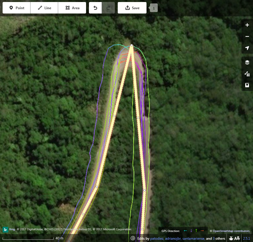
| 01:02, 27 August 2018 | Sentinel-vectorize-JOSM.jpg (file) |  |
693 KB | Final result in JOSM of wood and forest vectorizing process using Sentinel B11 image, NDVI vegetation index and QGIS. | 1 |
| 22:10, 26 August 2018 | B11-full-process-640.gif (file) |  |
1.08 MB | Brief animated exibition of wood and forest vectorizing process using Sentinel B11 image, NDVI vegetation index and QGIS | 1 |
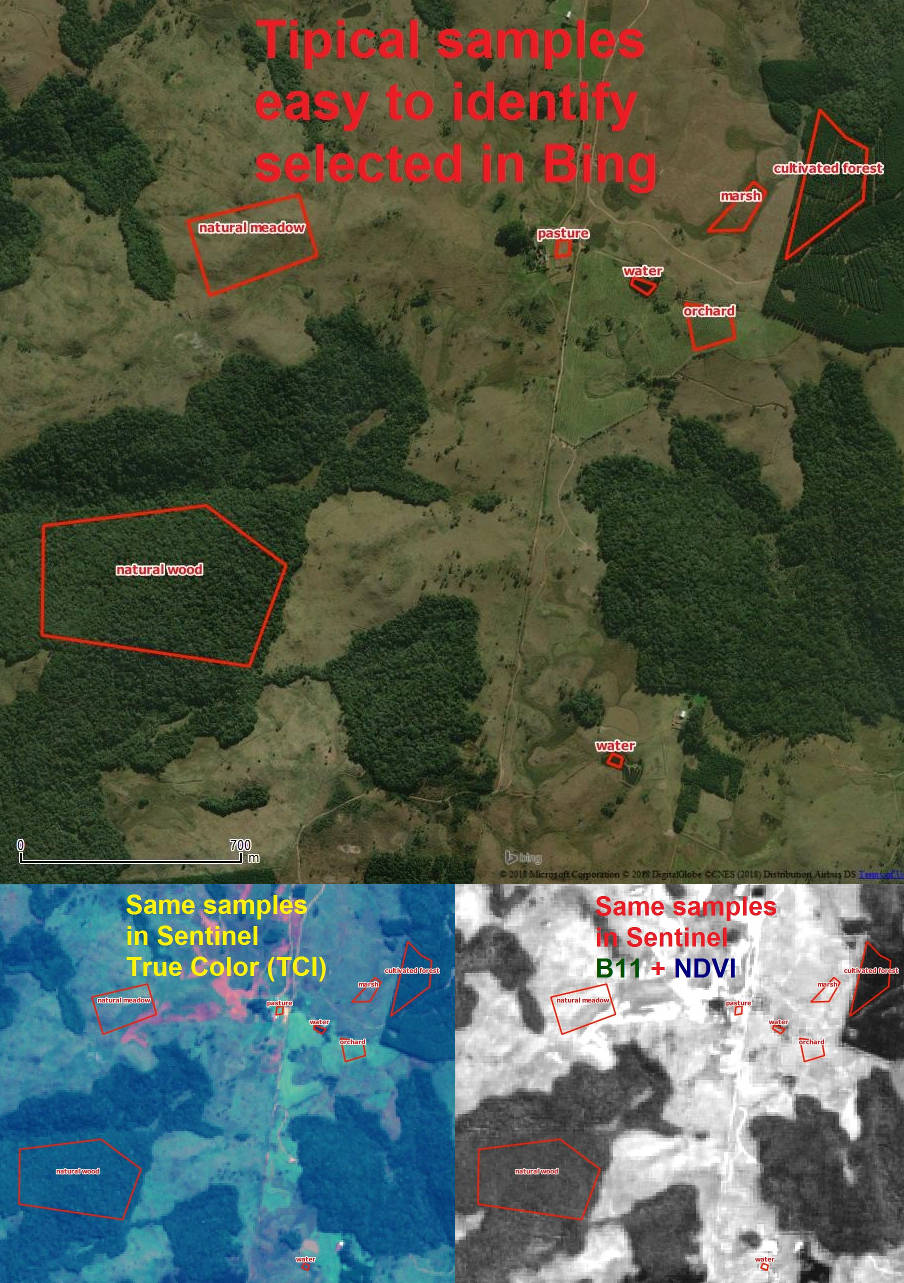
| 22:06, 26 August 2018 | Amostragem123.jpg (file) |  |
208 KB | Examples of samples for wood and forest vectorizing process using Sentinel images and QGIS | 1 |
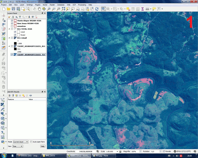
| 21:46, 3 August 2018 | Sat-QGIS-contour-2.jpg (file) |  |
388 KB | Contour lines generated in QGIS with Sentinel-2 image Band 11 | 1 |
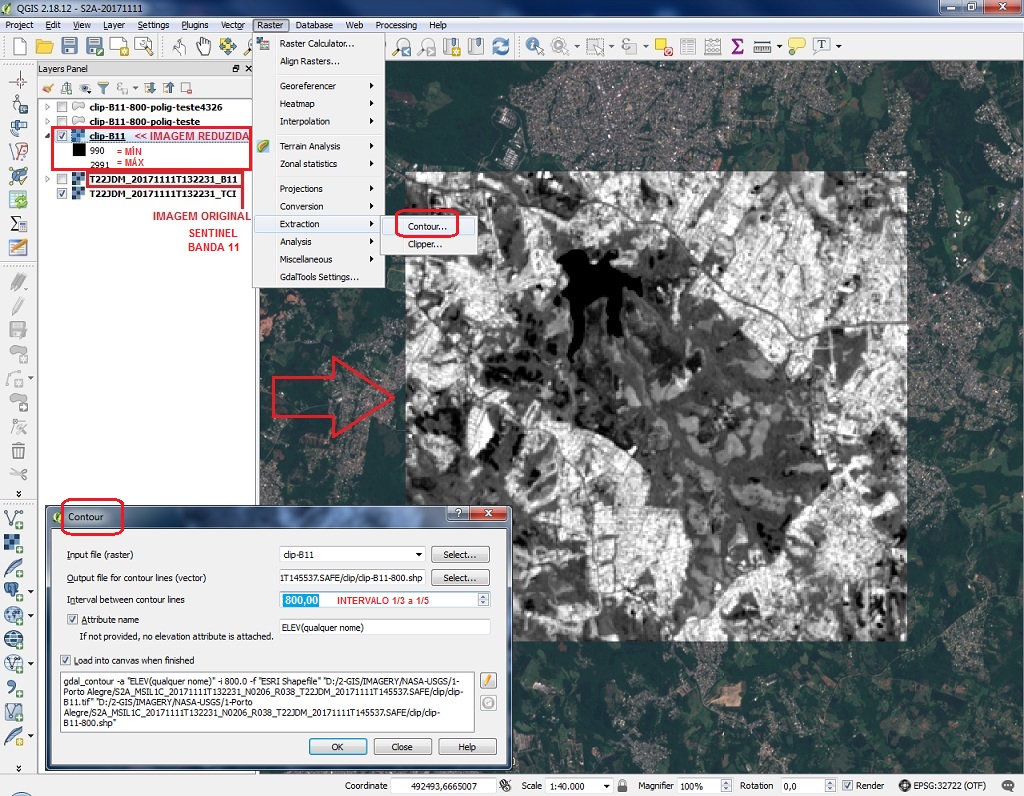
| 21:45, 3 August 2018 | Sat-QGIS-contour-1.jpg (file) |  |
342 KB | Sentinel-2 image clipped and contour lines generated in QGIS | 1 |
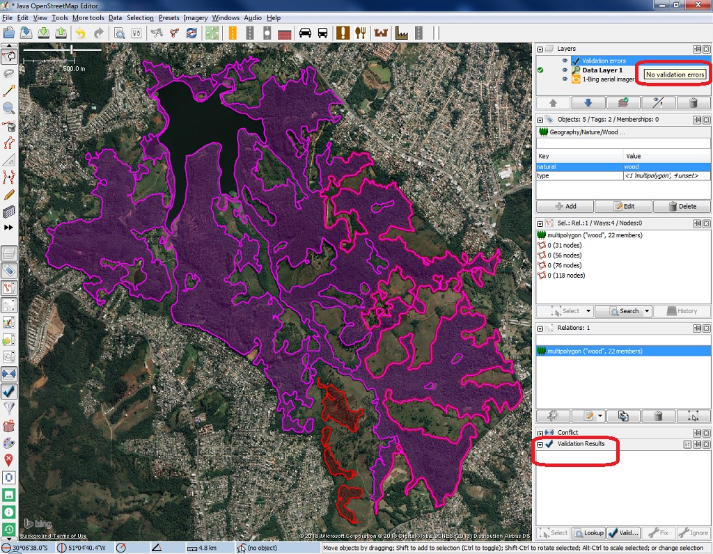
| 21:44, 3 August 2018 | Sat-JOSM-valid-1.jpg (file) |  |
459 KB | JOSM validation of multipolygons of natural=wood generated by QGIS countour lines with Sentinel-2 images | 1 |
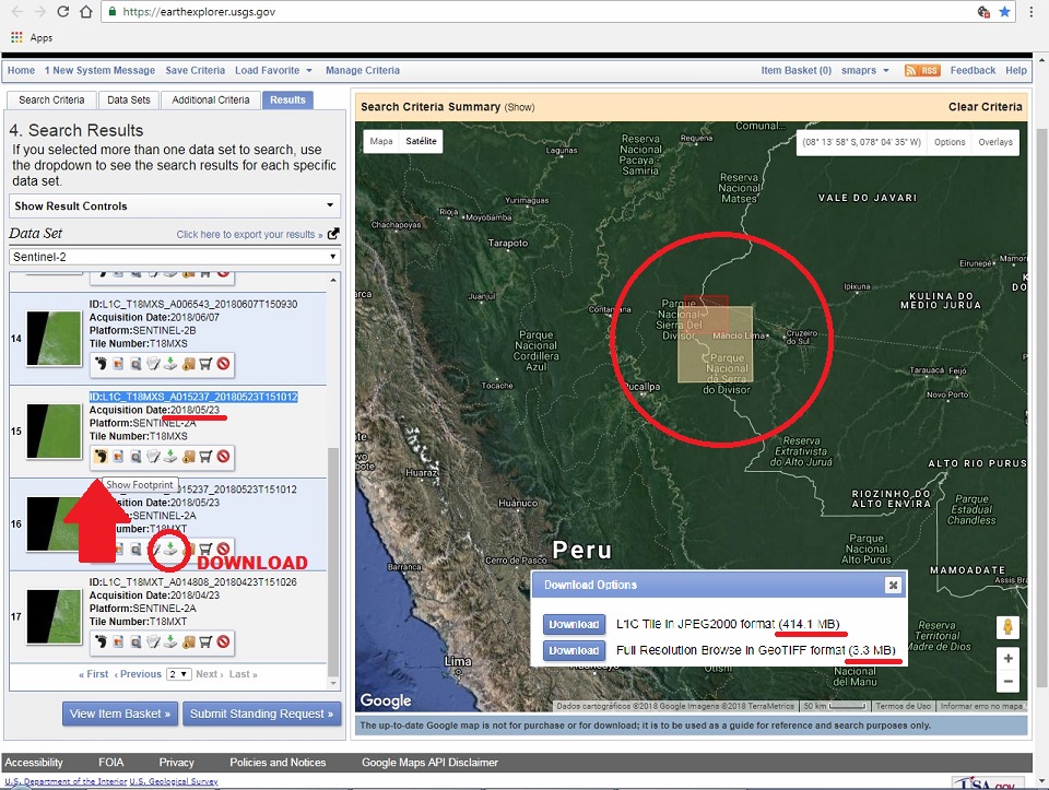
| 21:41, 3 August 2018 | Sat-EarthExplorer-1.jpg (file) |  |
283 KB | Web page of https://earthexplorer.usgs.gov/ for selection of satellites and image parameters | 1 |
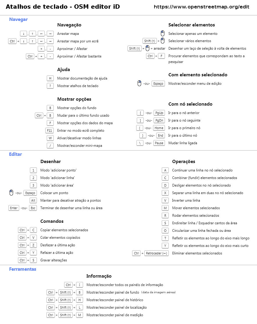
| 19:24, 2 February 2018 | Atalhos-iD-pt-br.png (file) |  |
133 KB | Atalhos de teclado - editor iD 2.6.1 (2018) - para imprimir em folha A4 (português pt-BR) | 1 |
| 18:36, 5 January 2018 | TMS-WORLD-WEB-MERCATOR.png (file) |  |
711 KB | removed "y" correspondence | 5 |
| 00:40, 4 January 2018 | Calcada-portuguesa1.jpg (file) |  |
562 KB | girado | 2 |
| 13:32, 30 December 2017 | Posic-imagem-sat.png (file) |  |
1.04 MB | 1 | |
| 13:32, 30 December 2017 | GPS-strava.png (file) |  |
780 KB | 1 | |
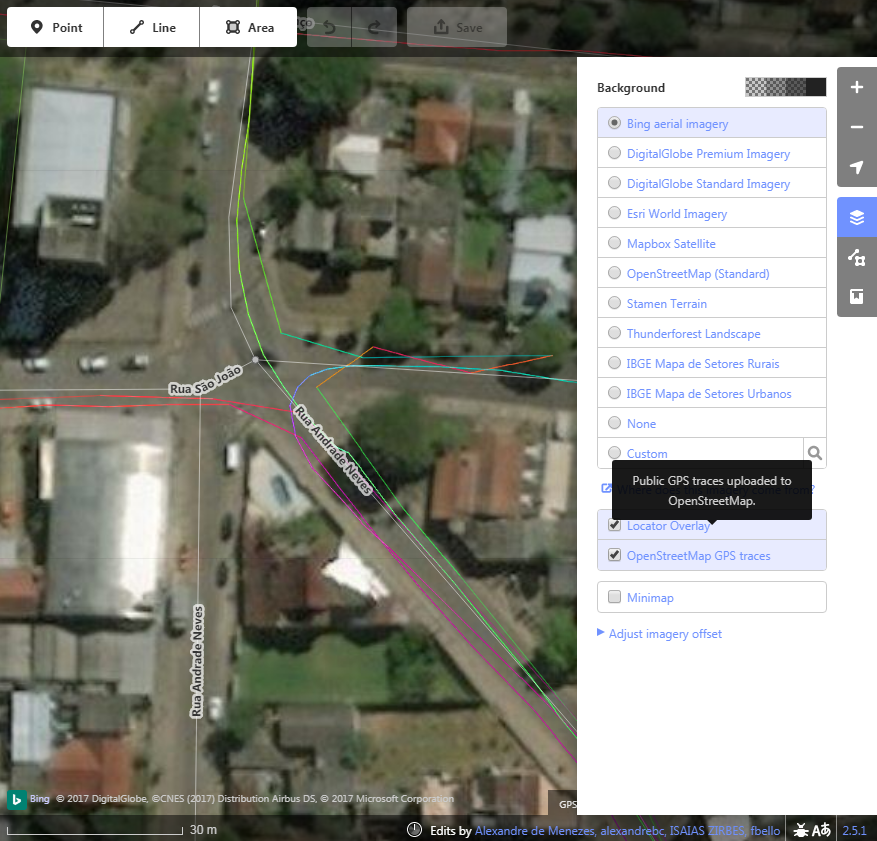
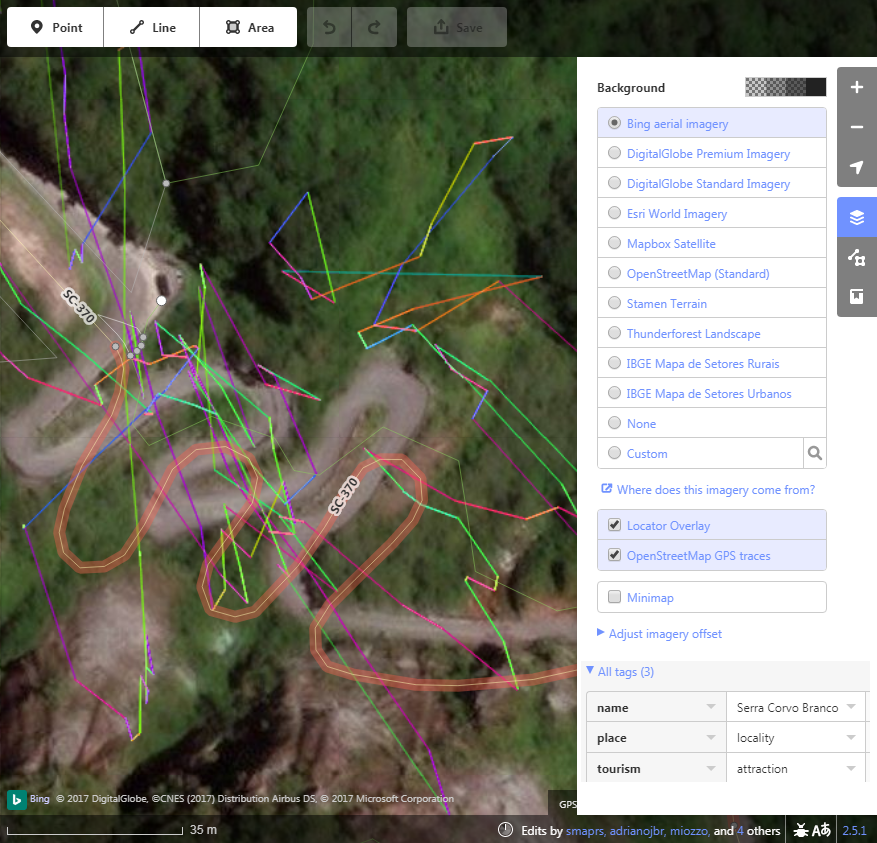
| 13:31, 30 December 2017 | GPS-serra corvo branco.png (file) |  |
726 KB | 1 | |
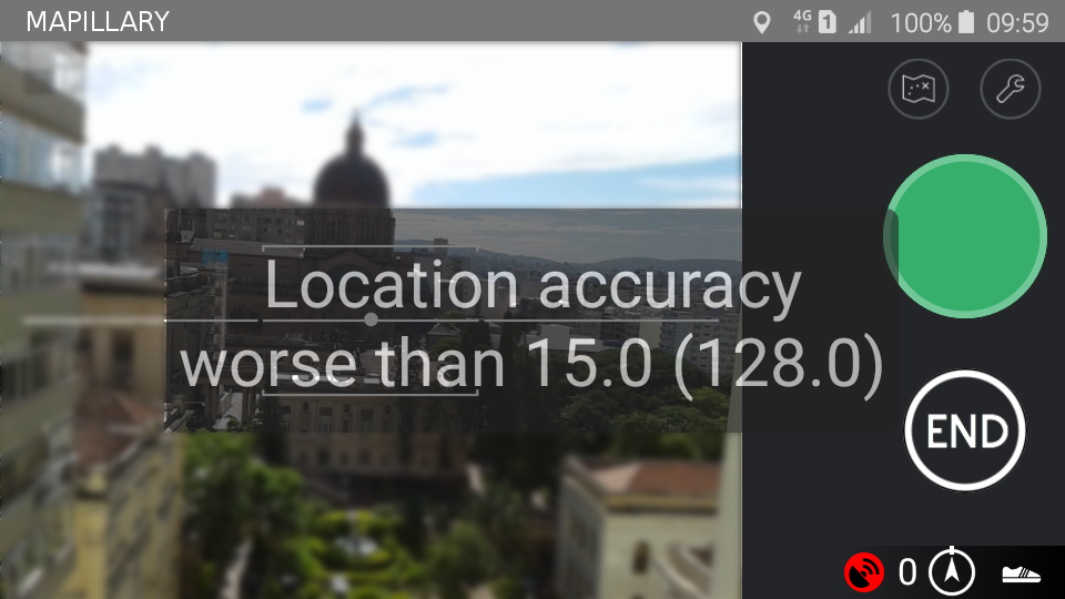
| 13:30, 30 December 2017 | GPS-mapillary.png (file) |  |
312 KB | 1 | |
| 13:30, 30 December 2017 | Angulo-170-vic-3nodes.png (file) |  |
1.05 MB | 1 | |
| 13:29, 30 December 2017 | Angulo-170-vic-2nodes.png (file) |  |
1.06 MB | 1 | |
| 13:28, 30 December 2017 | Angulo-170-vic-1node.png (file) |  |
1.07 MB | 1 | |
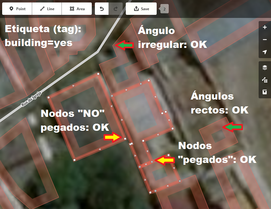
| 13:28, 30 December 2017 | Angulo-170-BR-12nodes.png (file) |  |
1.4 MB | 1 | |
| 13:27, 30 December 2017 | Angulo-170-BR-4nodes.png (file) |  |
1.03 MB | 1 | |
| 01:00, 30 December 2017 | GIMP-PDF-3.png (file) |  |
1.82 MB | 1 | |
| 01:00, 30 December 2017 | GIMP-PDF-2.png (file) |  |
1.29 MB | 1 | |
| 00:59, 30 December 2017 | GIMP-PDF-1.png (file) |  |
485 KB | 1 | |
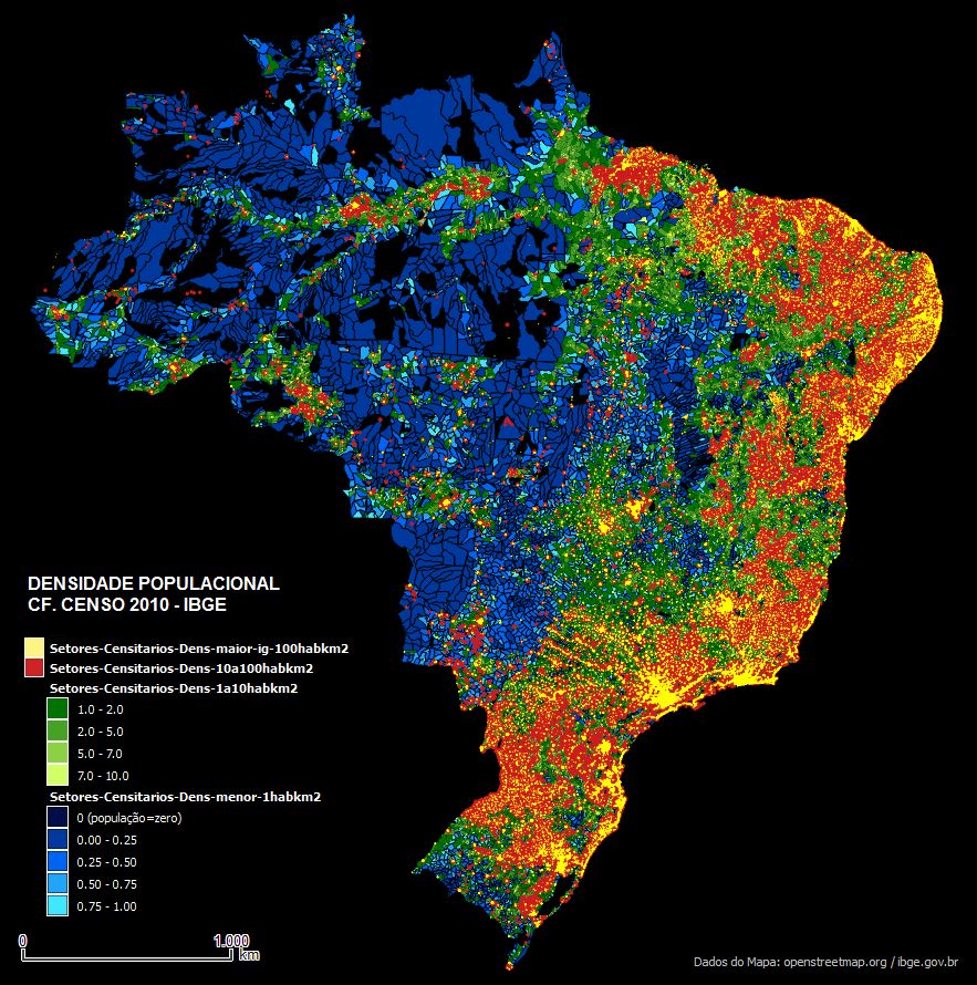
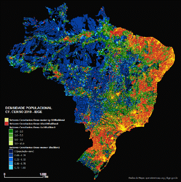
| 10:13, 7 October 2017 | 1DENSIDADE POPULACIONAL-SETORES-IBGE-CENSO2010.png (file) |  |
840 KB | DENSIDADE POPULACIONAL EM SETORES IBGE CONFORME DADOS DE UNIVERSO DO CENSO 2010 | 1 |
| 12:14, 6 October 2017 | DENSIDADE DE NOS OSM 2017-transition-600px.gif (file) | 3.75 MB | DENSIDADE DE NOS OSM 2017 animação gif | 1 | |
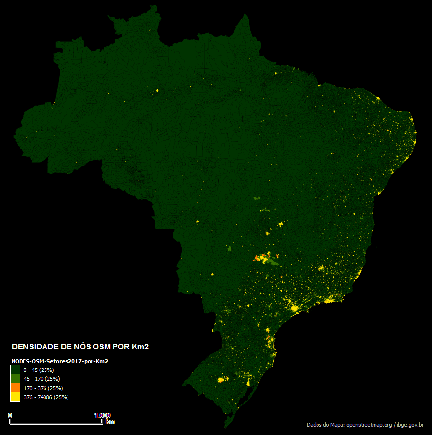
| 11:18, 6 October 2017 | 3DENSIDADE DE NOS POR KM2-QUANT25PCT-26-09-17.png (file) |  |
440 KB | DENSIDADE DE NOS POR KM2 EM QUANTILE 25 PCT 2EM 6-09-17 | 1 |
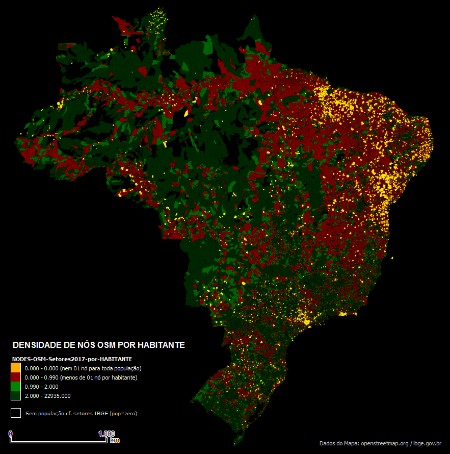
| 11:17, 6 October 2017 | 2DENSIDADE DE NOS POR HABITANTE-26-09-17.png (file) |  |
586 KB | DENSIDADE DE NOS POR HABITANTE EM 26-09-17 | 1 |
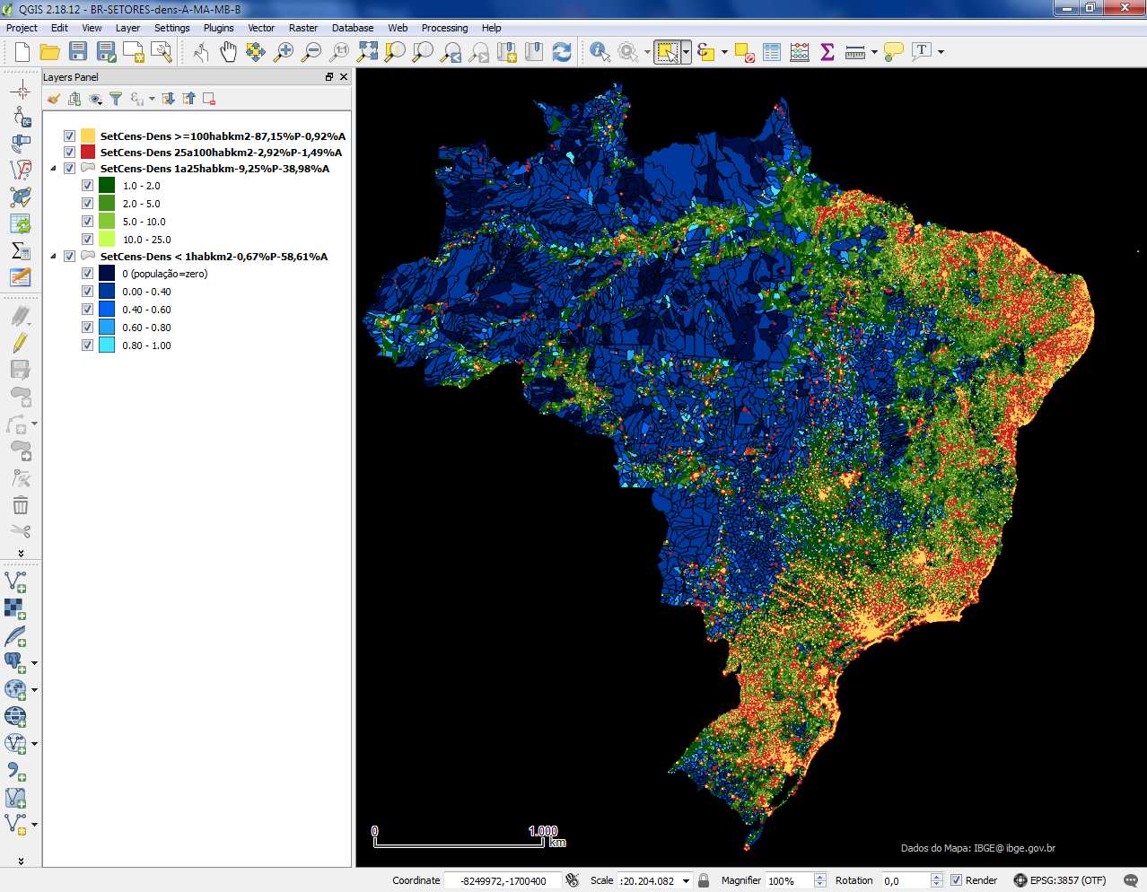
| 18:25, 26 September 2017 | IBGE-SetCens-QGIS-LEG-Dens-1-25-100.png (file) |  |
955 KB | completada legenda | 4 |
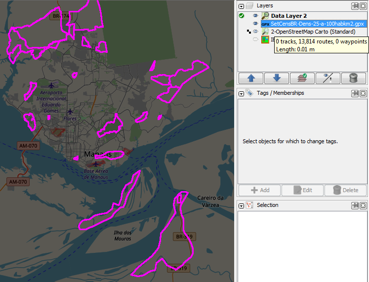
| 20:16, 21 September 2017 | SetCensBR-Dens-25-a-100habkm2.gpx.png (file) |  |
156 KB | Exemplo camada GPX auxiliar no JOSM, a partir de polígonos de filtragens demográficas em setores (aquiSetCensBR-Dens-25-a-100habkm2.gpx) | 1 |
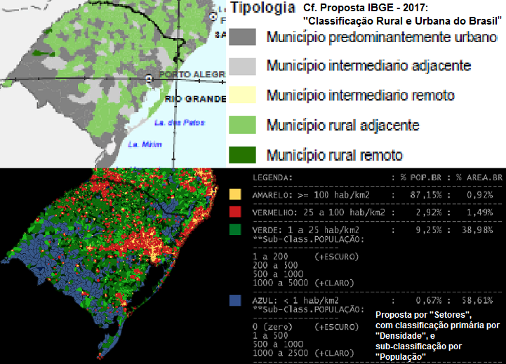
| 15:12, 21 September 2017 | Comparacao-municip-setores.png (file) |  |
322 KB | Comparação de classificações demográficas por municípios e setores com dados do IBGE | 1 |
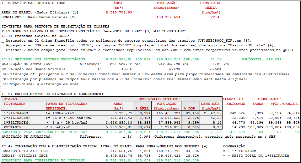
| 15:08, 21 September 2017 | PLANILHAS-XLS.png (file) |  |
61 KB | CLASSIFICAÇÕES ESTATÍSTICAS DEMOGRÁFICAS SOBRE POPULAÇÃO E SETORES TERRITORIAIS DO BRASIL CF. DADOS ORIGINAIS DO IBGE | 1 |
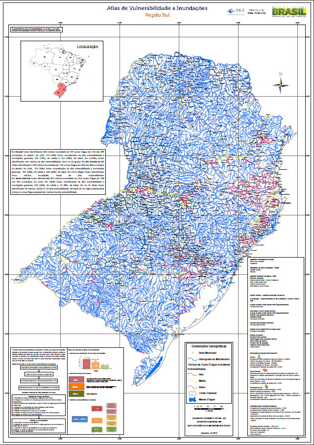
| 12:40, 12 September 2017 | Atlas de Vulnerabilidade a Inundações - Região SUL-ANA.png (file) |  |
401 KB | Atlas de Vulnerabilidade a Inundações - Região SUL (Agência Nacional de Água / Brasil) Fonte: Atlas de Vulnerabilidade a Inundações -- Brasília: ANA, 2014. 15 p. il. (Agência Nacional de Água / Brasil) ISBN: 978-85-8210-025-7 URL: http://bibl... | 1 |
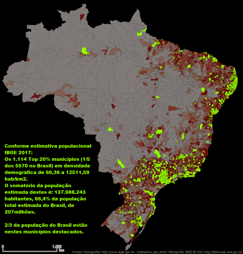
| 21:28, 9 September 2017 | Demog-top20municip-66%pop-TXT.png (file) |  |
423 KB | Conforme estimativa populacional IBGE 2017: Os 1114 Top 20% municípios (1/5 dos 5570 no Brasil) em densidade demográfica de 66,36 a 12511,59 hab/km2. O somatório da população estimada destes é: 137.988.243 habitantes, 66,4% da população total e... | 1 |
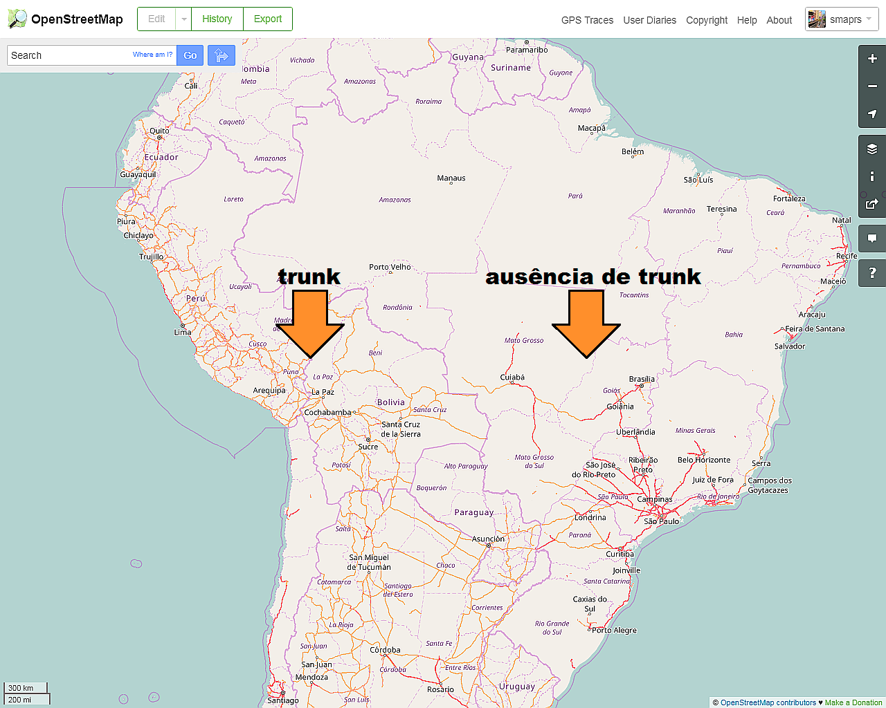
| 22:36, 15 August 2017 | 1-OSM-BRs atual.png (file) |  |
641 KB | situação BR em agosto de 2017 | 1 |
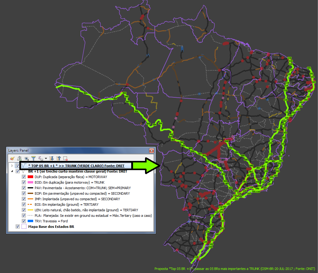
| 15:04, 14 August 2017 | Top 05 BRs + 1.png (file) |  |
350 KB | Proposta "Top 05 BR + 1" | 1 |
| 19:35, 7 August 2017 | LATAM-AI-BR-highways-crop-es-URUGUAY.png (file) |  |
819 KB | Proposta Mapatón LatAm Asentamientos Informalesː ejemplo de mapeamento de vias para URUGUAY. | 1 |
| 21:24, 6 August 2017 | LATAM-AI-BR-buildings-crop-en.png (file) |  |
598 KB | Mapathon Informal Settlements - Latinamericaː example of how to map buildings | 1 |
| 15:04, 3 August 2017 | LATAM-AI-BR-buildings-crop-es.png (file) |  |
831 KB | Proposta Mapatón LatAm Asentamientos Informalesː ejemplo de mapeamento de edificaciones | 1 |
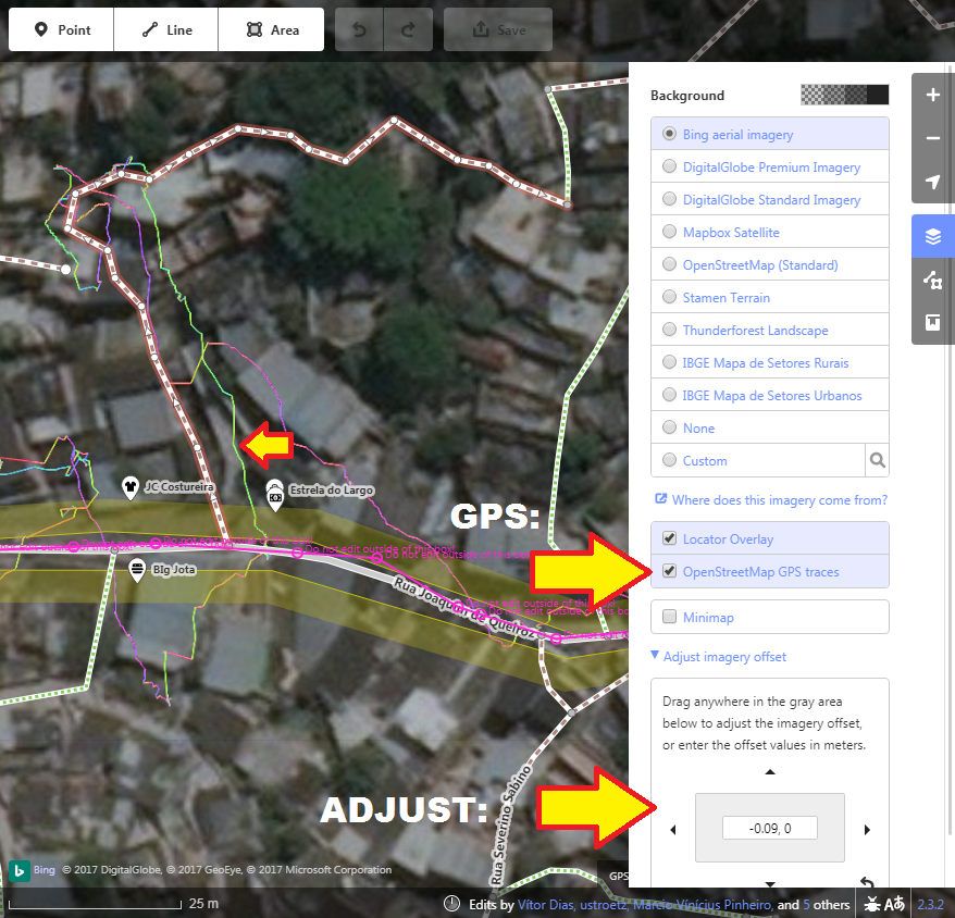
| 18:50, 2 August 2017 | Alinhamento GPS.png (file) |  |
825 KB | Adjust imagery with GPS layer (in iD) | 1 |