Uploads by Sven L
Jump to navigation
Jump to search
This special page shows all uploaded files.
| Date | Name | Thumbnail | Size | Description | Versions |
|---|---|---|---|---|---|
| 10:09, 21 October 2010 | Pennsylvania-PAMAP-cycle1-layers.png (file) |  |
69 KB | Overview of WMS layers in the PAMAP program aerial photography server for Pennsylvania (from http://146.186.163.133/arcgis/services/PAMAP_cycle1/MapServer/WMSServer?request=getcapabilities) | 1 |
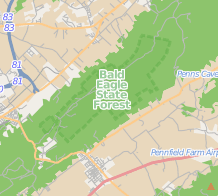
| 22:40, 20 October 2010 | Pennsylvania-screenshot-boundary-vs-landuse.png (file) |  |
51 KB | Mapnik screenshot showing the difference between park boundary (dashed green line) and forest land use (green area). | 1 |