Proposal talk:Advanced navigation
(Redirected from Talk:Proposed features/advanced navigation)
Please add still drawing, sketch, picture for better understandig of suggested idea. Thank you for cooperation. Great job!
Marek
- Marek, did you now, that your crossing=yes-nodes in "Steet area" can also be easy calculated, by dividing the length of the line of a crossing-relation by two?


The German group logic description is in the image description. --Fabi2 20:22, 6 November 2012 (UTC)
The street model is then like this:

But most of the things in earlier variants are known and have been already descrided here in the German forum. --Fabi2 20:52, 6 November 2012 (UTC)
- With the "relation based street model": Is the intention to create a new relation tree every time the road is being split? --Tordanik 08:15, 7 November 2012 (UTC)
- No, the lane is logical and consists of as many ways and areas as you want, but they must lay next to each other. I made my lane model specification
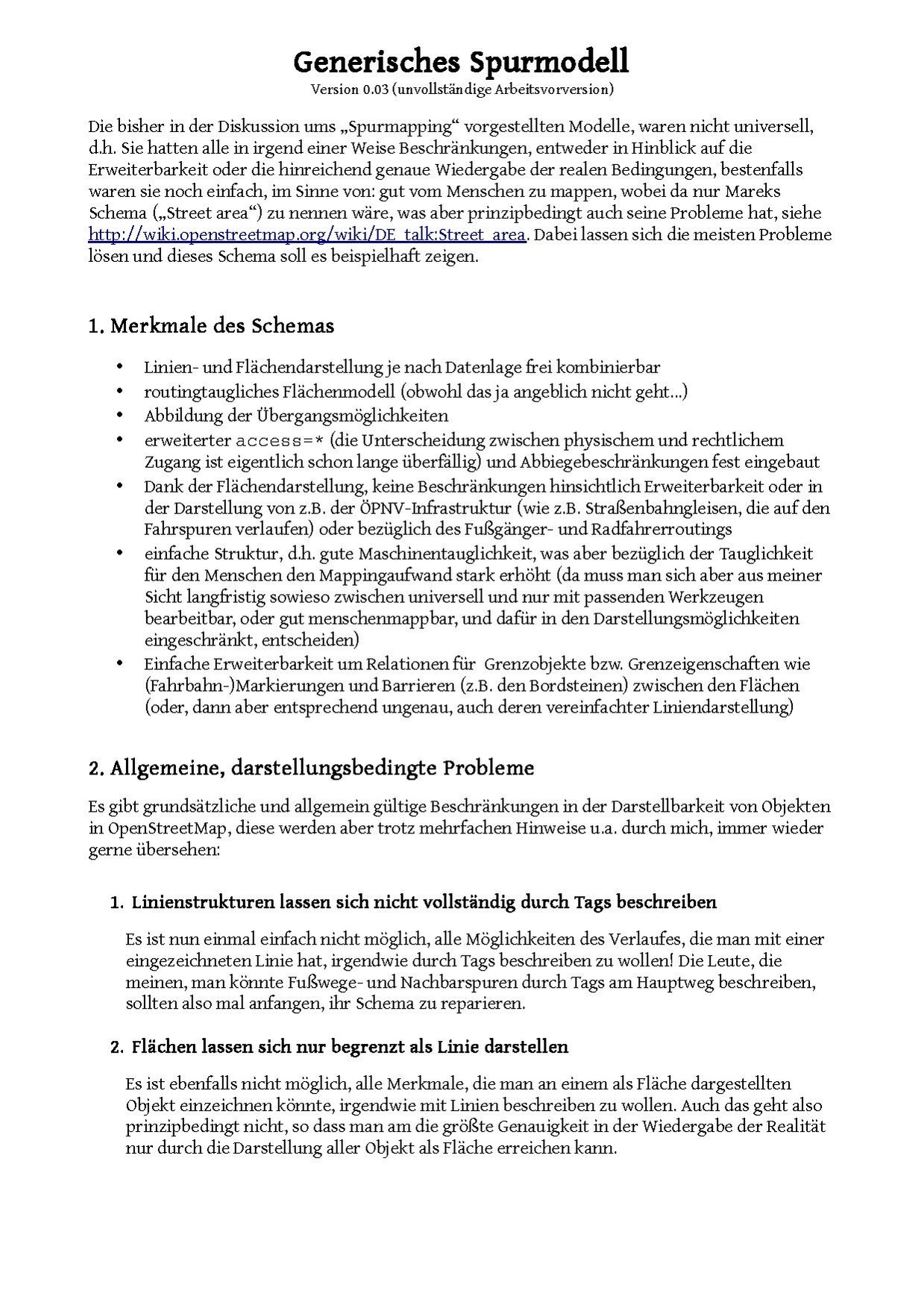 , which is based on User:Fabi2/Generic_lane_model and
 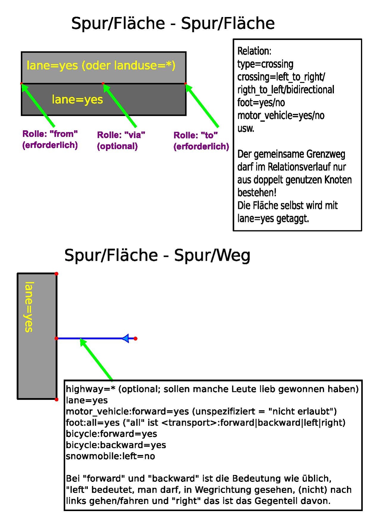 . It is a working draft and should already work in general, but needs additional review, extension (additional relations for kerbs and barriers on the crossing lines; relations for traffic signs (see the forum) and traffic lights ((ideas from User:Fabi2/Generic_lane_model must be converted)) and clean up, especially with using the crossing relation on lines and definition of the lane onset e.g. on crossings. You saved the spec from being getting silently tossed, because no one seems to want any of the ideas of it. Instead of making a spec which really works, people try to restrict further (micro)mapping! :( There must be a decision, soonen or further, between run into restriction because things must be human mapable or using a more general/complicated/extensible schema and tools to make things still mapable. But this was also already posted on the German forum. --Fabi2 04:09, 9 November 2012 (UTC)
- No, the lane is logical and consists of as many ways and areas as you want, but they must lay next to each other. I made my lane model specification