User:Ekidd/Routing to public lands with designated parking lots
I do a lot of hiking and mountain biking, and some of my family work in land conservation. This means that I have lots of opportunities to produce high-quality maps of local recreational areas in the 20–150 acre range. These have several characteristics:
- They're physically adjacent to multiple roads, but are only accessible from one or two.
- They usually have designated, official parking areas connected to a trailhead, often with an information kiosk. Sometimes, larger areas will have two official entrances.
- They typically have multiple, extra entrances that lack legal parking, but which may be accessed by foot.
- They almost never have a street address.
- Getting the last mile wrong has serious consequences: Some adjacent roads may be as
highway=residentialby TIGER, but have various major problems, including: (a) they may have incorrect locations, or (2) they may actually behighway=trackor "highway=path" roads. I try to resurvey as many of these roads as possible when I have time. But if the router picks the wrong road, users may find themselves stuck in pretty nasty places.
The ideal goal: When using high-quality routing software based on OpenStreetMap, users should be able to enter the name of the property/reserve/park/etc., and receive directions to the nearest official parking lot.
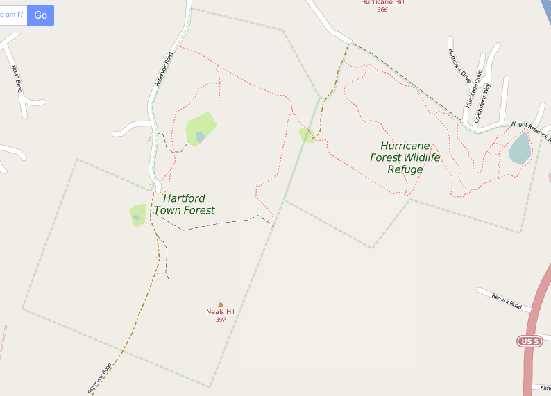
Example 1: Hartford Town Forest and Hurricane Wildlife Refuge
This is a nice pair of public forests with lots of interconnected hiking and biking trails. I'm mapping it as a demonstration for the town Recreation and GIS departments. There's also a local school project that's mapping the ecology in considerable detail, and a local trails association which has historically produced paper maps. In other words, this is a great area for both recreation and for recruiting new local mappers.
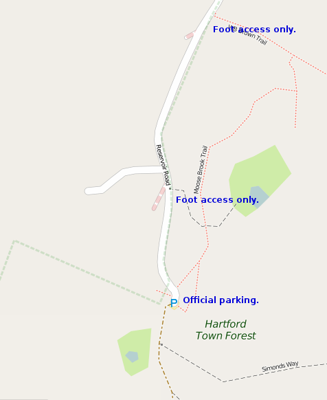
Let's start with a simple example. Here, we have one official parking lot, and two non-official entrances. There are also a lot of poorly surveyed private roads here, some of which are highway=track or worse, so delivering the user to the right location is critical:
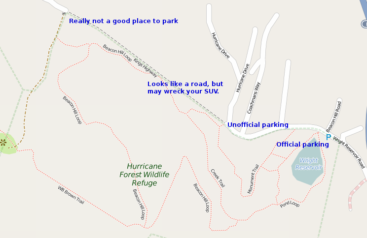
For a more complicated example, let's try the other side:
Here, we have an official parking area with a very nice trailhead (kiosk, giant map, picnic tables, official parking), and two alternate entrances, neither of which has official parking. We also have an unmaintained highway=path connecting the two entrances that initially looks like a decent highway=track, but which turns into something that can be seriously problematic even for SUVs. If the routing software delivers them to the top entrance, and they try to drive down Kings Highway to the main parking area, they may wind up in trouble. Better to route them to the correct entrance in the first place.
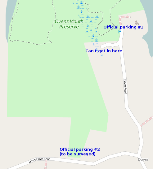
Example 2: Ovens Mouth Preserve
This is a spectacular nature reserve, much beloved by photographers, painters, hikers and horseback riders.
There are two official entrances, both of which have parking and kiosks. There's at least one more adjacent road which can't be used to access it, however. In this case, routers should ideally send drivers to the nearest official entrance, or pick the northeastern entrance, which provides better access to the park.
Is this important?
It's a common pattern. I have a whole bunch more of these examples which need to be surveyed, and I discover new ones regularly when doing outdoor activities in Vermont, New Hampshire and Maine. I currently have information for another 5 or 10 land preserves and parks, and I could get more.
Getting this wrong forces users to search for the entrance. And because we're dealing with backwoods roads, both the surveying and highway-class tagging may be wrong on nearby roads, possibly resulting in users getting lost and/or stuck.
Similar issues arising with regular addresses
Here's another example which might be related:
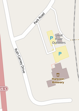
Here, Harpoon Brewery is 123 Ruth Carney Drive. But the only access to the brewery on Ruth Carney Drive is a big industrial loading dock. The actual public entrance is via the parking lot off of Park Road.
Tagging ideas
The central problem here is that we need to associate one or more official parking lots with large, named area. There's no widely supported way to do this right now. But I can imagine several options:
- Use
destination=Name of Preserveon the parking areas. This is easy to tag, butdestination=is rarely used withamenity=parking. - Represent the park as a relation, and give it children of type
parking. This is harder to tag. - Do something with
entrance. I don't know how this would work. - Provide hints to the geocoder so that it uses a specific point when routing to the named area.
There are probably some other ways to tackle this. Suggestions?
