User:Ottwiz/ottwiz-mapping-50-states

From OpenStreetMap Wiki
Jump to navigation Jump to search

Introduction

You may saw some of my changesets with the hashtag #ottwiz-mapping-50-states. What is this about? On June 4, 2021, I wrote the following in #general on OSMUS Slack: "So, it just popped out of my head, that it's summer, and I've got plenty of time to kill, since i finished my first year in university, then why shouldn't I map bits of all of the 50 states in the US (mostly forests, if there is, if not, then farmlands)?" That's where I got started.

So, what am I actually planning to do? Map the 50 states in the US. Before you ask me, I'm not going to include DC and Puerto Rico, Guam, American Samoa, the US Virgin Islands, and the US Minor Outlying Islands (aka the US territories).

What things am I going to map? Mostly wooded areas(so forests), and sometimes roads but that is going to be rare in this project.

How am I planning to realize this? I started from Washington, and by zig-zagish shape I'm going to map the lower 48, and after that Hawaii and Alaska comes.

The good thing is, that i already got some requests from mappers throughout the US to map their areas, so by this, I can accomplish that. By mapping areas it means i'm planning to do a few changesets, the number of changes doesn't count, since it happened that in a changeset made more than 18k changes.

Completion date: August 3, 2021.

Progress

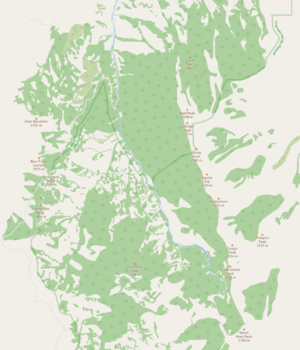
Washington - Makah Indian Reservation
Nevada - Jarbridge Wilderness Area
Utah - Mt. Nebo Scenic Byway
Maryland - Green Ridge State Forest

So, for reference, there are some screenshots of what I did.

Table of Progress
# of mapping State Mapped? Changeset(s)
1. Washington Yes 105804655
105816876
105818746
105824322
2. Oregon Yes 105840175
105841456
105844414
105845174
3. California Yes 105844414
105846464
4. Nevada Yes 105899361
105899365
105899846
5. Arizona Yes 105910682
105910684
105918626
6. Utah Yes 105987268
105990442
7. Idaho Yes 105995783
105997477
105998067
105998110
8. New Mexico Yes 105998559
106048277
106055571
9. Colorado Yes 106058658
106082978
106084714
106086330
106100915
106101004
10. Wyoming Yes 106116647
106174156
11. Montana Yes 106181456[note 1]
106221510
12. Texas Yes 106234807
106248912
106256956
106267364
13. Oklahoma Yes 106268219
106278451
106298939
14. Kansas Yes 106342190
106355942
15. Nebraska Yes 106360239
106384227
106420438
106420463
16 South Dakota Yes 106452421
106464664
106466060
17. North Dakota Yes 106528680
106555186
106584555
18. Louisiana Yes 106628795
106648978
19. Arkansas Yes 106655316
106662589
20. Missouri Yes 106712635
106728714
106738744
106739196
21. Iowa Yes 106782291
106800912
106800991
106801037
22. Minnesota Yes 106854149
106858919
23. Mississippi Yes 106913544
106918074
24. Alabama Yes 106946620
106961465
106964334
25. Tennessee Yes 106986194
106986648
107002515
107006349
107008740
107011511
107018369
107019728
26. Kentucky Yes 107038930
107051106
107052373
27. Indiana Yes 107053727
107100276
107103369
28. Illinois Yes 107155526
107162343
29. Wisconsin Yes 107231453
107231478
30. Florida Yes 107259114
107263919
107273070
31. Georgia Yes 107316913
107326959
107327193
32. South Carolina Yes 107348615
33. North Carolina Yes 107354426[note 2]
107357221
107357329
107361035
107368576
107383467
107384045
34. Virginia Yes 107396284
107897204
107913995
107924973
107931700
107932939
107934027
107936040
107936317
107979238
107985489
35. Delaware Yes 107995974
108000677
108004434
108041169
36. Maryland Yes 108060659
108065358
108069190
108074326
108248568
108268042[note 3]
37. West Virginia Yes 107052847
108271351
108277092
108278016
108278405
108295200
108295970
108298412
108305953
108312517
108317626
108385753
108385773
108387911
108388490
38. Ohio Yes 108390401
108447821
108450803
108453007
108481901
108503768
108505797
108515204
108516521
108522140
39. Michigan Yes 108541346
108549224
40. New Jersey Yes 108559310
108570551
108570997
108571522[note 4]
41. Pennsylvania Yes 108583621
108621158
108640098
108648577
42. New York Yes 108649617
108705422
108705745
43. Connecticut Yes 108779890
108781077
108781351
44. Rhode Island Yes 108783027
108912456
108913649
108942891
108948556
108950632
108951119
45. Massachusetts Yes 108850961
108887401
108899246
46. Vermont Yes 108910272
108910549
47. New Hampshire Yes 108967830
108972858
108985737
108988479
108988854
108989729
108990211
108990313
48. Maine Yes 109025169
109052515
49. Hawaii Yes 109054194
109089916
109093234
109094905
50. Alaska Yes 109104822
109109141
109109305
109109472

Notes

  1. Contains a bit of Idaho too.
  2. Contains NE Georgia too.
  3. Don't make you the (no comment) fooled. JOSM was again an ass with me, it forgot to change the comment before uploading.
  4. NJ has completed forest landcover except in the urban areas, but that is boring to map.