User:RGG
Jump to navigation
Jump to search
I'm a Garmin GPS user interested in having high quality topographic maps. I use GPS mainly in cycling activities.
Objectives:
- Map 100% cycling resources and paths in Curitiba.
- Treat all errors pointed in Curitiba and São José dos Pinhais - http://keepright.ipax.at/
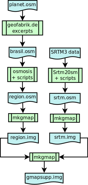
- Create a distribution of brazilian topographic routable maps with OSM database and srtm data, automaticaly updated (Acomplished). ftp://ftp.pucpr.br/osm
The compiling process for gathering Openstreetmap and SRTM3 data into Garmin .img file.
