User:Webrian
| Userboxes | |||||||||
|---|---|---|---|---|---|---|---|---|---|
| |||||||||
| Babel user information | ||||||
|---|---|---|---|---|---|---|
| ||||||
| Users by language |
South East Asia
After a long cycling tour through South East Asia namely Vietnam, Cambodia, Laos, Thailand and Malaysia I've got a lot of gps tracks. So, I've started to map and improve roads, add places etc. in this region.
I lived in Laos for two years where my focus was mainly on Vientiane. Here's a short story about my experiences.
I wrote a short tutorial how to use Landsat imagery to extract water bodies. Using this workflow I'm mapping existing and new hydro power reservoirs in Laos.
OpenStreetMap.la
Maintainer of OpenStreetMap.la.
Create your own Garmin img map for Laos


Since Garmin devices don't support lao fonts by default, use the following command to create routable, romanized Garmin maps with mkgmap:
java -ea -jar mkgmap.jar --description=OSMLaos --family-name=OpenStreetMap_mkgmap_build_20110409 --gmapsupp --latin1 --lower-case
--style-file=laostyle/ --name-tag-list=name:en,name:lo_rm,name:fr,name:de,name --index --add-pois-to-areas --remove-short-arcs
--country-name=LAOS --country-abbr=LA --route --net data.osm
See OSM Map On Garmin to get an overview how to create and upload maps to your device.
Bilingual Map for Laos
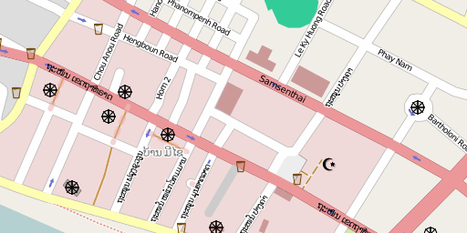
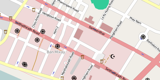
Using the name tagging system proposed on WikiProject_Laos#Names it is possible to render bilingual maps.
Vientiane downtown rendered in Lao language:

Vientiane downtown rendered in English:

Switzerland
Some mapping in the Längholz forest between Orpund and Brügg BE.
A few additions, mainly POIs in Zürich Höngg.
Started once to map the Opfikerpark.
