User:Xande
Jump to navigation
Jump to search
| Userboxes | ||||||||||||||||
|---|---|---|---|---|---|---|---|---|---|---|---|---|---|---|---|---|
| ||||||||||||||||
О себе - About me
I map around here.
Маплю где-то здесь.
В работе - Working on
- Тверь.
- Нанести недостающие населённые пункты по валидатору ОКАТО в Тверской области.
- Андреаполь (адреса, частично землепользования).
- Бывшие Озерецкие торфразработки.
- Проставить official_status на границы и центры нас. пунктов по Тверской области.
Выполнено - Done
- Конаково (адреса, землепользования, статусы дорог, сдвиг под привязанный снимок).
- Редкино, Городня, Изоплит и Озерки.
Спутниковые снимки - Satellite imagery
- GeoEye SceneID: 20100730085515903GE10610549_003
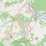
Расположение: Конаковский район Тверской области.
Дата съёмки: 30.07.2010 г.
Продавец: ООО ИТЦ «СКАНЭКС» г. Москва.
Текст лицензии (RU).
Населённые пункты в границах снимка: пос. Редкино, с. Городня, д. Артёмово, д. Заполок, д. Турыгино.
Контакты - Contacts
skype: xalmeidax
xmpp: xande@neko.im, xande@jabbim.com
Полезные ссылки - Useful links
Прочее - Miscellaneous
| All my contributions to OpenStreetMap are released into the public domain. This applies worldwide. In case this is not legally possible, I grant anyone the right to use my contributions for any purpose, without any conditions, unless such conditions are required by law. |

