2011 Sendai earthquake and tsunami/Imageries
| 2011 Sendai earthquake and tsunami (Main Page) | Mapping coordination and data sources | Imageries |
|---|
Post-Disaster Imagery
The German DLR/ZKI released a satellite map with images from DigitalGlobe's WorldView-2 satellite: [1]. The road data comes from OSM, by the way. See also other products. And the Other links section below for similar products from other sources.
DigitalGlobe Sendai 0312
see List of DigitalGlobe Editors
The post-disaster imagery appears to be a multi footprint covering many areas of Japan, including a strip in area strongly affected by tsunami with these limits and another area and some more.
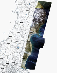
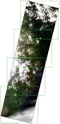
JAXA/ALOS Sendai 0312
By NIED(National Research Institute for Earth Science and Disaster Prevention, Japanese national institute for disaster), a satellite image after the earthquake from JAXA(Japan Aerospace Exploration Agency) is permitted to be traced. See also BOSAI-DRIP/NIED
| Image set | Boundary | Use in JOSM | Use in Potlatch |
|---|---|---|---|
| ALOS/Pan-Sharpened
Date: 2011-03-12 Use the tag: source=JAXA/ALOS/pan-sharpened, 2011-03-12 |
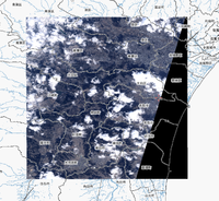 see image boundary here |
Use the following WMS URL in JOSM :
GetCapability: http://hazardmap.service-section.com/geoserver/wmscapabilities?id=alpans_0312_1 GetMap: wms:http://hazardmap.service-section.com/cgi-bin/mapserv? map=/map/UserRaster/alpans_0312_1.map&SERVICE=WMS& VERSION=1.1.1&REQUEST=GetMap&LAYERS=alpans_0312_1& STYLES=&EXCEPTIONS=application%2Fvnd.ogc.se_inimage& FORMAT=image/png&SRS=EPSG:4326& |
In Potlatch paste the following URL into the 'custom' setting:
Not available
|
| ALOS/AVNIR-2
Date: 2011-03-12
|
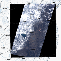 see image boundary here |
Use the following WMS URL in JOSM :
GetCapability: http://hazardmap.service-section.com/geoserver/wmscapabilities?id=alav2a_0312_1 GetMap: wms:http://hazardmap.service-section.com/cgi-bin/mapserv? map=/map/UserRaster/alav2a_0312_1.map& SERVICE=WMS&VERSION=1.1.1& REQUEST=GetMap&LAYERS=alav2a_0312_1&STYLES=& EXCEPTIONS=application%2Fvnd.ogc.se_inimage& FORMAT=image/png&SRS=EPSG:4326& |
In Potlatch paste the following URL into the 'custom' setting:
Not available |
| ALOS/AVNIR-2
Date: 2011-03-14 Use the tag: source=JAXA/ALOS/AVNIR2, 2011-03-14 |
Use the following WMS URL in JOSM :
GetCapability: http://hazardmap.service-section.com/geoserver/wmscapabilities?id=alav2a_0314_1 GetMap: http://hazardmap.service-section.com/cgi-bin/mapserv?map=/map/UserRaster/alav2a_0314_1.map&SERVICE=WMS&VERSION=1.1.1&REQUEST=GetMap&LAYERS=alav2a_0314_1&STYLES=&EXCEPTIONS=application%2Fvnd.ogc.se_inimage&FORMAT=image/png&SRS=EPSG:4326& |
In Potlatch paste the following URL into the 'custom' setting:
Not available |
MapQuest Open Aerial
By MapQuest(supported by NIED), a satellite image after the earthquake from JAXA(Japan Aerospace Exploration Agency) is permitted to be traced. See also JOSM
| Image set | Boundary | Use in JOSM | Use in Potlatch |
|---|---|---|---|
| ALOS/Pan-Sharpened
Date: 2011-03-12 Use the tag: source=JAXA/ALOS/pan-sharpened, 2011-03-12 |
Use the MapQuest Open Aerial in JOSM :
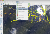 see image boundary here |
Potlatch 2 1. Visit http://open.mapquest.com/ or any of our other Open Beta domains and click the Edit button above the map zoom controls to launch Potlatch 2. |
Bing Post-disaster imagery
Bing has made available some areas of post-disaster imagery mashed in with the older imagery. Compare top and bottom of this view (at the boundary of patch in Sendai)
The bing imagery analyzer doesn't help see these patches. It only shows the available level of resolution (including weird blotches over blue where people have zoomed to super-high-res) Even in areas of post-quake coverage, the top zoom levels are old. We can investigate the area of coverage by following around the visible seam, or by looking at the dates using the date revealing version. The post quake areas reportedly cover around Ishinomaki and in coastal areas from Yamamoto to Okuma (including Minamisoma). Suggested to tag source as 'Bing 2011-03-1#'.
Some affected areas:
- Sendai in OSM -
- Natori in OSM -
- Matsushima Bay in OSM -
- City Matsushima Azuma in OSM -
- Ishinomaki harbor in OSM
(from sinsai.info).
Cnes / SpotImage Sendai 03-12 & 03-13
Spot imagery over Sendai and Tohoku coast available through UNOSAT in the framework of the activation of the International Charter "Space and Major Disasters". Spot Image agrees that OpenStreetMap contributors use this SPOT imagery and the corresponding online WMS service provided that each contributor acknowledge the following license : http://www.youmapps.org/licenses/EULA-OSM-en.html This is briefly what is required by the license :
- The SPOT imagery is provided to you, the final user, only to extract information that will be stored in the OpenStreetMap database under a CC-by-SA 2.0 and/or OpenDbL licence.
- Please, fill the source tag with source = “Cnes / Spot Image”
- Do not use, download or redistribute the imagery for any other purposes than what is authorized here.
| Image set | Boundary | Use in JOSM | Use in Potlatch |
|---|---|---|---|
| SPOT 5
Resolution: 2.5m (panchromatic) Use the tag: source=Cnes / Spot Image 2011-03-12 |
Use the following WMS URL in JOSM :
GetCapability: http://cernunosat05.cern.ch/arcgis/services/Japan/SendaiMosaic/ImageServer/WMSServer? GetMap: wms:http://cernunosat05.cern.ch/ArcGIS/services/Japan/SendaiMosaic/ImageServer/WMSServer?FORMAT=image/jpeg&VERSION=1.1.1&SERVICE=WMS&REQUEST=GetMap&Layers=0& |
Not allowed | |
| SPOT 5
Resolution: 2.5m (pan-sharpened "natural colors") Use the tag: source=Cnes / Spot Image 2011-03-13 |
Use the following WMS URL in JOSM :
GetCapability: http://cernunosat05.cern.ch/ArcGIS/services/Japan/Japan_earthquake_Tsunami_area/MapServer/WMSServer? GetMap: wms:http://cernunosat05.cern.ch/ArcGIS/services/Japan/Japan_earthquake_Tsunami_area/MapServer/WMSServer?FORMAT=image/jpeg&VERSION=1.1.1&SERVICE=WMS&REQUEST=GetMap&Layers=0&Styles=default& |
Not allowed | |
| SPOT 5
Resolution: 2.5m (panchromatic) Use the tag: source=Cnes / Spot Image 2011-03-13 |
Use the following WMS URL in JOSM :
GetCapability: http://osm.arkemie.org/cgi-bin/osm_wms?map=/mapsite/japan.map& GetMap: wms:http://osm.arkemie.org/cgi-bin/osm_wms?map=/mapsite/japan.map&FORMAT=image/jpeg&VERSION=1.1.1&SERVICE=WMS&REQUEST=GetMap&Layers=tohokucoast20110313& This imagery was not tied to ground control points (level 2A). Adjust offset based on GPS tracks or existing data before use. For better visibility, contrast is scaled for each WMS request (you can change displayed resolution to have contrast adjusted on different window size). |
Not allowed | |
| SPOT 5
Resolution: 10m (multispectral) Use the tag: source=Cnes / Spot Image 2011-03-13 |
Use the following WMS URL in JOSM :
GetCapability: http://osm.arkemie.org/cgi-bin/osm_wms?map=/mapsite/japan.map& GetMap: wms:http://osm.arkemie.org/cgi-bin/osm_wms?map=/mapsite/japan.map&FORMAT=image/jpeg&VERSION=1.1.1&SERVICE=WMS&REQUEST=GetMap&Layers=tohokucoast20110313xs& This imagery was not tied to ground control points (level 2A). Adjust offset based on GPS tracks or existing data before use. |
Not allowed |
Aerial orthophotos from Japanese mapping authority GSI (Finished)
This project is finished. Please use post-disaster imagery provided by Bing instead.
(Apparently, the license permits only to use for the purpose of mapping damaged situation, not for the base map).
The Japanese mapping authority GSI released aerial orthophotos. The data can be used for disaster mapping.
An overview about the locations is available from here: index (You can use this automatic translation to read place names).
Most of the imagery are aerial images (JPEG). Among them there are a kind of orthophotos (simplified process and less pixels). For these images JPEG+worldfile is available. Worldfile’s coordinate system is GaussKrueger zone 10 (EPSG:2452) except Fukushima (http://saigai.gsi.go.jp/mosaic/index07.html) is zone 9 (EPSG:2451).
Various satellite images: EO-1 03-13, Landsat, etc.
Telascience hosts several satellite images, including some not detailed here (like DigitalGlobe and Aster), with a jp_earthquake browser there. Right-click on a layer to zoom to its extent, or to get a WMS link for it - (twice if your browser pop-up menu hides it).
- EO-1, 2011-03-13 (10 m resolution) - image boundary - WMS link - Use the tag: source=EO-1, USGS, 2011-03-13
- A Landsat ETM image taken on 2011-03-12 is available (30 m resolution, layer LANDSAT_ETM_USGS_gaps_interpolated_20110312).
It is available in WMS (for JOSM, for example) with this link. (Image boundary) - Use the tag: source=Landsat ETM, USGS, 2011-03-12
- (Another, pre-disaster (2011-02-24), Landsat image is also available in WMS with this link - Image boundary - Use the tag: source=Landsat ETM, USGS, 2011-02-24 )
Pre-Disaster Imagery
We have Bing imagery which is easy to use in editors and seems to be much better resolution than the post disaster imagery listed above, but it is pre-disaster. We might use bing imagery for accurate tracing work, but using the above post-disaster imagery to try to assess if we're tracing stuff which has been obliterated. The bing imagery coverage includes some weird strip shapes over this part of northern Japan. Note that part of the imagery is replaced with post-disaster one.
